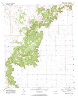
Apache Canyon Topo Map New Mexico
To zoom in, hover over the map of Apache Canyon
USGS Topo Quad 34103h4 - 1:24,000 scale
| Topo Map Name: | Apache Canyon |
| USGS Topo Quad ID: | 34103h4 |
| Print Size: | ca. 21 1/4" wide x 27" high |
| Southeast Coordinates: | 34.875° N latitude / 103.375° W longitude |
| Map Center Coordinates: | 34.9375° N latitude / 103.4375° W longitude |
| U.S. State: | NM |
| Filename: | o34103h4.jpg |
| Download Map JPG Image: | Apache Canyon topo map 1:24,000 scale |
| Map Type: | Topographic |
| Topo Series: | 7.5´ |
| Map Scale: | 1:24,000 |
| Source of Map Images: | United States Geological Survey (USGS) |
| Alternate Map Versions: |
Apache Canyon NM 1971, updated 1974 Download PDF Buy paper map Apache Canyon NM 2010 Download PDF Buy paper map Apache Canyon NM 2013 Download PDF Buy paper map Apache Canyon NM 2017 Download PDF Buy paper map |
1:24,000 Topo Quads surrounding Apache Canyon
> Back to 34103e1 at 1:100,000 scale
> Back to 34102a1 at 1:250,000 scale
> Back to U.S. Topo Maps home
Apache Canyon topo map: Gazetteer
Apache Canyon: Valleys
Apache Canyon elevation 1341m 4399′Puerto Canyon elevation 1369m 4491′
Apache Canyon: Wells
10250 Water Well elevation 1440m 4724′10267 Water Well elevation 1486m 4875′
10268 Water Well elevation 1439m 4721′
10269 Water Well elevation 1371m 4498′
10270 Water Well elevation 1387m 4550′
10271 Water Well elevation 1478m 4849′
10272 Water Well elevation 1465m 4806′
10273 Water Well elevation 1415m 4642′
10274 Water Well elevation 1458m 4783′
10275 Water Well elevation 1445m 4740′
10276 Water Well elevation 1440m 4724′
10277 Water Well elevation 1437m 4714′
10763 Water Well elevation 1365m 4478′
10764 Water Well elevation 1481m 4858′
10765 Water Well elevation 1457m 4780′
10766 Water Well elevation 1454m 4770′
10767 Water Well elevation 1452m 4763′
10769 Water Well elevation 1446m 4744′
10773 Water Well elevation 1500m 4921′
Apache Canyon digital topo map on disk
Buy this Apache Canyon topo map showing relief, roads, GPS coordinates and other geographical features, as a high-resolution digital map file on DVD:


