Circle S Mesa Topo Map New Mexico
To zoom in, hover over the map of Circle S Mesa
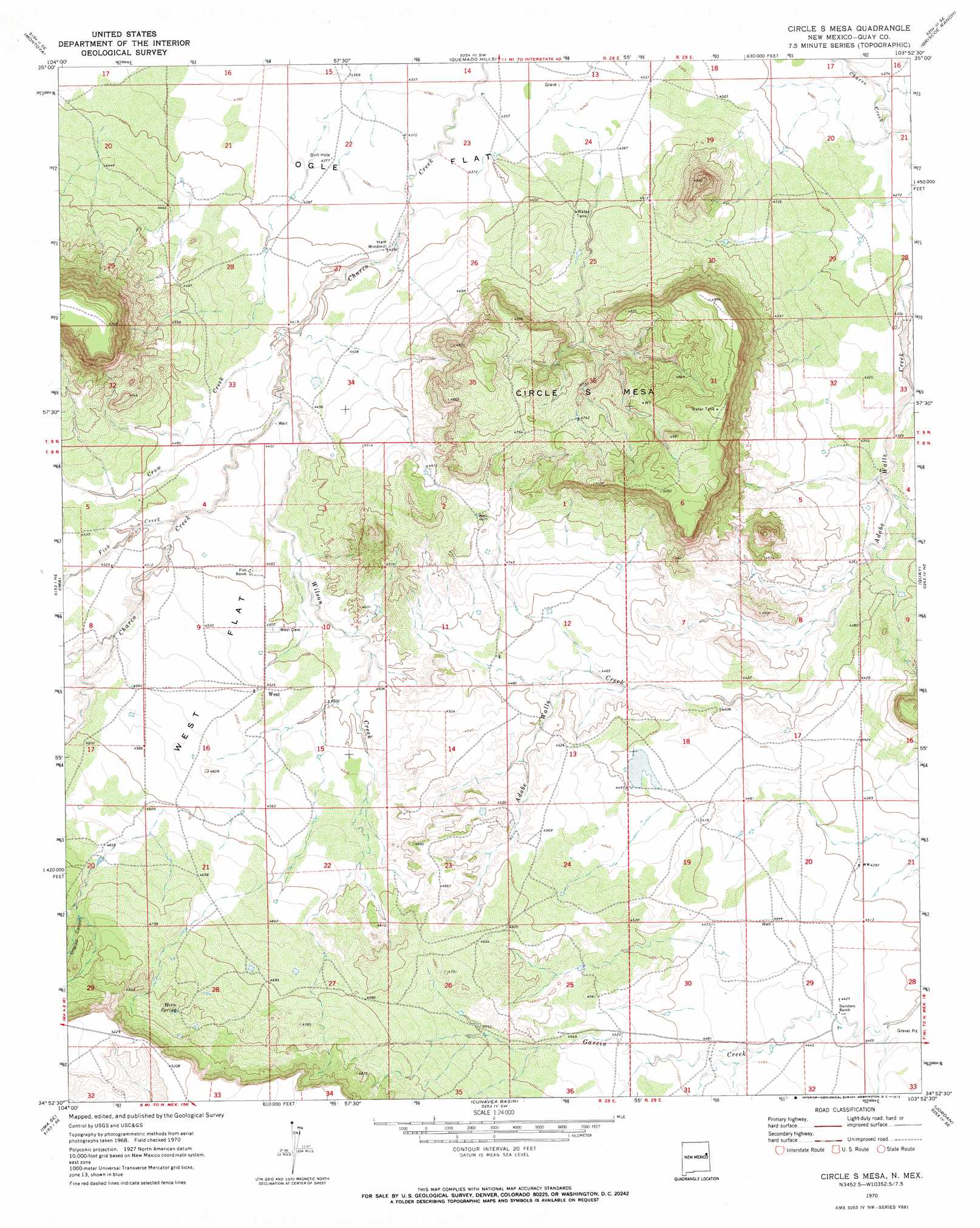
USGS Topo Quad 34103h8 - 1:24,000 scale
| Topo Map Name: | Circle S Mesa |
| USGS Topo Quad ID: | 34103h8 |
| Print Size: | ca. 21 1/4" wide x 27" high |
| Southeast Coordinates: | 34.875° N latitude / 103.875° W longitude |
| Map Center Coordinates: | 34.9375° N latitude / 103.9375° W longitude |
| U.S. State: | NM |
| Filename: | o34103h8.jpg |
| Download Map JPG Image: | Circle S Mesa topo map 1:24,000 scale |
| Map Type: | Topographic |
| Topo Series: | 7.5´ |
| Map Scale: | 1:24,000 |
| Source of Map Images: | United States Geological Survey (USGS) |
| Alternate Map Versions: |
Circles S Mesa NM 1970, updated 1973 Download PDF Buy paper map Circle S Mesa NM 2010 Download PDF Buy paper map Circle S Mesa NM 2013 Download PDF Buy paper map Circle S Mesa NM 2017 Download PDF Buy paper map |
1:24,000 Topo Quads surrounding Circle S Mesa
Ortega Tank |
Muniz Canyon |
Cow Canyon |
Liberty Mesa |
Tucumcari |
Gate Canyon |
Montoya |
Quemado Hills |
Briscoe Ranch |
Bulldog Mesa |
Ima Nw |
Ima |
Circle S Mesa |
Quay |
Mesa Redonda |
Ima Sw |
Ima Se |
Cunavea Basin |
Jordan |
Ragland |
Twin Mesa Nw |
Hassell |
House |
Mcalister |
Weber City |
> Back to 34103e1 at 1:100,000 scale
> Back to 34102a1 at 1:250,000 scale
> Back to U.S. Topo Maps home
Circle S Mesa topo map: Gazetteer
Circle S Mesa: Flats
Ogle Flat elevation 1331m 4366′West Flat elevation 1384m 4540′
Circle S Mesa: Populated Places
Ogle (historical) elevation 1333m 4373′Circle S Mesa: Post Offices
West Post Office (historical) elevation 1379m 4524′Circle S Mesa: Springs
Hern Spring elevation 1464m 4803′Circle S Mesa: Streams
Crow Creek elevation 1342m 4402′Fish Creek elevation 1360m 4461′
Wilson Creek elevation 1347m 4419′
Circle S Mesa: Summits
Pyramid Mountain elevation 1500m 4921′Circle S Mesa: Valleys
Bogard Canyon elevation 1426m 4678′Circle S Mesa: Wells
10263 Water Well elevation 1350m 4429′Circle S Mesa digital topo map on disk
Buy this Circle S Mesa topo map showing relief, roads, GPS coordinates and other geographical features, as a high-resolution digital map file on DVD: