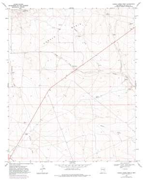
Conejo Creek West Topo Map New Mexico
To zoom in, hover over the map of Conejo Creek West
USGS Topo Quad 34104b4 - 1:24,000 scale
| Topo Map Name: | Conejo Creek West |
| USGS Topo Quad ID: | 34104b4 |
| Print Size: | ca. 21 1/4" wide x 27" high |
| Southeast Coordinates: | 34.125° N latitude / 104.375° W longitude |
| Map Center Coordinates: | 34.1875° N latitude / 104.4375° W longitude |
| U.S. State: | NM |
| Filename: | o34104b4.jpg |
| Download Map JPG Image: | Conejo Creek West topo map 1:24,000 scale |
| Map Type: | Topographic |
| Topo Series: | 7.5´ |
| Map Scale: | 1:24,000 |
| Source of Map Images: | United States Geological Survey (USGS) |
| Alternate Map Versions: |
Conejo Creek West NM 1967, updated 1971 Download PDF Buy paper map Conejo Creek West NM 1967, updated 1982 Download PDF Buy paper map Conejo Creek West NM 2010 Download PDF Buy paper map Conejo Creek West NM 2013 Download PDF Buy paper map Conejo Creek West NM 2017 Download PDF Buy paper map |
1:24,000 Topo Quads surrounding Conejo Creek West
> Back to 34104a1 at 1:100,000 scale
> Back to 34104a1 at 1:250,000 scale
> Back to U.S. Topo Maps home
Conejo Creek West topo map: Gazetteer
Conejo Creek West: Basins
Conejo Basin elevation 1278m 4192′Conejo Creek West: Springs
Conejo Spring elevation 1327m 4353′Mum Spring elevation 1247m 4091′
Shaw Spring elevation 1298m 4258′
Conejo Creek West: Streams
Little Conejo Creek elevation 1224m 4015′Conejo Creek West: Wells
10005 Water Well elevation 1281m 4202′10006 Water Well elevation 1265m 4150′
10007 Water Well elevation 1265m 4150′
10008 Water Well elevation 1285m 4215′
10009 Water Well elevation 1282m 4206′
10013 Water Well elevation 1286m 4219′
10014 Water Well elevation 1263m 4143′
10017 Water Well elevation 1240m 4068′
10018 Water Well elevation 1224m 4015′
10765 Water Well elevation 1253m 4110′
10766 Water Well elevation 1243m 4078′
10776 Water Well elevation 1247m 4091′
10777 Water Well elevation 1260m 4133′
10779 Water Well elevation 1259m 4130′
10848 Water Well elevation 1287m 4222′
10849 Water Well elevation 1278m 4192′
Conejo Creek West digital topo map on disk
Buy this Conejo Creek West topo map showing relief, roads, GPS coordinates and other geographical features, as a high-resolution digital map file on DVD:


