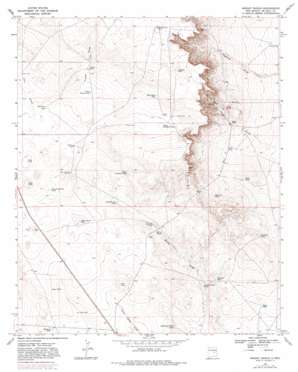
Wright Ranch Topo Map New Mexico
To zoom in, hover over the map of Wright Ranch
USGS Topo Quad 34104b7 - 1:24,000 scale
| Topo Map Name: | Wright Ranch |
| USGS Topo Quad ID: | 34104b7 |
| Print Size: | ca. 21 1/4" wide x 27" high |
| Southeast Coordinates: | 34.125° N latitude / 104.75° W longitude |
| Map Center Coordinates: | 34.1875° N latitude / 104.8125° W longitude |
| U.S. State: | NM |
| Filename: | o34104b7.jpg |
| Download Map JPG Image: | Wright Ranch topo map 1:24,000 scale |
| Map Type: | Topographic |
| Topo Series: | 7.5´ |
| Map Scale: | 1:24,000 |
| Source of Map Images: | United States Geological Survey (USGS) |
| Alternate Map Versions: |
Wright Ranch NM 1967, updated 1971 Download PDF Buy paper map Wright Ranch NM 1967, updated 1982 Download PDF Buy paper map Wright Ranch NM 2010 Download PDF Buy paper map Wright Ranch NM 2013 Download PDF Buy paper map Wright Ranch NM 2017 Download PDF Buy paper map |
1:24,000 Topo Quads surrounding Wright Ranch
> Back to 34104a1 at 1:100,000 scale
> Back to 34104a1 at 1:250,000 scale
> Back to U.S. Topo Maps home
Wright Ranch topo map: Gazetteer
Wright Ranch: Lakes
Dipping Vat Lake elevation 1494m 4901′Mail Carrier Lake elevation 1500m 4921′
Red Lake elevation 1468m 4816′
Wright Ranch: Reservoirs
Antelope Tank elevation 1572m 5157′Burro Junior Tank elevation 1477m 4845′
Burro Tank elevation 1473m 4832′
Charlies Tank elevation 1455m 4773′
Cocklebur Tank elevation 1462m 4796′
Coyote Tank elevation 1480m 4855′
Dunlap Camp Tank elevation 1443m 4734′
Highway Tank elevation 1471m 4826′
Hub Corn Tank elevation 1488m 4881′
Little Tank elevation 1505m 4937′
Loco Tank elevation 1508m 4947′
Lower Turner Tank elevation 1535m 5036′
North Sandhills Tank elevation 1536m 5039′
Panama Martin Tank elevation 1520m 4986′
Posie Tank elevation 1440m 4724′
Robertson Fence Tank elevation 1459m 4786′
Rock Lake Tank elevation 1521m 4990′
Ryan Tank elevation 1435m 4708′
South Sandhills Tank elevation 1518m 4980′
Turner Tank elevation 1548m 5078′
White Rock Tank elevation 1558m 5111′
Wright Ranch: Valleys
Loco Draw elevation 1522m 4993′Turner Draw elevation 1539m 5049′
Wright Ranch: Wells
Berts Well elevation 1473m 4832′Electric Wells elevation 1509m 4950′
Mexican Lake Wells elevation 1589m 5213′
Miller Wells elevation 1504m 4934′
Wright Ranch digital topo map on disk
Buy this Wright Ranch topo map showing relief, roads, GPS coordinates and other geographical features, as a high-resolution digital map file on DVD:


