Horney Ranch Topo Map New Mexico
To zoom in, hover over the map of Horney Ranch
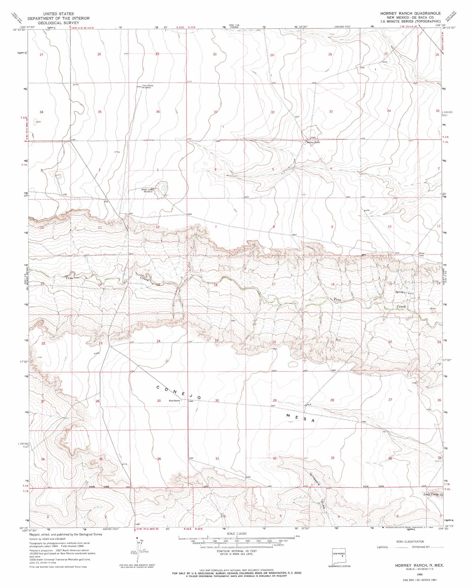
USGS Topo Quad 34104c5 - 1:24,000 scale
| Topo Map Name: | Horney Ranch |
| USGS Topo Quad ID: | 34104c5 |
| Print Size: | ca. 21 1/4" wide x 27" high |
| Southeast Coordinates: | 34.25° N latitude / 104.5° W longitude |
| Map Center Coordinates: | 34.3125° N latitude / 104.5625° W longitude |
| U.S. State: | NM |
| Filename: | o34104c5.jpg |
| Download Map JPG Image: | Horney Ranch topo map 1:24,000 scale |
| Map Type: | Topographic |
| Topo Series: | 7.5´ |
| Map Scale: | 1:24,000 |
| Source of Map Images: | United States Geological Survey (USGS) |
| Alternate Map Versions: |
Horney Ranch NM 1966, updated 1969 Download PDF Buy paper map Horney Ranch NM 2010 Download PDF Buy paper map Horney Ranch NM 2013 Download PDF Buy paper map Horney Ranch NM 2017 Download PDF Buy paper map |
1:24,000 Topo Quads surrounding Horney Ranch
El Morro Ranch Se |
Borica Sw |
Cooper Ranch |
Alamogordo Dam |
Windmill Draw |
Yeso Mesa |
Yeso Nw |
Yeso |
Ricardo |
Fort Sumner West |
Yeso Mesa Se |
El Morro Mesa |
Horney Ranch |
West Camp |
Alamo Ranch |
Wright Ranch |
The Old Dry Lake |
Dunlap Ne |
Conejo Creek West |
Conejo Creek East |
Wire Lake |
Devils Well |
Dunlap |
Lovelady Draw |
La Espia Peak |
> Back to 34104a1 at 1:100,000 scale
> Back to 34104a1 at 1:250,000 scale
> Back to U.S. Topo Maps home
Horney Ranch digital topo map on disk
Buy this Horney Ranch topo map showing relief, roads, GPS coordinates and other geographical features, as a high-resolution digital map file on DVD: