Ricardo Topo Map New Mexico
To zoom in, hover over the map of Ricardo
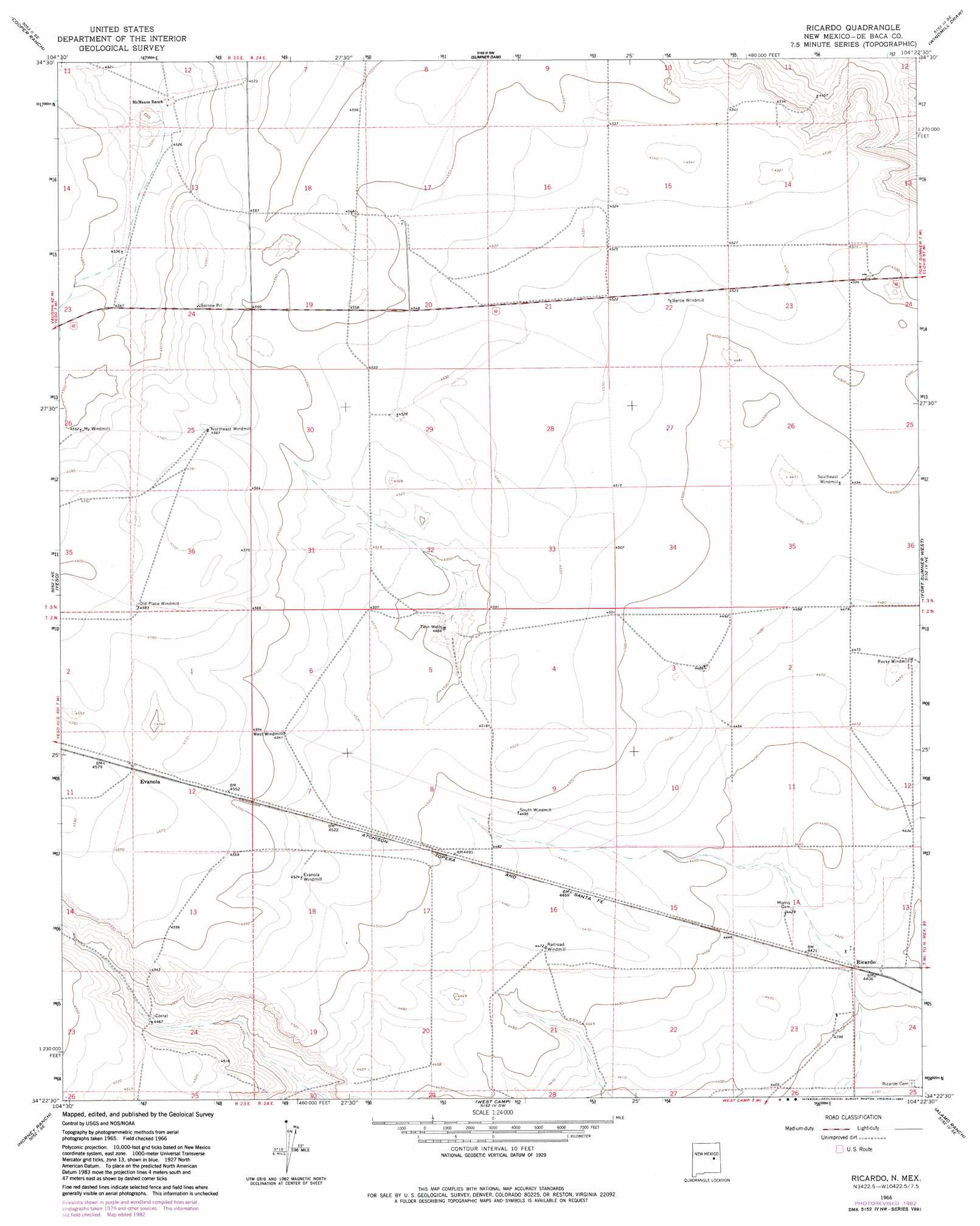
USGS Topo Quad 34104d4 - 1:24,000 scale
| Topo Map Name: | Ricardo |
| USGS Topo Quad ID: | 34104d4 |
| Print Size: | ca. 21 1/4" wide x 27" high |
| Southeast Coordinates: | 34.375° N latitude / 104.375° W longitude |
| Map Center Coordinates: | 34.4375° N latitude / 104.4375° W longitude |
| U.S. State: | NM |
| Filename: | o34104d4.jpg |
| Download Map JPG Image: | Ricardo topo map 1:24,000 scale |
| Map Type: | Topographic |
| Topo Series: | 7.5´ |
| Map Scale: | 1:24,000 |
| Source of Map Images: | United States Geological Survey (USGS) |
| Alternate Map Versions: |
Ricardo NM 1966, updated 1968 Download PDF Buy paper map Ricardo NM 1966, updated 1982 Download PDF Buy paper map Ricardo NM 2010 Download PDF Buy paper map Ricardo NM 2013 Download PDF Buy paper map Ricardo NM 2017 Download PDF Buy paper map |
1:24,000 Topo Quads surrounding Ricardo
Borica |
Ojo Negro Creek |
Gibbons Ranch |
Colorado Canyon |
Twin Mesa Nw |
Borica Sw |
Cooper Ranch |
Alamogordo Dam |
Windmill Draw |
Twin Mesa |
Yeso Nw |
Yeso |
Ricardo |
Fort Sumner West |
Fort Sumner East |
El Morro Mesa |
Horney Ranch |
West Camp |
Alamo Ranch |
Bonner Lake |
The Old Dry Lake |
Dunlap Ne |
Conejo Creek West |
Conejo Creek East |
Eighteenmile Hill |
> Back to 34104a1 at 1:100,000 scale
> Back to 34104a1 at 1:250,000 scale
> Back to U.S. Topo Maps home
Ricardo topo map: Gazetteer
Ricardo: Mines
Borrow Pit elevation 1397m 4583′Ricardo: Populated Places
Evanola elevation 1396m 4580′Ricardo (historical) elevation 1345m 4412′
Ricardo: Post Offices
Ricardo Post Office (historical) elevation 1345m 4412′Ricardo: Wells
Twin Wells elevation 1362m 4468′Ricardo digital topo map on disk
Buy this Ricardo topo map showing relief, roads, GPS coordinates and other geographical features, as a high-resolution digital map file on DVD: