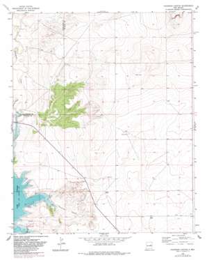
Colorado Canyon Topo Map New Mexico
To zoom in, hover over the map of Colorado Canyon
USGS Topo Quad 34104f3 - 1:24,000 scale
| Topo Map Name: | Colorado Canyon |
| USGS Topo Quad ID: | 34104f3 |
| Print Size: | ca. 21 1/4" wide x 27" high |
| Southeast Coordinates: | 34.625° N latitude / 104.25° W longitude |
| Map Center Coordinates: | 34.6875° N latitude / 104.3125° W longitude |
| U.S. State: | NM |
| Filename: | o34104f3.jpg |
| Download Map JPG Image: | Colorado Canyon topo map 1:24,000 scale |
| Map Type: | Topographic |
| Topo Series: | 7.5´ |
| Map Scale: | 1:24,000 |
| Source of Map Images: | United States Geological Survey (USGS) |
| Alternate Map Versions: |
Colorado Canyon NM 1966, updated 1969 Download PDF Buy paper map Colorado Canyon NM 1966, updated 1983 Download PDF Buy paper map Colorado Canyon NM 2010 Download PDF Buy paper map Colorado Canyon NM 2013 Download PDF Buy paper map Colorado Canyon NM 2017 Download PDF Buy paper map |
1:24,000 Topo Quads surrounding Colorado Canyon
> Back to 34104e1 at 1:100,000 scale
> Back to 34104a1 at 1:250,000 scale
> Back to U.S. Topo Maps home
Colorado Canyon topo map: Gazetteer
Colorado Canyon: Streams
Arroyo Potrillo elevation 1312m 4304′Colorado Canyon: Valleys
Colorado Canyon elevation 1307m 4288′Colorado Canyon: Wells
10004 Water Well elevation 1348m 4422′10461 Water Well elevation 1333m 4373′
10574 Water Well elevation 1326m 4350′
10575 Water Well elevation 1329m 4360′
10576 Water Well elevation 1332m 4370′
10581 WAter Well elevation 1331m 4366′
10582 Water Well elevation 1327m 4353′
10585 Water Well elevation 1324m 4343′
10595 Water Well elevation 1320m 4330′
10596 Water Well elevation 1406m 4612′
10597 Water Well elevation 1393m 4570′
10598 Water Well elevation 1399m 4589′
10599 Water Well elevation 1396m 4580′
10600 Water Well elevation 1338m 4389′
10601 Water Well elevation 1376m 4514′
10602 Water Well elevation 1392m 4566′
10604 WAter Well elevation 1383m 4537′
10605 Water Well elevation 1376m 4514′
10606 Water Well elevation 1376m 4514′
10607 Water Well elevation 1384m 4540′
10608 Water Well elevation 1357m 4452′
10609 Water Well elevation 1367m 4484′
10610 Water Well elevation 1375m 4511′
10611 Water Well elevation 1365m 4478′
10613 Water Well elevation 1361m 4465′
10614 Water Well elevation 1363m 4471′
10615 Water Well elevation 1351m 4432′
10616 Water Well elevation 1350m 4429′
10617 Water Well elevation 1363m 4471′
10618 Water Well elevation 1332m 4370′
10619 Water Well elevation 1344m 4409′
10620 Water Well elevation 1351m 4432′
10621 Water Well elevation 1352m 4435′
10622 Water Well elevation 1348m 4422′
10623 Water Well elevation 1347m 4419′
10624 Water Well elevation 1349m 4425′
10625 Water Well elevation 1353m 4438′
10626 Water Well elevation 1351m 4432′
10721 Water Well elevation 1451m 4760′
10722 Water Well elevation 1431m 4694′
10725 Water Well elevation 1366m 4481′
10730 Water Well elevation 1378m 4520′
10731 Water Well elevation 1366m 4481′
10732 Water Well elevation 1363m 4471′
10733 Water Well elevation 1437m 4714′
Colorado Canyon digital topo map on disk
Buy this Colorado Canyon topo map showing relief, roads, GPS coordinates and other geographical features, as a high-resolution digital map file on DVD:


