Borica Topo Map New Mexico
To zoom in, hover over the map of Borica
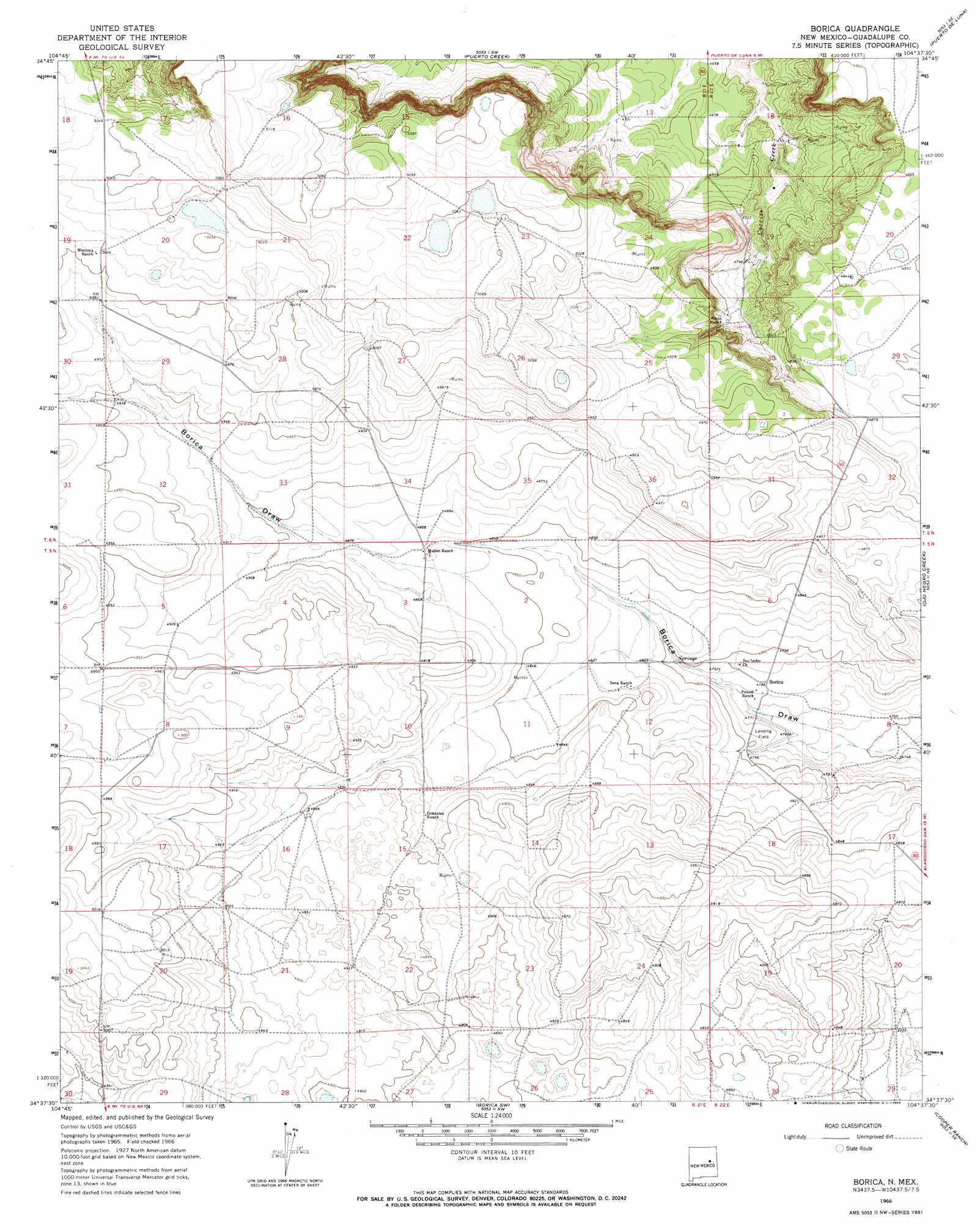
USGS Topo Quad 34104f6 - 1:24,000 scale
| Topo Map Name: | Borica |
| USGS Topo Quad ID: | 34104f6 |
| Print Size: | ca. 21 1/4" wide x 27" high |
| Southeast Coordinates: | 34.625° N latitude / 104.625° W longitude |
| Map Center Coordinates: | 34.6875° N latitude / 104.6875° W longitude |
| U.S. State: | NM |
| Filename: | o34104f6.jpg |
| Download Map JPG Image: | Borica topo map 1:24,000 scale |
| Map Type: | Topographic |
| Topo Series: | 7.5´ |
| Map Scale: | 1:24,000 |
| Source of Map Images: | United States Geological Survey (USGS) |
| Alternate Map Versions: |
Borica NM 1966, updated 1969 Download PDF Buy paper map Borica NM 2010 Download PDF Buy paper map Borica NM 2013 Download PDF Buy paper map Borica NM 2017 Download PDF Buy paper map |
1:24,000 Topo Quads surrounding Borica
San Ignacio |
Pastura Ne |
Santa Rosa |
Sunshine Mesa |
Harben Lake |
Pastura |
Pastura Se |
Puerto Creek |
Puerto De Luna |
Fallon Ranch |
El Morro Ranch Nw |
Laguna De Los Terreros |
Borica |
Ojo Negro Creek |
Gibbons Ranch |
El Morro Ranch |
El Morro Ranch Se |
Borica Sw |
Cooper Ranch |
Alamogordo Dam |
Duoro |
Yeso Mesa |
Yeso Nw |
Yeso |
Ricardo |
> Back to 34104e1 at 1:100,000 scale
> Back to 34104a1 at 1:250,000 scale
> Back to U.S. Topo Maps home
Borica topo map: Gazetteer
Borica: Populated Places
Borica elevation 1459m 4786′Borica: Post Offices
Borica Post Office (historical) elevation 1459m 4786′Borica digital topo map on disk
Buy this Borica topo map showing relief, roads, GPS coordinates and other geographical features, as a high-resolution digital map file on DVD: