Ima Sw Topo Map New Mexico
To zoom in, hover over the map of Ima Sw
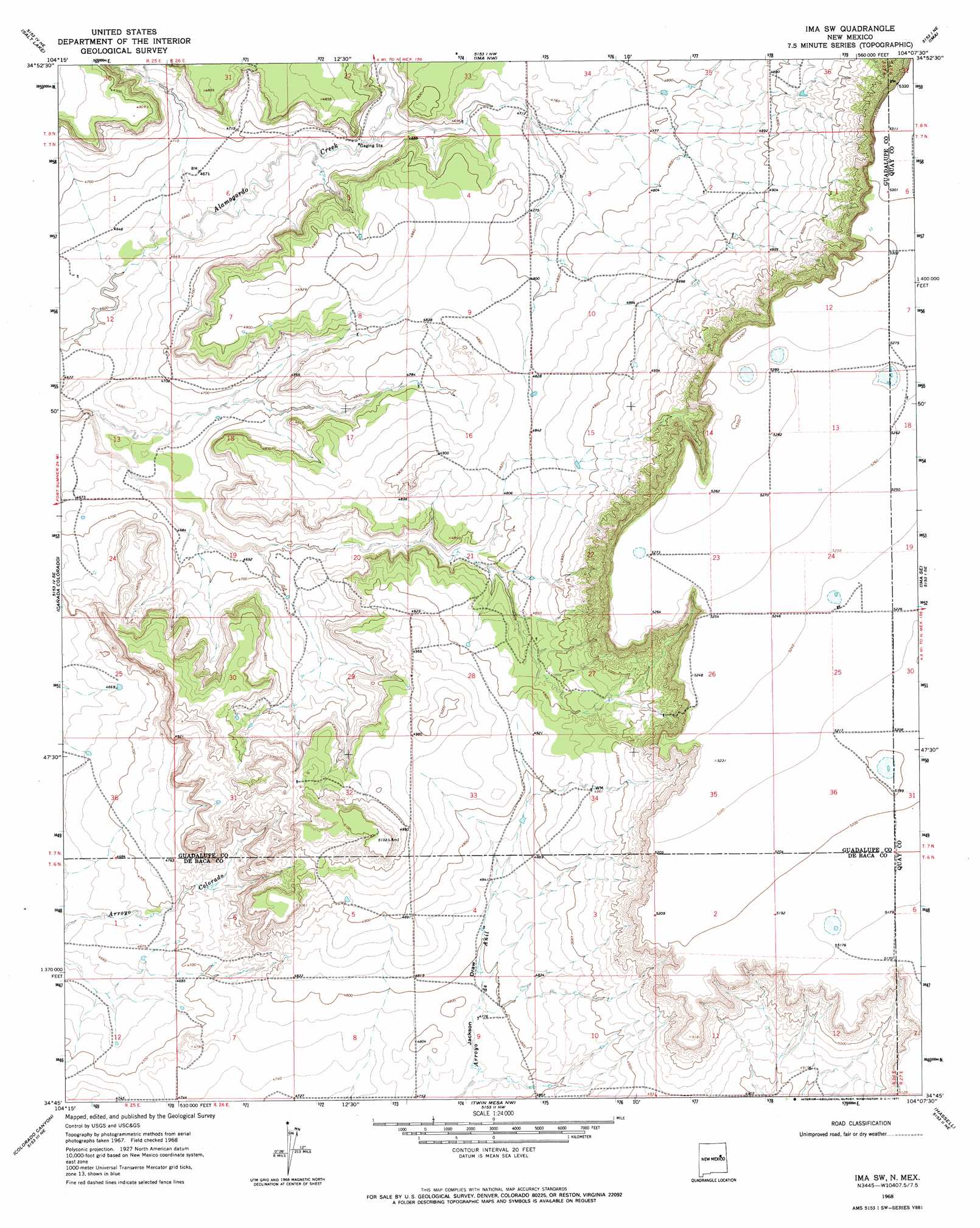
USGS Topo Quad 34104g2 - 1:24,000 scale
| Topo Map Name: | Ima Sw |
| USGS Topo Quad ID: | 34104g2 |
| Print Size: | ca. 21 1/4" wide x 27" high |
| Southeast Coordinates: | 34.75° N latitude / 104.125° W longitude |
| Map Center Coordinates: | 34.8125° N latitude / 104.1875° W longitude |
| U.S. State: | NM |
| Filename: | o34104g2.jpg |
| Download Map JPG Image: | Ima Sw topo map 1:24,000 scale |
| Map Type: | Topographic |
| Topo Series: | 7.5´ |
| Map Scale: | 1:24,000 |
| Source of Map Images: | United States Geological Survey (USGS) |
| Alternate Map Versions: |
Ima SW NM 1968, updated 1971 Download PDF Buy paper map Ima SW NM 2010 Download PDF Buy paper map Ima SW NM 2013 Download PDF Buy paper map Ima SW NM 2017 Download PDF Buy paper map |
1:24,000 Topo Quads surrounding Ima Sw
Cuervo |
Newkirk |
Gate Canyon |
Montoya |
Quemado Hills |
Harben Lake |
Salt Lake |
Ima Nw |
Ima |
Circle S Mesa |
Fallon Ranch |
Canada Colorado |
Ima Sw |
Ima Se |
Cunavea Basin |
Gibbons Ranch |
Colorado Canyon |
Twin Mesa Nw |
Hassell |
House |
Alamogordo Dam |
Windmill Draw |
Twin Mesa |
Candy Mesa |
Peach Canyon |
> Back to 34104e1 at 1:100,000 scale
> Back to 34104a1 at 1:250,000 scale
> Back to U.S. Topo Maps home
Ima Sw topo map: Gazetteer
Ima Sw: Valleys
Jackson Draw elevation 1446m 4744′Ima Sw: Wells
10648 Water Well elevation 1604m 5262′Ima Sw digital topo map on disk
Buy this Ima Sw topo map showing relief, roads, GPS coordinates and other geographical features, as a high-resolution digital map file on DVD: