Pelan Hill Topo Map New Mexico
To zoom in, hover over the map of Pelan Hill
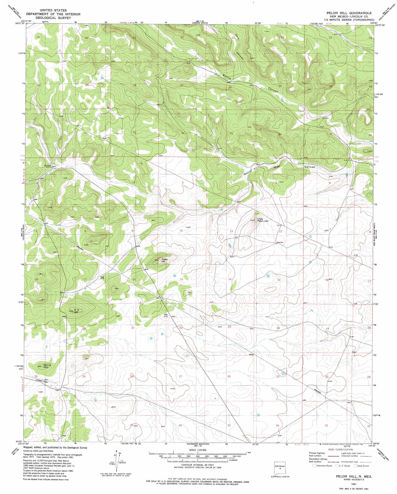
USGS Topo Quad 34105a5 - 1:24,000 scale
| Topo Map Name: | Pelan Hill |
| USGS Topo Quad ID: | 34105a5 |
| Print Size: | ca. 21 1/4" wide x 27" high |
| Southeast Coordinates: | 34° N latitude / 105.5° W longitude |
| Map Center Coordinates: | 34.0625° N latitude / 105.5625° W longitude |
| U.S. State: | NM |
| Filename: | o34105a5.jpg |
| Download Map JPG Image: | Pelan Hill topo map 1:24,000 scale |
| Map Type: | Topographic |
| Topo Series: | 7.5´ |
| Map Scale: | 1:24,000 |
| Source of Map Images: | United States Geological Survey (USGS) |
| Alternate Map Versions: |
Pelon Hill NM 1981 Download PDF Buy paper map Pelon Hill NM 2010 Download PDF Buy paper map Pelon Hill NM 2013 Download PDF Buy paper map Pelon Hill NM 2017 Download PDF Buy paper map |
1:24,000 Topo Quads surrounding Pelan Hill
Progresso Se |
Cedarvale |
Corono North |
Camaleon Draw West |
Camaleon Draw East |
Pajaro Canyon |
Rough Mountain |
Corona South |
Gallo Spring Canyon |
Gallo Spring Canyon Ne |
Claunch Se |
Tecolote Peak |
Pelan Hill |
Red Bluff Draw West |
Red Bluff Draw East |
Little Black Peak Ne |
Ancho |
Chupadero Mountain |
Hasperos Camp |
Golondrina Well |
Lone Mountain |
White Oaks North |
Jicarilla Peak |
Box Lake |
Pedernal Arroyo |
> Back to 34105a1 at 1:100,000 scale
> Back to 34104a1 at 1:250,000 scale
> Back to U.S. Topo Maps home
Pelan Hill topo map: Gazetteer
Pelan Hill: Summits
Little Pelon Hill elevation 1989m 6525′Monte Alto elevation 2020m 6627′
Pelon Hill elevation 2047m 6715′
R D Hill elevation 2026m 6646′
Pelan Hill: Valleys
Dark Canyon elevation 1907m 6256′Pelan Hill digital topo map on disk
Buy this Pelan Hill topo map showing relief, roads, GPS coordinates and other geographical features, as a high-resolution digital map file on DVD: