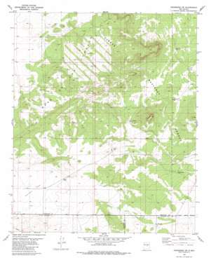
Progresso Sw Topo Map New Mexico
To zoom in, hover over the map of Progresso Sw
USGS Topo Quad 34105c8 - 1:24,000 scale
| Topo Map Name: | Progresso Sw |
| USGS Topo Quad ID: | 34105c8 |
| Print Size: | ca. 21 1/4" wide x 27" high |
| Southeast Coordinates: | 34.25° N latitude / 105.875° W longitude |
| Map Center Coordinates: | 34.3125° N latitude / 105.9375° W longitude |
| U.S. State: | NM |
| Filename: | o34105c8.jpg |
| Download Map JPG Image: | Progresso Sw topo map 1:24,000 scale |
| Map Type: | Topographic |
| Topo Series: | 7.5´ |
| Map Scale: | 1:24,000 |
| Source of Map Images: | United States Geological Survey (USGS) |
| Alternate Map Versions: |
Progresso SW NM 1981, updated 1981 Download PDF Buy paper map Progresso SW NM 1995, updated 1998 Download PDF Buy paper map Progresso SW NM 2011 Download PDF Buy paper map Progresso SW NM 2013 Download PDF Buy paper map Progresso SW NM 2017 Download PDF Buy paper map |
| FStopo: | US Forest Service topo Progresso SW is available: Download FStopo PDF Download FStopo TIF |
1:24,000 Topo Quads surrounding Progresso Sw
> Back to 34105a1 at 1:100,000 scale
> Back to 34104a1 at 1:250,000 scale
> Back to U.S. Topo Maps home
Progresso Sw topo map: Gazetteer
Progresso Sw: Flats
Atkinson Flats elevation 1946m 6384′Progresso Sw: Lakes
Wire Lake elevation 1967m 6453′Progresso Sw: Reservoirs
Horse Pasture Tank elevation 1957m 6420′Mesa Trick Tank elevation 1949m 6394′
South Tank elevation 2024m 6640′
Progresso Sw: Wells
Atkinson Well elevation 1968m 6456′Axtell Well elevation 2026m 6646′
Dempster Well elevation 2016m 6614′
Middle Well elevation 1952m 6404′
North Well elevation 1996m 6548′
South Well elevation 2024m 6640′
Progresso Sw digital topo map on disk
Buy this Progresso Sw topo map showing relief, roads, GPS coordinates and other geographical features, as a high-resolution digital map file on DVD:


