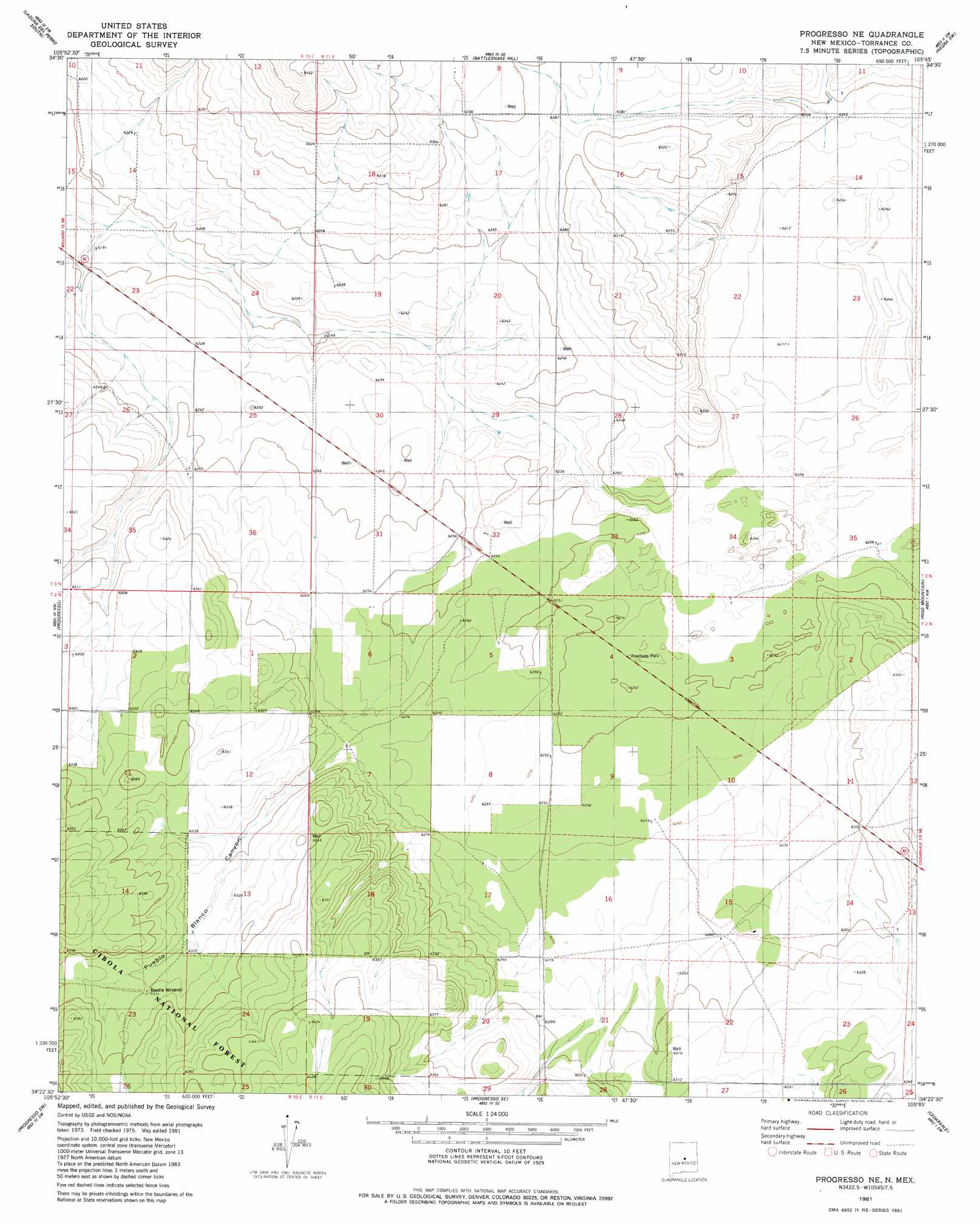
Progresso Ne Topo Map New Mexico
To zoom in, hover over the map of Progresso Ne
USGS Topo Quad 34105d7 - 1:24,000 scale
| Topo Map Name: | Progresso Ne |
| USGS Topo Quad ID: | 34105d7 |
| Print Size: | ca. 21 1/4" wide x 27" high |
| Southeast Coordinates: | 34.375° N latitude / 105.75° W longitude |
| Map Center Coordinates: | 34.4375° N latitude / 105.8125° W longitude |
| U.S. State: | NM |
| Filename: | o34105d7.jpg |
| Download Map JPG Image: | Progresso Ne topo map 1:24,000 scale |
| Map Type: | Topographic |
| Topo Series: | 7.5´ |
| Map Scale: | 1:24,000 |
| Source of Map Images: | United States Geological Survey (USGS) |
| Alternate Map Versions: |
Progresso NE NM 1981, updated 1981 Download PDF Buy paper map Progresso NE NM 1995, updated 1998 Download PDF Buy paper map Progresso NE NM 2011 Download PDF Buy paper map Progresso NE NM 2013 Download PDF Buy paper map Progresso NE NM 2017 Download PDF Buy paper map |
| FStopo: | US Forest Service topo Progresso NE is available: Download FStopo PDF Download FStopo TIF |
1:24,000 Topo Quads surrounding Progresso Ne
Mountainair Ne |
Laguna Del Perro North |
Lucy |
Pedernal |
Negra |
Willard |
Laguna Del Perro South |
Rattlesnake Hill |
Negra Sw |
Negra Se |
Round Top |
Progresso |
Progresso Ne |
Pino Mountain |
Cedarvale Ne |
Gran Quivira |
Progresso Sw |
Progresso Se |
Cedarvale |
Corono North |
Turkey Ridge Ne |
Claunch |
Pajaro Canyon |
Rough Mountain |
Corona South |
> Back to 34105a1 at 1:100,000 scale
> Back to 34104a1 at 1:250,000 scale
> Back to U.S. Topo Maps home
Progresso Ne digital topo map on disk
Buy this Progresso Ne topo map showing relief, roads, GPS coordinates and other geographical features, as a high-resolution digital map file on DVD: