Pintada Topo Map New Mexico
To zoom in, hover over the map of Pintada
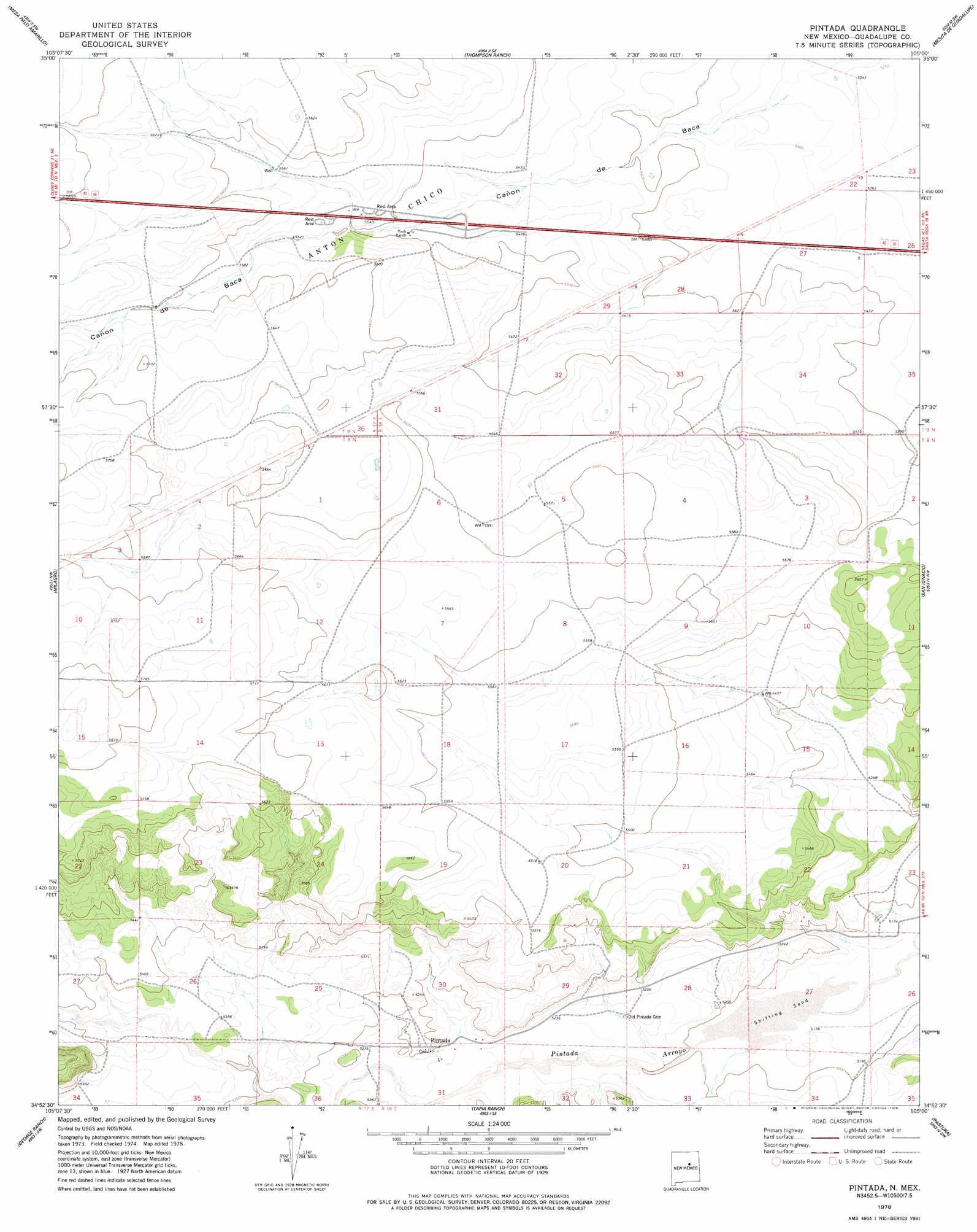
USGS Topo Quad 34105h1 - 1:24,000 scale
| Topo Map Name: | Pintada |
| USGS Topo Quad ID: | 34105h1 |
| Print Size: | ca. 21 1/4" wide x 27" high |
| Southeast Coordinates: | 34.875° N latitude / 105° W longitude |
| Map Center Coordinates: | 34.9375° N latitude / 105.0625° W longitude |
| U.S. State: | NM |
| Filename: | o34105h1.jpg |
| Download Map JPG Image: | Pintada topo map 1:24,000 scale |
| Map Type: | Topographic |
| Topo Series: | 7.5´ |
| Map Scale: | 1:24,000 |
| Source of Map Images: | United States Geological Survey (USGS) |
| Alternate Map Versions: |
Pintada NM 1978, updated 1978 Download PDF Buy paper map Pintada NM 2010 Download PDF Buy paper map Pintada NM 2013 Download PDF Buy paper map Pintada NM 2017 Download PDF Buy paper map |
1:24,000 Topo Quads surrounding Pintada
San Juan |
Anton Chico |
Dilia |
Pedro Miguel Peak |
Horse Pasture Tank |
Potrillo Hill |
Mesa Palo Amarillo |
Thompson Ranch |
Mesita De Guadalupe |
Colonias |
Milagro Spring |
Milagro |
Pintada |
San Ignacio |
Pastura Ne |
Pinavete Canyon |
George Ranch |
Tapia Ranch |
Pastura |
Pastura Se |
Santa Barbara Lake |
Mesa Leon |
Burro Lake |
El Morro Ranch Nw |
Laguna De Los Terreros |
> Back to 34105e1 at 1:100,000 scale
> Back to 34104a1 at 1:250,000 scale
> Back to U.S. Topo Maps home
Pintada topo map: Gazetteer
Pintada: Populated Places
Pintada elevation 1618m 5308′Pintada: Post Offices
Pintada Post Office (historical) elevation 1618m 5308′Pintada: Valleys
Cañon de Baca elevation 1628m 5341′Pintada digital topo map on disk
Buy this Pintada topo map showing relief, roads, GPS coordinates and other geographical features, as a high-resolution digital map file on DVD: