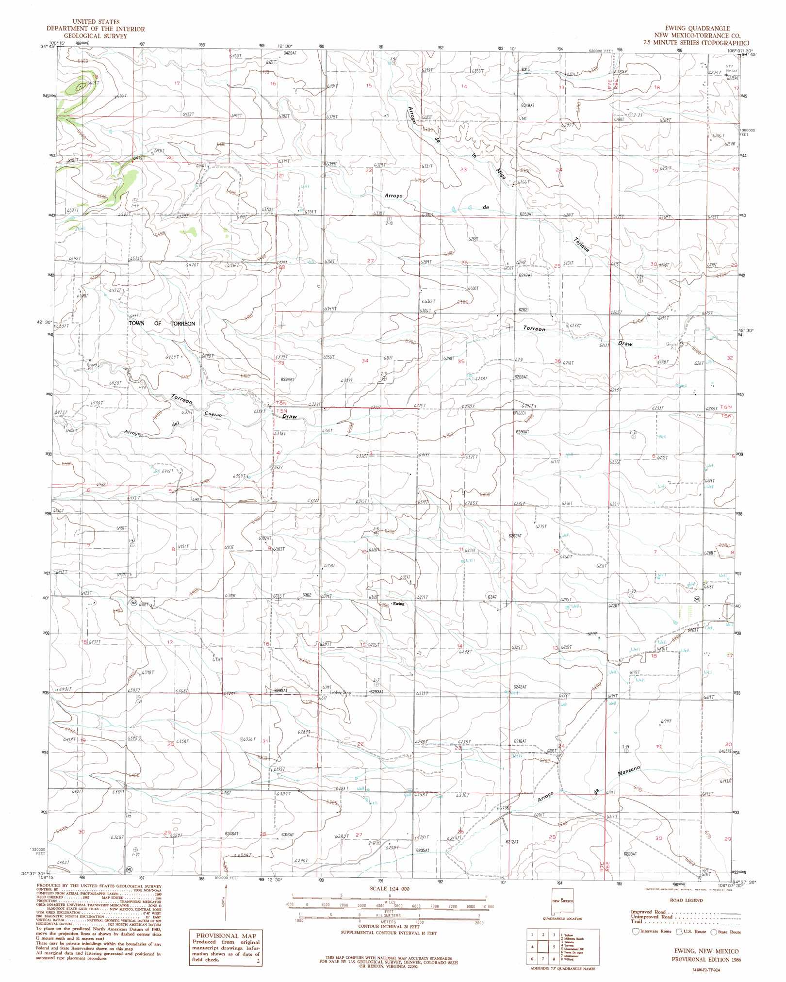
Ewing Topo Map New Mexico
To zoom in, hover over the map of Ewing
USGS Topo Quad 34106f2 - 1:24,000 scale
| Topo Map Name: | Ewing |
| USGS Topo Quad ID: | 34106f2 |
| Print Size: | ca. 21 1/4" wide x 27" high |
| Southeast Coordinates: | 34.625° N latitude / 106.125° W longitude |
| Map Center Coordinates: | 34.6875° N latitude / 106.1875° W longitude |
| U.S. State: | NM |
| Filename: | o34106f2.jpg |
| Download Map JPG Image: | Ewing topo map 1:24,000 scale |
| Map Type: | Topographic |
| Topo Series: | 7.5´ |
| Map Scale: | 1:24,000 |
| Source of Map Images: | United States Geological Survey (USGS) |
| Alternate Map Versions: |
Ewing NM 1986, updated 1986 Download PDF Buy paper map Ewing NM 2010 Download PDF Buy paper map Ewing NM 2013 Download PDF Buy paper map Ewing NM 2017 Download PDF Buy paper map |
1:24,000 Topo Quads surrounding Ewing
Mount Washington |
Escabosa |
Chilili |
Moriarty South |
Lobo Hill |
Bosque Peak |
Tajique |
Milbourn Ranch |
Estancia |
Lobo Hill Sw |
Capilla Peak |
Torreon |
Ewing |
Mountainair Ne |
Laguna Del Perro North |
Manzano Peak |
Punta De Agua |
Mountainair |
Willard |
Laguna Del Perro South |
Scholle |
Abo |
Mesa Draw |
Round Top |
Progresso |
> Back to 34106e1 at 1:100,000 scale
> Back to 34106a1 at 1:250,000 scale
> Back to U.S. Topo Maps home
Ewing topo map: Gazetteer
Ewing: Arroyos
Arroyo de Tajique elevation 1887m 6190′Arroyo del Cuervo elevation 1930m 6332′
Ewing: Streams
Arroyo Miga elevation 1907m 6256′Ewing: Wells
10020 Water Well elevation 1909m 6263′10021 Water Well elevation 1903m 6243′
10026 Water Well elevation 1896m 6220′
10030 Water Well elevation 1901m 6236′
10061 Water Well elevation 1892m 6207′
10198 Water Well elevation 1890m 6200′
Ewing digital topo map on disk
Buy this Ewing topo map showing relief, roads, GPS coordinates and other geographical features, as a high-resolution digital map file on DVD: