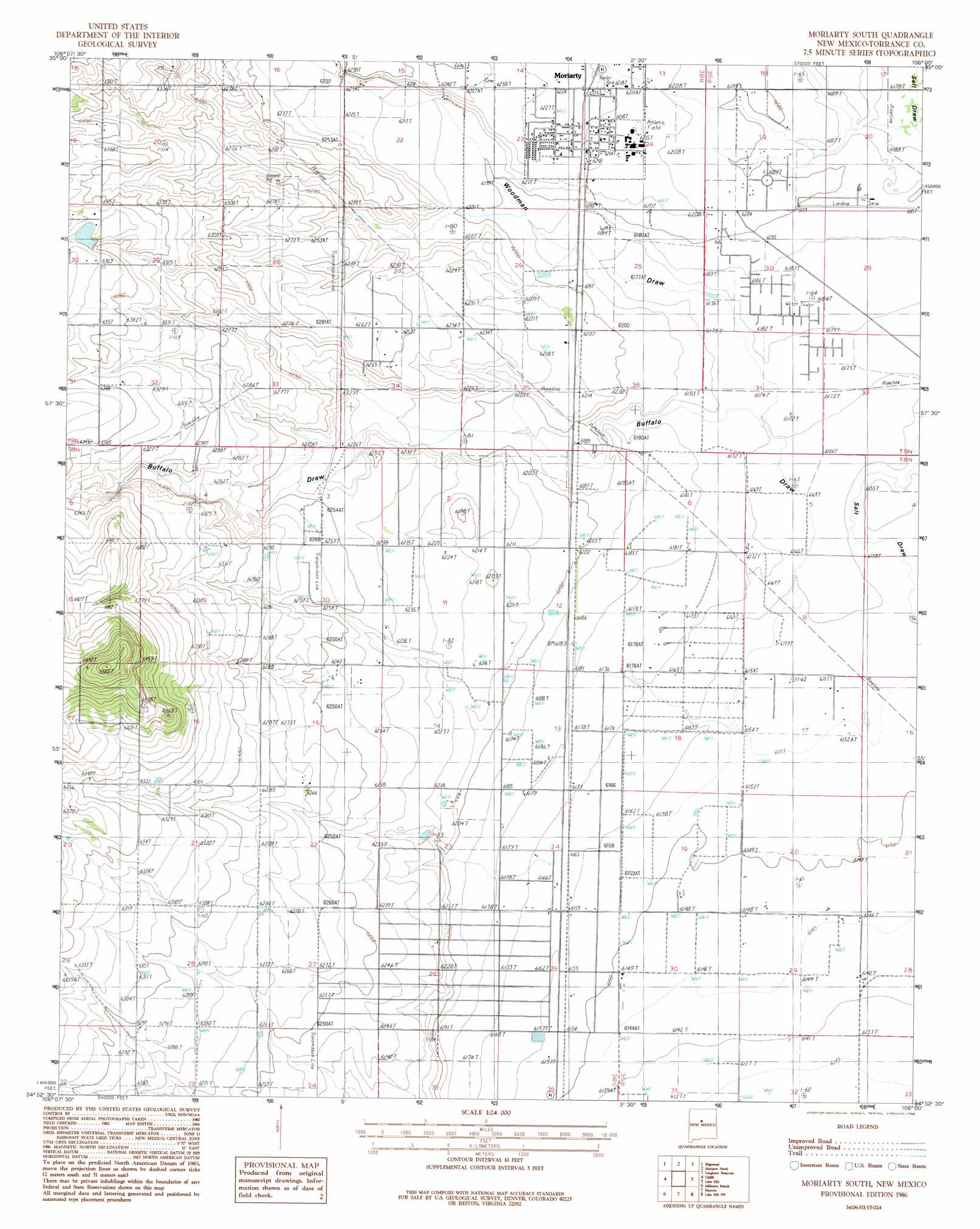
Moriarty South Topo Map New Mexico
To zoom in, hover over the map of Moriarty South
USGS Topo Quad 34106h1 - 1:24,000 scale
| Topo Map Name: | Moriarty South |
| USGS Topo Quad ID: | 34106h1 |
| Print Size: | ca. 21 1/4" wide x 27" high |
| Southeast Coordinates: | 34.875° N latitude / 106° W longitude |
| Map Center Coordinates: | 34.9375° N latitude / 106.0625° W longitude |
| U.S. State: | NM |
| Filename: | o34106h1.jpg |
| Download Map JPG Image: | Moriarty South topo map 1:24,000 scale |
| Map Type: | Topographic |
| Topo Series: | 7.5´ |
| Map Scale: | 1:24,000 |
| Source of Map Images: | United States Geological Survey (USGS) |
| Alternate Map Versions: |
Moriarty South NM 1986, updated 1986 Download PDF Buy paper map Moriarty South NM 2010 Download PDF Buy paper map Moriarty South NM 2013 Download PDF Buy paper map Moriarty South NM 2017 Download PDF Buy paper map |
1:24,000 Topo Quads surrounding Moriarty South
Sandia Park |
San Pedro |
King Draw |
Stanley |
White |
Sedillo |
Edgewood |
Moriarty North |
Longhorn Reservoir |
El Cuervo Butte |
Escabosa |
Chilili |
Moriarty South |
Lobo Hill |
Lobo Hill Ne |
Tajique |
Milbourn Ranch |
Estancia |
Lobo Hill Sw |
Lobo Hill Se |
Torreon |
Ewing |
Mountainair Ne |
Laguna Del Perro North |
Lucy |
> Back to 34106e1 at 1:100,000 scale
> Back to 34106a1 at 1:250,000 scale
> Back to U.S. Topo Maps home
Moriarty South topo map: Gazetteer
Moriarty South: Airports
Moriarty Airport elevation 1888m 6194′Moriarty South: Dams
Mescalero Lake Dam elevation 1941m 6368′Moriarty South: Populated Places
C Davis Place elevation 1928m 6325′E Davis Place elevation 1912m 6272′
Moriarty elevation 1896m 6220′
Moriarty South: Post Offices
Moriarty Post Office elevation 1896m 6220′Moriarty South: Reservoirs
Mescalero Reservoir elevation 1941m 6368′Moriarty South: Valleys
Buffalo Draw elevation 1878m 6161′Woodman Draw elevation 1883m 6177′
Moriarty South: Wells
10176 Water Well elevation 1876m 6154′10189 Water Well elevation 1905m 6250′
10196 Water Well elevation 1902m 6240′
E-3859-S-Enlarged Well elevation 1871m 6138′
Moriarty South digital topo map on disk
Buy this Moriarty South topo map showing relief, roads, GPS coordinates and other geographical features, as a high-resolution digital map file on DVD: