Augustine Well Topo Map New Mexico
To zoom in, hover over the map of Augustine Well
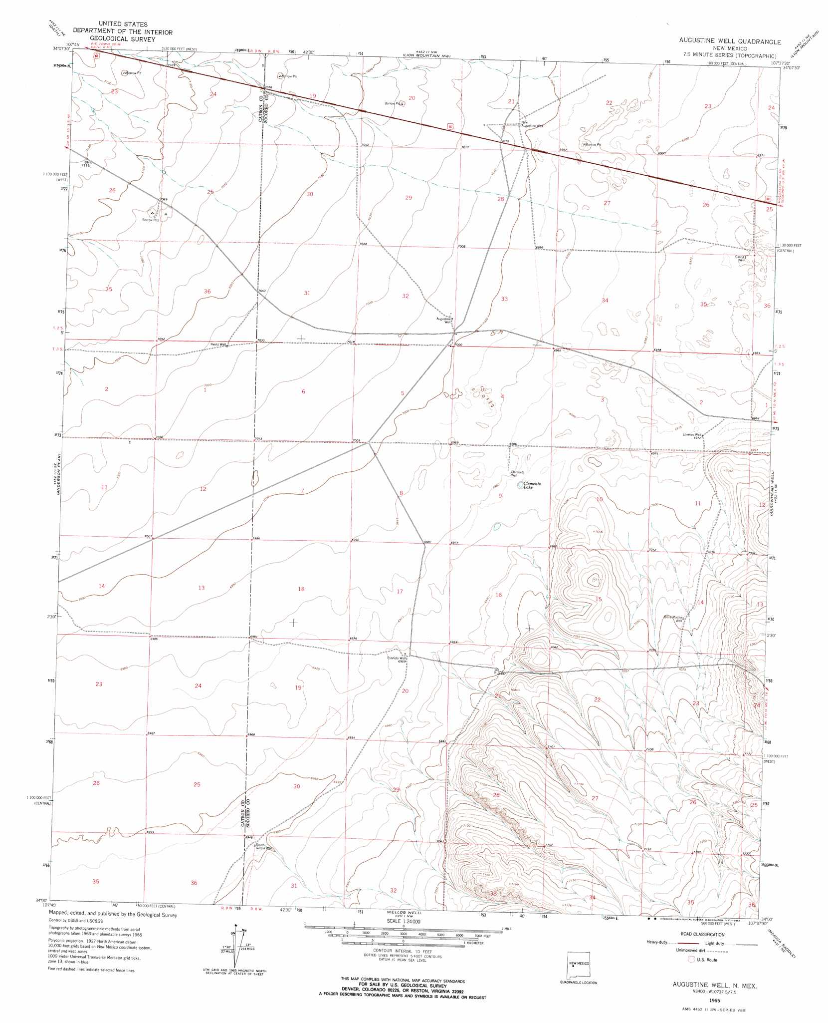
USGS Topo Quad 34107a6 - 1:24,000 scale
| Topo Map Name: | Augustine Well |
| USGS Topo Quad ID: | 34107a6 |
| Print Size: | ca. 21 1/4" wide x 27" high |
| Southeast Coordinates: | 34° N latitude / 107.625° W longitude |
| Map Center Coordinates: | 34.0625° N latitude / 107.6875° W longitude |
| U.S. State: | NM |
| Filename: | o34107a6.jpg |
| Download Map JPG Image: | Augustine Well topo map 1:24,000 scale |
| Map Type: | Topographic |
| Topo Series: | 7.5´ |
| Map Scale: | 1:24,000 |
| Source of Map Images: | United States Geological Survey (USGS) |
| Alternate Map Versions: |
Augustine Well NM 1965, updated 1967 Download PDF Buy paper map Augustine Well NM 2010 Download PDF Buy paper map Augustine Well NM 2013 Download PDF Buy paper map Augustine Well NM 2017 Download PDF Buy paper map |
1:24,000 Topo Quads surrounding Augustine Well
Madre Mountain |
Cal Ship Mesa |
Dog Springs |
Indian Mesa |
Indian Spring Canyon |
Crosby Springs |
Datil |
Lion Mountain Nw |
Lion Mountain |
Gallinas Peak |
Sugarloaf Mountain |
Anderson Peak |
Augustine Well |
Arrowhead Well |
Tres Montosas |
Luera Mountains Nw |
C-N Lake |
Kellog Well |
Monica Saddle |
Mount Withington |
Luera Mountains West |
Luera Mountains East |
Oak Peak |
Bay Buck Peaks |
Grassy Lookout |
> Back to 34107a1 at 1:100,000 scale
> Back to 34106a1 at 1:250,000 scale
> Back to U.S. Topo Maps home
Augustine Well topo map: Gazetteer
Augustine Well: Lakes
Clements Lake elevation 2125m 6971′Augustine Well: Populated Places
Augustine (historical) elevation 2135m 7004′Augustine Well: Wells
10010 Water Well elevation 2122m 6961′Augustine Well elevation 2135m 7004′
Bone Mocho Water Well elevation 2148m 7047′
Bone Mocho Well elevation 2148m 7047′
Chadwick Water Well elevation 2135m 7004′
Clements Well elevation 2128m 6981′
Estafeta Water Well elevation 2122m 6961′
Estafeta Well elevation 2122m 6961′
Garcia Water Well elevation 2125m 6971′
Heinz Water Well elevation 2145m 7037′
Heinz Well elevation 2145m 7037′
Lorenzo Well elevation 2126m 6975′
New Augustine Well elevation 2137m 7011′
Newaugusti Water Well elevation 2138m 7014′
South Garcia Well elevation 2118m 6948′
VLA Water Well elevation 2125m 6971′
Augustine Well digital topo map on disk
Buy this Augustine Well topo map showing relief, roads, GPS coordinates and other geographical features, as a high-resolution digital map file on DVD: