Granite Mountain Topo Map New Mexico
To zoom in, hover over the map of Granite Mountain
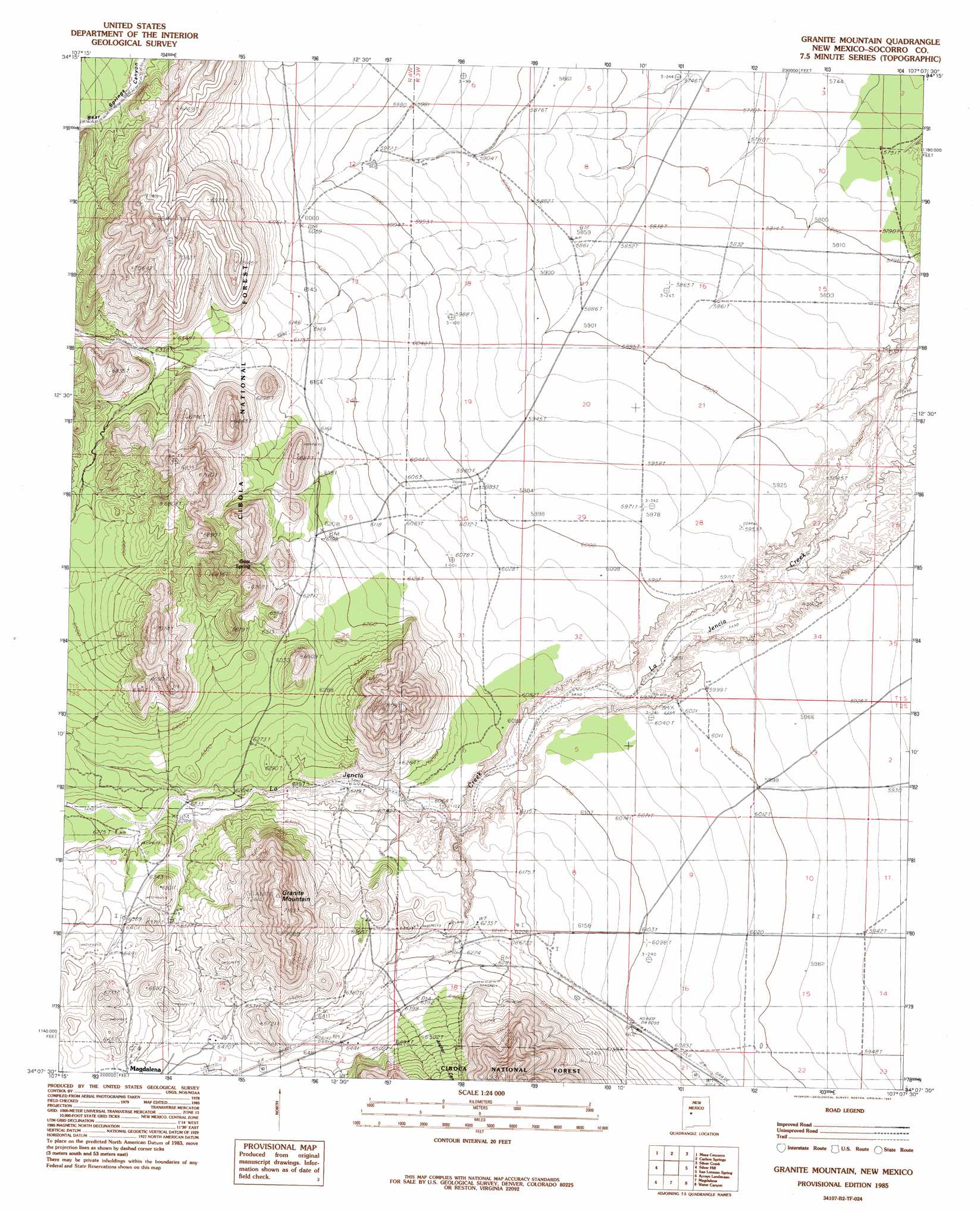
USGS Topo Quad 34107b2 - 1:24,000 scale
| Topo Map Name: | Granite Mountain |
| USGS Topo Quad ID: | 34107b2 |
| Print Size: | ca. 21 1/4" wide x 27" high |
| Southeast Coordinates: | 34.125° N latitude / 107.125° W longitude |
| Map Center Coordinates: | 34.1875° N latitude / 107.1875° W longitude |
| U.S. State: | NM |
| Filename: | o34107b2.jpg |
| Download Map JPG Image: | Granite Mountain topo map 1:24,000 scale |
| Map Type: | Topographic |
| Topo Series: | 7.5´ |
| Map Scale: | 1:24,000 |
| Source of Map Images: | United States Geological Survey (USGS) |
| Alternate Map Versions: |
Granite Mountain NM 1985, updated 1985 Download PDF Buy paper map Granite Mountain NM 1995, updated 1998 Download PDF Buy paper map Granite Mountain NM 2011 Download PDF Buy paper map Granite Mountain NM 2013 Download PDF Buy paper map Granite Mountain NM 2017 Download PDF Buy paper map |
| FStopo: | US Forest Service topo Granite Mountain is available: Download FStopo PDF Download FStopo TIF |
1:24,000 Topo Quads surrounding Granite Mountain
Puertecito |
La Jara Peak |
Riley |
Ladron Peak |
La Joya Nw |
Indian Spring Canyon |
Mesa Cencerro |
Carbon Springs |
Silver Creek |
San Acacia |
Gallinas Peak |
Silver Hill |
Granite Mountain |
San Lorenzo Spring |
Lemitar |
Tres Montosas |
Arroyo Landavaso |
Magdalena |
Water Canyon |
Socorro |
Mount Withington |
Squaw Peak |
South Baldy |
Molino Peak |
Luis Lopez |
> Back to 34107a1 at 1:100,000 scale
> Back to 34106a1 at 1:250,000 scale
> Back to U.S. Topo Maps home
Granite Mountain topo map: Gazetteer
Granite Mountain: Arroyos
Arroyo Gato elevation 1909m 6263′Granite Mountain: Mines
Heister elevation 2004m 6574′Granite Mountain: Reservoirs
Jornado Tank elevation 1819m 5967′Granite Mountain: Springs
Bird Spring elevation 1864m 6115′Goat Spring elevation 1956m 6417′
Granite Mountain: Summits
Granite Mountain elevation 2208m 7244′Granite Mountain: Valleys
Anchor Canyon elevation 1927m 6322′Granite Mountain digital topo map on disk
Buy this Granite Mountain topo map showing relief, roads, GPS coordinates and other geographical features, as a high-resolution digital map file on DVD: