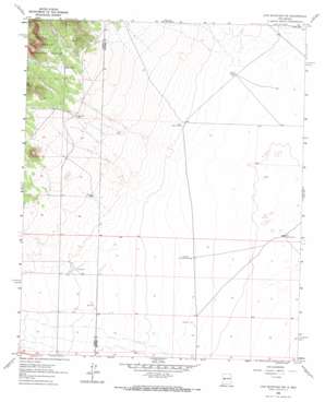
Lion Mountain Nw Topo Map New Mexico
To zoom in, hover over the map of Lion Mountain Nw
USGS Topo Quad 34107b6 - 1:24,000 scale
| Topo Map Name: | Lion Mountain Nw |
| USGS Topo Quad ID: | 34107b6 |
| Print Size: | ca. 21 1/4" wide x 27" high |
| Southeast Coordinates: | 34.125° N latitude / 107.625° W longitude |
| Map Center Coordinates: | 34.1875° N latitude / 107.6875° W longitude |
| U.S. State: | NM |
| Filename: | o34107b6.jpg |
| Download Map JPG Image: | Lion Mountain Nw topo map 1:24,000 scale |
| Map Type: | Topographic |
| Topo Series: | 7.5´ |
| Map Scale: | 1:24,000 |
| Source of Map Images: | United States Geological Survey (USGS) |
| Alternate Map Versions: |
Lion Mountain NW NM 1995, updated 1998 Download PDF Buy paper map Lion Mountain NW NM 2011 Download PDF Buy paper map Lion Mountain NW NM 2013 Download PDF Buy paper map Lion Mountain NW NM 2017 Download PDF Buy paper map |
| FStopo: | US Forest Service topo Lion Mountain NW is available: Download FStopo PDF Download FStopo TIF |
1:24,000 Topo Quads surrounding Lion Mountain Nw
> Back to 34107a1 at 1:100,000 scale
> Back to 34106a1 at 1:250,000 scale
> Back to U.S. Topo Maps home
Lion Mountain Nw topo map: Gazetteer
Lion Mountain Nw: Reservoirs
North Lake elevation 2138m 7014′Number 3 Tank elevation 2268m 7440′
Lion Mountain Nw: Valleys
Rincon Draw elevation 2221m 7286′Lion Mountain Nw: Wells
10008 Water Well elevation 2156m 7073′Antelope Water Well elevation 2140m 7020′
Fullerton Well elevation 2177m 7142′
K and R Well elevation 2222m 7290′
RG 32328 Water Well elevation 2127m 6978′
Lion Mountain Nw digital topo map on disk
Buy this Lion Mountain Nw topo map showing relief, roads, GPS coordinates and other geographical features, as a high-resolution digital map file on DVD:


