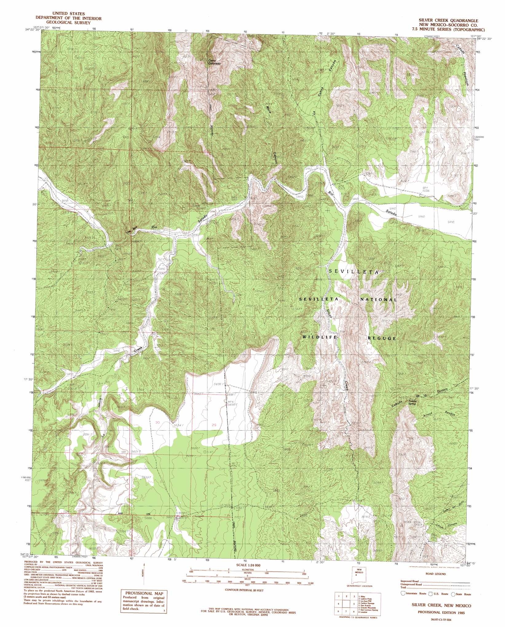
Silver Creek Topo Map New Mexico
To zoom in, hover over the map of Silver Creek
USGS Topo Quad 34107c1 - 1:24,000 scale
| Topo Map Name: | Silver Creek |
| USGS Topo Quad ID: | 34107c1 |
| Print Size: | ca. 21 1/4" wide x 27" high |
| Southeast Coordinates: | 34.25° N latitude / 107° W longitude |
| Map Center Coordinates: | 34.3125° N latitude / 107.0625° W longitude |
| U.S. State: | NM |
| Filename: | o34107c1.jpg |
| Download Map JPG Image: | Silver Creek topo map 1:24,000 scale |
| Map Type: | Topographic |
| Topo Series: | 7.5´ |
| Map Scale: | 1:24,000 |
| Source of Map Images: | United States Geological Survey (USGS) |
| Alternate Map Versions: |
Silver Creek NM 1985, updated 1985 Download PDF Buy paper map Silver Creek NM 2010 Download PDF Buy paper map Silver Creek NM 2013 Download PDF Buy paper map Silver Creek NM 2017 Download PDF Buy paper map |
1:24,000 Topo Quads surrounding Silver Creek
Puerto De Los Cavadores |
Mesa Sarca |
Comanche Ranch |
Belen Sw |
Veguita |
La Jara Peak |
Riley |
Ladron Peak |
La Joya Nw |
Abeytas |
Mesa Cencerro |
Carbon Springs |
Silver Creek |
San Acacia |
La Joya |
Silver Hill |
Granite Mountain |
San Lorenzo Spring |
Lemitar |
Mesa Del Yeso |
Arroyo Landavaso |
Magdalena |
Water Canyon |
Socorro |
Loma De Las Canas |
> Back to 34107a1 at 1:100,000 scale
> Back to 34106a1 at 1:250,000 scale
> Back to U.S. Topo Maps home
Silver Creek topo map: Gazetteer
Silver Creek: Channels
The Box elevation 1592m 5223′Silver Creek: Mines
Rio Salado Group elevation 1701m 5580′Santa Rita elevation 1661m 5449′
Silver Creek: Springs
Tortola Spring elevation 1689m 5541′Silver Creek: Streams
La Jencia Creek elevation 1577m 5173′Silver Creek elevation 1535m 5036′
Silver Creek: Summits
Cerro Colorado elevation 2029m 6656′Silver Creek: Valleys
La Cueva Canyon elevation 1546m 5072′Mule Canyon elevation 1627m 5337′
Silver Creek digital topo map on disk
Buy this Silver Creek topo map showing relief, roads, GPS coordinates and other geographical features, as a high-resolution digital map file on DVD: