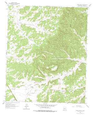
Third Canyon Topo Map New Mexico
To zoom in, hover over the map of Third Canyon
USGS Topo Quad 34107d8 - 1:24,000 scale
| Topo Map Name: | Third Canyon |
| USGS Topo Quad ID: | 34107d8 |
| Print Size: | ca. 21 1/4" wide x 27" high |
| Southeast Coordinates: | 34.375° N latitude / 107.875° W longitude |
| Map Center Coordinates: | 34.4375° N latitude / 107.9375° W longitude |
| U.S. State: | NM |
| Filename: | o34107d8.jpg |
| Download Map JPG Image: | Third Canyon topo map 1:24,000 scale |
| Map Type: | Topographic |
| Topo Series: | 7.5´ |
| Map Scale: | 1:24,000 |
| Source of Map Images: | United States Geological Survey (USGS) |
| Alternate Map Versions: |
Third Canyon NM 1964, updated 1967 Download PDF Buy paper map Third Canyon NM 1964, updated 1978 Download PDF Buy paper map Third Canyon NM 1995, updated 1998 Download PDF Buy paper map Third Canyon NM 2011 Download PDF Buy paper map Third Canyon NM 2013 Download PDF Buy paper map Third Canyon NM 2017 Download PDF Buy paper map |
| FStopo: | US Forest Service topo Third Canyon is available: Download FStopo PDF Download FStopo TIF |
1:24,000 Topo Quads surrounding Third Canyon
> Back to 34107a1 at 1:100,000 scale
> Back to 34106a1 at 1:250,000 scale
> Back to U.S. Topo Maps home
Third Canyon topo map: Gazetteer
Third Canyon: Lakes
Sunflower Lake elevation 2313m 7588′Trinchera Lake elevation 2285m 7496′
Third Canyon: Mines
Midnight Deposit elevation 2282m 7486′Red Basin Deposit elevation 2246m 7368′
Third Canyon: Reservoirs
Freeland Arroyo Tank elevation 2330m 7644′Goat Tank elevation 2300m 7545′
Oat Tank elevation 2241m 7352′
W H Tank elevation 2241m 7352′
Third Canyon: Summits
Third Canyon Mesa elevation 2393m 7851′Third Canyon: Valleys
Lion Canyon elevation 2187m 7175′Oat Canyon elevation 2235m 7332′
Third Canyon elevation 2155m 7070′
W H Canyon elevation 2194m 7198′
Third Canyon: Wells
Bobcat Well elevation 2345m 7693′Green Well elevation 2326m 7631′
Lobo Well elevation 2288m 7506′
Mae Well elevation 2335m 7660′
Third Canyon digital topo map on disk
Buy this Third Canyon topo map showing relief, roads, GPS coordinates and other geographical features, as a high-resolution digital map file on DVD:


