Cebollita Peak Topo Map New Mexico
To zoom in, hover over the map of Cebollita Peak
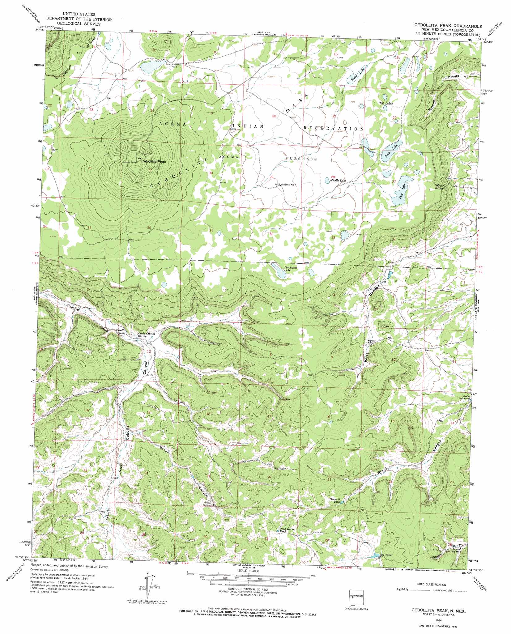
USGS Topo Quad 34107f7 - 1:24,000 scale
| Topo Map Name: | Cebollita Peak |
| USGS Topo Quad ID: | 34107f7 |
| Print Size: | ca. 21 1/4" wide x 27" high |
| Southeast Coordinates: | 34.625° N latitude / 107.75° W longitude |
| Map Center Coordinates: | 34.6875° N latitude / 107.8125° W longitude |
| U.S. State: | NM |
| Filename: | o34107f7.jpg |
| Download Map JPG Image: | Cebollita Peak topo map 1:24,000 scale |
| Map Type: | Topographic |
| Topo Series: | 7.5´ |
| Map Scale: | 1:24,000 |
| Source of Map Images: | United States Geological Survey (USGS) |
| Alternate Map Versions: |
Cebollita Peak NM 1964, updated 1967 Download PDF Buy paper map Cebollita Peak NM 2010 Download PDF Buy paper map Cebollita Peak NM 2013 Download PDF Buy paper map Cebollita Peak NM 2017 Download PDF Buy paper map |
1:24,000 Topo Quads surrounding Cebollita Peak
Ice Caves |
Arrosa Ranch |
Los Pilares |
Crow Point |
Acoma Pueblo |
Ice Caves Se |
North Pasture |
Laguna Honda |
Blue Mesa |
East Mesa |
York Ranch |
Sand Canyon |
Cebollita Peak |
Mecate Meadow |
Broom Mountain |
York Ranch Se |
Bonine Canyon |
Wild Horse Canyon |
Wiley Mesa |
Pueblo Viejo Mesa |
Tres Lagunas |
Third Canyon |
Pasture Canyon |
D Cross Mountain |
Table Mountain |
> Back to 34107e1 at 1:100,000 scale
> Back to 34106a1 at 1:250,000 scale
> Back to U.S. Topo Maps home
Cebollita Peak topo map: Gazetteer
Cebollita Peak: Lakes
Flag Lake elevation 2424m 7952′Middle Lake elevation 2444m 8018′
Porcupine Lake elevation 2448m 8031′
Rodeo Lake elevation 2413m 7916′
Trap Lake elevation 2421m 7942′
Tub Lakes elevation 2415m 7923′
Cebollita Peak: Populated Places
Hughes Place elevation 2337m 7667′Cebollita Peak: Reservoirs
Dead Horse Tank elevation 2400m 7874′Jug Tank elevation 2348m 7703′
Sawmill Tank elevation 2350m 7709′
Cebollita Peak: Springs
Cebolla Spring elevation 2261m 7417′Little Cebolla Spring elevation 2262m 7421′
Major Spring elevation 2389m 7837′
Cebollita Peak: Summits
Cebollita Mesa elevation 2672m 8766′Cebollita Peak elevation 2535m 8316′
Cebollita Peak: Valleys
Baker Canyon elevation 2281m 7483′Cebollita Peak: Wells
Gibson WML Water Well elevation 2327m 7634′Hughes Pl Water Well elevation 2348m 7703′
Owsley Water Well elevation 2278m 7473′
Cebollita Peak digital topo map on disk
Buy this Cebollita Peak topo map showing relief, roads, GPS coordinates and other geographical features, as a high-resolution digital map file on DVD: