Correo Topo Map New Mexico
To zoom in, hover over the map of Correo
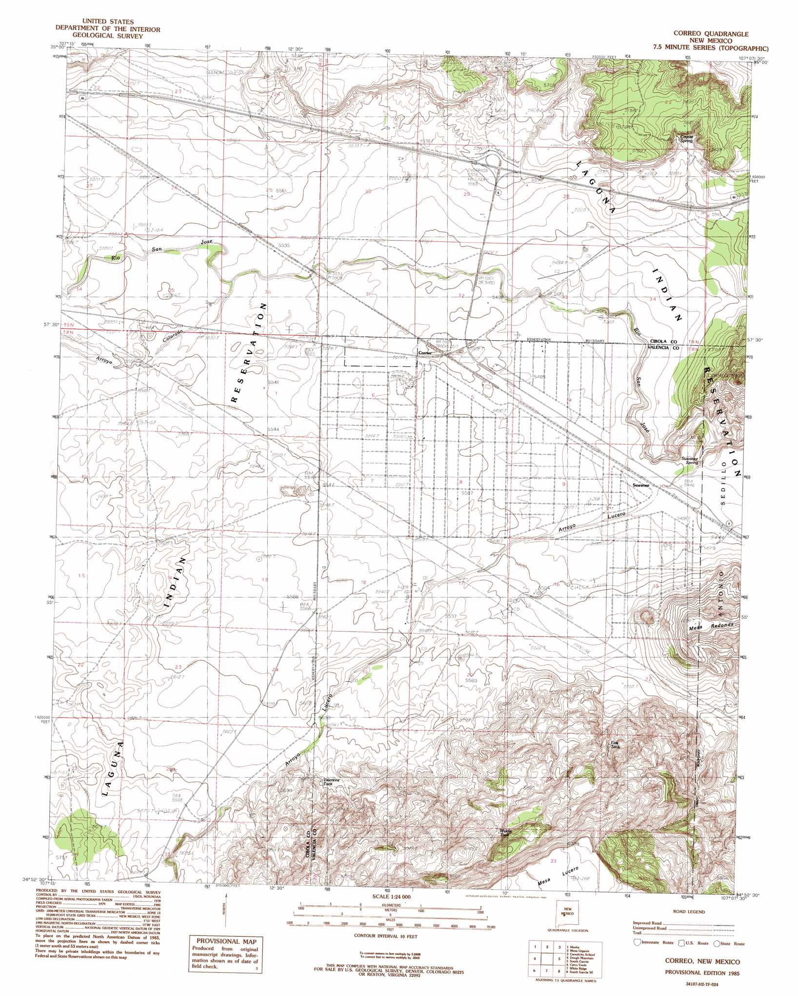
USGS Topo Quad 34107h2 - 1:24,000 scale
| Topo Map Name: | Correo |
| USGS Topo Quad ID: | 34107h2 |
| Print Size: | ca. 21 1/4" wide x 27" high |
| Southeast Coordinates: | 34.875° N latitude / 107.125° W longitude |
| Map Center Coordinates: | 34.9375° N latitude / 107.1875° W longitude |
| U.S. State: | NM |
| Filename: | o34107h2.jpg |
| Download Map JPG Image: | Correo topo map 1:24,000 scale |
| Map Type: | Topographic |
| Topo Series: | 7.5´ |
| Map Scale: | 1:24,000 |
| Source of Map Images: | United States Geological Survey (USGS) |
| Alternate Map Versions: |
Correo NM 1985, updated 1985 Download PDF Buy paper map Correo NM 2010 Download PDF Buy paper map Correo NM 2013 Download PDF Buy paper map Correo NM 2017 Download PDF Buy paper map |
1:24,000 Topo Quads surrounding Correo
Seboyeta |
Moquino |
Arch Mesa |
Herrera |
Benavidez Ranch |
Laguna |
Mesita |
Mesa Gigante |
Canoncito School |
La Mesita Negra |
South Butte |
Dough Mountain |
Correo |
South Garcia |
Dalies Nw |
Marmon Ranch |
Cerro Verde |
White Ridge |
South Garcia Se |
Rio Puerco |
Cerro Del Oro |
Chicken Mountain |
Mesa Gallina |
Mesas Mojinas |
Belen Nw |
> Back to 34107e1 at 1:100,000 scale
> Back to 34106a1 at 1:250,000 scale
> Back to U.S. Topo Maps home
Correo topo map: Gazetteer
Correo: Populated Places
Correo elevation 1680m 5511′Suwanee elevation 1662m 5452′
Correo: Reservoirs
East Tank elevation 1745m 5725′Middle Tank elevation 1820m 5971′
Tank Number 3 elevation 1811m 5941′
Valentine Tank elevation 1723m 5652′
Correo: Springs
Coyote Spring elevation 1702m 5583′Suwanee Spring elevation 1632m 5354′
Correo: Streams
Arroyo Colorado elevation 1687m 5534′Arroyo Lucero elevation 1622m 5321′
Correo: Summits
Mesa Redonda elevation 1888m 6194′Correo: Wells
RWP-15 Water Well elevation 1711m 5613′Correo digital topo map on disk
Buy this Correo topo map showing relief, roads, GPS coordinates and other geographical features, as a high-resolution digital map file on DVD: