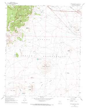
Dough Mountain Topo Map New Mexico
To zoom in, hover over the map of Dough Mountain
USGS Topo Quad 34107h3 - 1:24,000 scale
| Topo Map Name: | Dough Mountain |
| USGS Topo Quad ID: | 34107h3 |
| Print Size: | ca. 21 1/4" wide x 27" high |
| Southeast Coordinates: | 34.875° N latitude / 107.25° W longitude |
| Map Center Coordinates: | 34.9375° N latitude / 107.3125° W longitude |
| U.S. State: | NM |
| Filename: | o34107h3.jpg |
| Download Map JPG Image: | Dough Mountain topo map 1:24,000 scale |
| Map Type: | Topographic |
| Topo Series: | 7.5´ |
| Map Scale: | 1:24,000 |
| Source of Map Images: | United States Geological Survey (USGS) |
| Alternate Map Versions: |
Dough Mountain NM 1960, updated 1963 Download PDF Buy paper map Dough Mountain NM 1960, updated 1973 Download PDF Buy paper map Dough Mountain NM 2010 Download PDF Buy paper map Dough Mountain NM 2013 Download PDF Buy paper map Dough Mountain NM 2017 Download PDF Buy paper map |
1:24,000 Topo Quads surrounding Dough Mountain
> Back to 34107e1 at 1:100,000 scale
> Back to 34106a1 at 1:250,000 scale
> Back to U.S. Topo Maps home
Dough Mountain topo map: Gazetteer
Dough Mountain: Areas
South Passage elevation 1748m 5734′Dough Mountain: Lakes
Dough Mountain Lake elevation 1724m 5656′Dough Mountain: Mines
South Laguna Mines elevation 1807m 5928′Dough Mountain: Populated Places
El Rito elevation 1724m 5656′Dough Mountain: Ranges
Dough Mountain elevation 1815m 5954′Dough Mountain: Reservoirs
Flat Reservoir elevation 1717m 5633′Shonagana Reservoir elevation 1772m 5813′
South Passage Reservoirs elevation 1732m 5682′
Dough Mountain: Springs
Johnson Spring elevation 1782m 5846′Dough Mountain: Streams
Arroyo Conchas elevation 1708m 5603′Big Sandy Wash elevation 1715m 5626′
Cottonwood Creek elevation 1720m 5643′
Dough Mountain: Summits
Crow Mesa elevation 1936m 6351′Dirty Point elevation 1740m 5708′
Lava Butte elevation 1837m 6026′
Mesita Blanca elevation 1779m 5836′
New Mountain elevation 1749m 5738′
Rolling Mounds elevation 1795m 5889′
Schcro Gana elevation 1726m 5662′
South Lava Butte elevation 1800m 5905′
Standing Twin Peak elevation 1764m 5787′
Dough Mountain: Wells
Laguna 2 Water Well elevation 1732m 5682′Laguna 3 Water Well elevation 1734m 5688′
S Pino 2 Water Well elevation 1708m 5603′
Dough Mountain digital topo map on disk
Buy this Dough Mountain topo map showing relief, roads, GPS coordinates and other geographical features, as a high-resolution digital map file on DVD:


