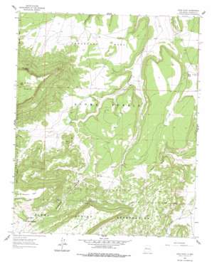
Crow Point Topo Map New Mexico
To zoom in, hover over the map of Crow Point
USGS Topo Quad 34107h6 - 1:24,000 scale
| Topo Map Name: | Crow Point |
| USGS Topo Quad ID: | 34107h6 |
| Print Size: | ca. 21 1/4" wide x 27" high |
| Southeast Coordinates: | 34.875° N latitude / 107.625° W longitude |
| Map Center Coordinates: | 34.9375° N latitude / 107.6875° W longitude |
| U.S. State: | NM |
| Filename: | o34107h6.jpg |
| Download Map JPG Image: | Crow Point topo map 1:24,000 scale |
| Map Type: | Topographic |
| Topo Series: | 7.5´ |
| Map Scale: | 1:24,000 |
| Source of Map Images: | United States Geological Survey (USGS) |
| Alternate Map Versions: |
Crow Point NM 1961, updated 1963 Download PDF Buy paper map Crow Point NM 1961, updated 1978 Download PDF Buy paper map Crow Point NM 2010 Download PDF Buy paper map Crow Point NM 2013 Download PDF Buy paper map Crow Point NM 2017 Download PDF Buy paper map |
1:24,000 Topo Quads surrounding Crow Point
> Back to 34107e1 at 1:100,000 scale
> Back to 34106a1 at 1:250,000 scale
> Back to U.S. Topo Maps home
Crow Point topo map: Gazetteer
Crow Point: Cliffs
Crow Point elevation 2045m 6709′Crow Point: Dams
Crow Point Dam elevation 1995m 6545′Crow Point: Springs
Mesa Negra Spring elevation 2339m 7673′Sky Spring elevation 2287m 7503′
Crow Point: Summits
Koya Mesa elevation 2046m 6712′Mesa Negra elevation 2506m 8221′
Sandstone Mesa elevation 2062m 6765′
Crow Point: Valleys
Acoma Canyon elevation 1954m 6410′Crow Point: Wells
Sand City Water Well elevation 1949m 6394′Crow Point digital topo map on disk
Buy this Crow Point topo map showing relief, roads, GPS coordinates and other geographical features, as a high-resolution digital map file on DVD:


