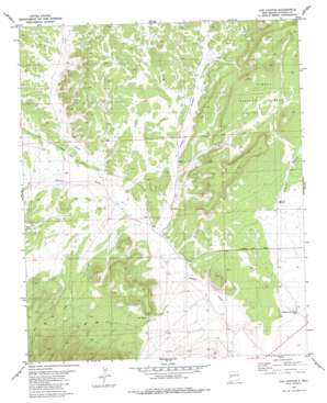
Log Canyon Topo Map New Mexico
To zoom in, hover over the map of Log Canyon
USGS Topo Quad 34108a1 - 1:24,000 scale
| Topo Map Name: | Log Canyon |
| USGS Topo Quad ID: | 34108a1 |
| Print Size: | ca. 21 1/4" wide x 27" high |
| Southeast Coordinates: | 34° N latitude / 108° W longitude |
| Map Center Coordinates: | 34.0625° N latitude / 108.0625° W longitude |
| U.S. State: | NM |
| Filename: | o34108a1.jpg |
| Download Map JPG Image: | Log Canyon topo map 1:24,000 scale |
| Map Type: | Topographic |
| Topo Series: | 7.5´ |
| Map Scale: | 1:24,000 |
| Source of Map Images: | United States Geological Survey (USGS) |
| Alternate Map Versions: |
Log Canyon NM 1981, updated 1981 Download PDF Buy paper map Log Canyon NM 1995, updated 1998 Download PDF Buy paper map Log Canyon NM 2011 Download PDF Buy paper map Log Canyon NM 2013 Download PDF Buy paper map Log Canyon NM 2017 Download PDF Buy paper map |
| FStopo: | US Forest Service topo Log Canyon is available: Download FStopo PDF Download FStopo TIF |
1:24,000 Topo Quads surrounding Log Canyon
> Back to 34108a1 at 1:100,000 scale
> Back to 34108a1 at 1:250,000 scale
> Back to U.S. Topo Maps home
Log Canyon topo map: Gazetteer
Log Canyon: Airports
Happy Mountain Airport elevation 2200m 7217′Log Canyon: Springs
Oak Spring elevation 2215m 7267′Log Canyon: Valleys
J L Draw elevation 2167m 7109′Log Canyon elevation 2156m 7073′
Pino Draw elevation 2160m 7086′
Z Slash Canyon elevation 2159m 7083′
Log Canyon: Wells
10011 Water Well elevation 2146m 7040′Agua Fria Water Well elevation 2199m 7214′
Henderson Two Section Well elevation 2132m 6994′
RG-27460 Water Well elevation 2194m 7198′
Log Canyon digital topo map on disk
Buy this Log Canyon topo map showing relief, roads, GPS coordinates and other geographical features, as a high-resolution digital map file on DVD:


