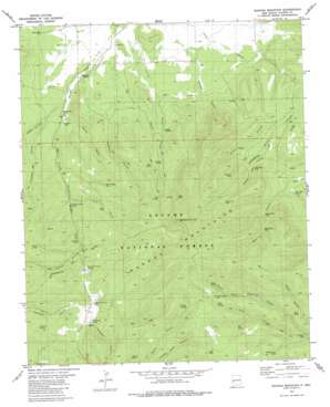
Mangas Mountain Topo Map New Mexico
To zoom in, hover over the map of Mangas Mountain
USGS Topo Quad 34108a3 - 1:24,000 scale
| Topo Map Name: | Mangas Mountain |
| USGS Topo Quad ID: | 34108a3 |
| Print Size: | ca. 21 1/4" wide x 27" high |
| Southeast Coordinates: | 34° N latitude / 108.25° W longitude |
| Map Center Coordinates: | 34.0625° N latitude / 108.3125° W longitude |
| U.S. State: | NM |
| Filename: | o34108a3.jpg |
| Download Map JPG Image: | Mangas Mountain topo map 1:24,000 scale |
| Map Type: | Topographic |
| Topo Series: | 7.5´ |
| Map Scale: | 1:24,000 |
| Source of Map Images: | United States Geological Survey (USGS) |
| Alternate Map Versions: |
Mangas Mountain NM 1981, updated 1981 Download PDF Buy paper map Mangas Mountain NM 1999, updated 2002 Download PDF Buy paper map Mangas Mountain NM 2011 Download PDF Buy paper map Mangas Mountain NM 2013 Download PDF Buy paper map Mangas Mountain NM 2017 Download PDF Buy paper map |
| FStopo: | US Forest Service topo Mangas Mountain is available: Download FStopo PDF Download FStopo TIF |
1:24,000 Topo Quads surrounding Mangas Mountain
> Back to 34108a1 at 1:100,000 scale
> Back to 34108a1 at 1:250,000 scale
> Back to U.S. Topo Maps home
Mangas Mountain topo map: Gazetteer
Mangas Mountain: Lakes
Sawmill Pond elevation 2611m 8566′Mangas Mountain: Reservoirs
Alamocito Tank elevation 2640m 8661′Bell Pit Tank elevation 2482m 8143′
Big Tank elevation 2494m 8182′
Box Canyon Tank elevation 2497m 8192′
Cienaga Tank elevation 2479m 8133′
Hollow Tank elevation 2440m 8005′
J D Pit Tank elevation 2496m 8188′
Little Tank elevation 2696m 8845′
Lower Bear Tank elevation 2533m 8310′
Lower Cat Tank elevation 2546m 8353′
Mangas Tank elevation 2343m 7687′
Patterson Tank elevation 2428m 7965′
Sheep Camp Tank elevation 2511m 8238′
Sleeping Steer Tank elevation 2433m 7982′
Spike Tank elevation 2523m 8277′
Tordcha Tank elevation 2432m 7979′
Trail Tank elevation 2501m 8205′
Upper Bear Tank elevation 2594m 8510′
Upper Cat Tank elevation 2700m 8858′
Valle Tio Vinces Tank elevation 2437m 7995′
Mangas Mountain: Springs
Bear Well Spring elevation 2458m 8064′Bell Spring elevation 2587m 8487′
Burro Spring elevation 2608m 8556′
Caballeriza elevation 2499m 8198′
Familia Spring elevation 2512m 8241′
Gallina Spring elevation 2626m 8615′
Indian Spring elevation 2699m 8854′
Mud Spring elevation 2655m 8710′
Oak Spring elevation 2566m 8418′
Padilla Spring elevation 2507m 8225′
Valle Tio Vinces Spring elevation 2482m 8143′
Mangas Mountain: Summits
Mangas Mountain elevation 2925m 9596′Tub Peak elevation 2725m 8940′
Mangas Mountain: Valleys
Bell Canyon elevation 2282m 7486′Caballeriza Canyon elevation 2439m 8001′
Cassidera Canyon elevation 2348m 7703′
El Toro Canyon elevation 2426m 7959′
Gabaldon Canyon elevation 2303m 7555′
Green Canyon elevation 2341m 7680′
Padilla Canyon elevation 2293m 7522′
San Antone Canyon elevation 2311m 7582′
Vereda Canyon elevation 2333m 7654′
Mangas Mountain: Wells
Rincon Well elevation 2354m 7723′Mangas Mountain digital topo map on disk
Buy this Mangas Mountain topo map showing relief, roads, GPS coordinates and other geographical features, as a high-resolution digital map file on DVD:


