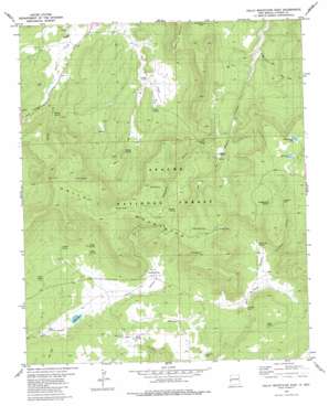
Gallo Mountains East Topo Map New Mexico
To zoom in, hover over the map of Gallo Mountains East
USGS Topo Quad 34108a5 - 1:24,000 scale
| Topo Map Name: | Gallo Mountains East |
| USGS Topo Quad ID: | 34108a5 |
| Print Size: | ca. 21 1/4" wide x 27" high |
| Southeast Coordinates: | 34° N latitude / 108.5° W longitude |
| Map Center Coordinates: | 34.0625° N latitude / 108.5625° W longitude |
| U.S. State: | NM |
| Filename: | o34108a5.jpg |
| Download Map JPG Image: | Gallo Mountains East topo map 1:24,000 scale |
| Map Type: | Topographic |
| Topo Series: | 7.5´ |
| Map Scale: | 1:24,000 |
| Source of Map Images: | United States Geological Survey (USGS) |
| Alternate Map Versions: |
Gallo Mountains East NM 1981, updated 1981 Download PDF Buy paper map Gallo Mountains East NM 1999, updated 2002 Download PDF Buy paper map Gallo Mountains East NM 2011 Download PDF Buy paper map Gallo Mountains East NM 2013 Download PDF Buy paper map Gallo Mountains East NM 2017 Download PDF Buy paper map |
| FStopo: | US Forest Service topo Gallo Mountains East is available: Download FStopo PDF Download FStopo TIF |
1:24,000 Topo Quads surrounding Gallo Mountains East
> Back to 34108a1 at 1:100,000 scale
> Back to 34108a1 at 1:250,000 scale
> Back to U.S. Topo Maps home
Gallo Mountains East topo map: Gazetteer
Gallo Mountains East: Lakes
Gallo Lake elevation 2347m 7700′Tule Lake elevation 2633m 8638′
White Rock Lake elevation 2644m 8674′
Gallo Mountains East: Ranges
Gallo Mountains elevation 2715m 8907′Gallo Mountains East: Reservoirs
Acorn Tank elevation 2497m 8192′Agua Fria Tank elevation 2436m 7992′
Ambrosia Tank elevation 2345m 7693′
Armijo Tank elevation 2357m 7732′
Bog Tank elevation 2705m 8874′
Bull Camp Pit Tank elevation 2305m 7562′
Crater Tank elevation 2649m 8690′
East Tank elevation 2688m 8818′
Gallo Tank elevation 2414m 7919′
Gibbs Tank elevation 2396m 7860′
Hog Back Pit Tank elevation 2715m 8907′
Hook Tank elevation 2397m 7864′
Old State Tank elevation 2369m 7772′
Preference Tank elevation 2363m 7752′
Road Tanks elevation 2370m 7775′
Shallow Tank elevation 2663m 8736′
Telephone Tank elevation 2565m 8415′
Waterdog Tank elevation 2585m 8480′
Windy Tank elevation 2618m 8589′
Gallo Mountains East: Springs
Armijo Spring elevation 2388m 7834′Bull Camp Spring elevation 2413m 7916′
Campground Spring elevation 2595m 8513′
Costilla Spring elevation 2410m 7906′
Frank Spring elevation 2698m 8851′
Gallita Spring elevation 2389m 7837′
Malpais Spring elevation 2600m 8530′
Porcupine Spring elevation 2426m 7959′
Pueblo Spring elevation 2392m 7847′
Rim Spring elevation 2600m 8530′
Route Spring elevation 2380m 7808′
Trough Spring elevation 2422m 7946′
Willow Spring elevation 2421m 7942′
Gallo Mountains East: Streams
Willow Creek elevation 2361m 7746′Gallo Mountains East: Trails
Sawmill Camp Trail elevation 2472m 8110′Gallo Mountains East: Valleys
Gallita Canyon elevation 2348m 7703′Porcupine Canyon elevation 2401m 7877′
Telephone Canyon elevation 2392m 7847′
Gallo Mountains East digital topo map on disk
Buy this Gallo Mountains East topo map showing relief, roads, GPS coordinates and other geographical features, as a high-resolution digital map file on DVD:


