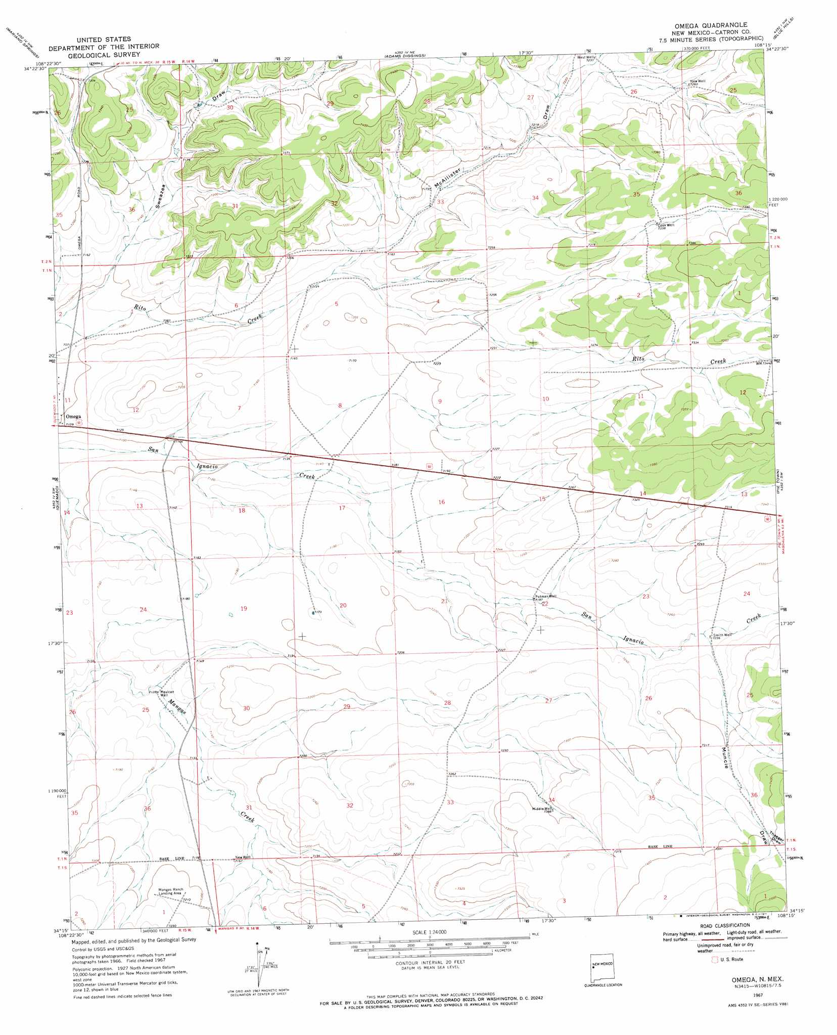
Omega Topo Map New Mexico
To zoom in, hover over the map of Omega
USGS Topo Quad 34108c3 - 1:24,000 scale
| Topo Map Name: | Omega |
| USGS Topo Quad ID: | 34108c3 |
| Print Size: | ca. 21 1/4" wide x 27" high |
| Southeast Coordinates: | 34.25° N latitude / 108.25° W longitude |
| Map Center Coordinates: | 34.3125° N latitude / 108.3125° W longitude |
| U.S. State: | NM |
| Filename: | o34108c3.jpg |
| Download Map JPG Image: | Omega topo map 1:24,000 scale |
| Map Type: | Topographic |
| Topo Series: | 7.5´ |
| Map Scale: | 1:24,000 |
| Source of Map Images: | United States Geological Survey (USGS) |
| Alternate Map Versions: |
Omega NM 1967, updated 1971 Download PDF Buy paper map Omega NM 2010 Download PDF Buy paper map Omega NM 2013 Download PDF Buy paper map Omega NM 2017 Download PDF Buy paper map |
1:24,000 Topo Quads surrounding Omega
Cerro Prieto |
Techado |
Veteado Mountain |
Trail Lake |
York Ranch Se |
Tejana Mesa |
Mariano Springs |
Adams Diggings |
Blue Hills |
Tres Lagunas |
Armstrong Canyon |
Quemado |
Omega |
Pie Town |
Red Flats |
Largo Mesa |
Escondido Mountains |
Mangas |
Alegres Mountain |
Cox Peak |
Gallo Mountains East |
Slaughter Mesa |
Mangas Mountain |
Wallace Mesa |
Log Canyon |
> Back to 34108a1 at 1:100,000 scale
> Back to 34108a1 at 1:250,000 scale
> Back to U.S. Topo Maps home
Omega topo map: Gazetteer
Omega: Populated Places
Omega elevation 2166m 7106′Omega: Post Offices
Omega Post Office (historical) elevation 2166m 7106′Omega: Valleys
McAllister Draw elevation 2173m 7129′Muncie Draw elevation 2203m 7227′
Thaeger Draw elevation 2253m 7391′
Omega: Wells
Cook Well elevation 2236m 7335′Mexican Well elevation 2172m 7125′
Middle Well elevation 2223m 7293′
New Well elevation 2215m 7267′
New Well elevation 2184m 7165′
Putman Well elevation 2189m 7181′
Smith Well elevation 2205m 7234′
West Well elevation 2204m 7230′
Omega digital topo map on disk
Buy this Omega topo map showing relief, roads, GPS coordinates and other geographical features, as a high-resolution digital map file on DVD: