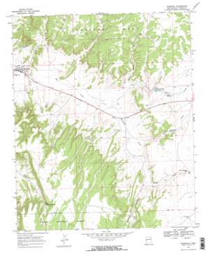
Quemado Topo Map New Mexico
To zoom in, hover over the map of Quemado
USGS Topo Quad 34108c4 - 1:24,000 scale
| Topo Map Name: | Quemado |
| USGS Topo Quad ID: | 34108c4 |
| Print Size: | ca. 21 1/4" wide x 27" high |
| Southeast Coordinates: | 34.25° N latitude / 108.375° W longitude |
| Map Center Coordinates: | 34.3125° N latitude / 108.4375° W longitude |
| U.S. State: | NM |
| Filename: | o34108c4.jpg |
| Download Map JPG Image: | Quemado topo map 1:24,000 scale |
| Map Type: | Topographic |
| Topo Series: | 7.5´ |
| Map Scale: | 1:24,000 |
| Source of Map Images: | United States Geological Survey (USGS) |
| Alternate Map Versions: |
Quemado NM 1967, updated 1971 Download PDF Buy paper map Quemado NM 2011 Download PDF Buy paper map Quemado NM 2013 Download PDF Buy paper map Quemado NM 2017 Download PDF Buy paper map |
| FStopo: | US Forest Service topo Quemado is available: Download FStopo PDF Download FStopo TIF |
1:24,000 Topo Quads surrounding Quemado
> Back to 34108a1 at 1:100,000 scale
> Back to 34108a1 at 1:250,000 scale
> Back to U.S. Topo Maps home
Quemado topo map: Gazetteer
Quemado: Populated Places
Quemado elevation 2099m 6886′Quemado: Post Offices
Quemado Post Office elevation 2099m 6886′Quemado: Reservoirs
Sweazea Lake elevation 2139m 7017′Quemado: Springs
Nutria Spring elevation 2164m 7099′Rito Spring elevation 2140m 7020′
San Ignacio Spring elevation 2148m 7047′
Spring Tanque de Caballos elevation 2257m 7404′
Quemado: Streams
Escondido Creek elevation 2104m 6902′Mangas Creek elevation 2136m 7007′
San Ignacio Creek elevation 2107m 6912′
Quemado: Valleys
Baca Arroyo elevation 2095m 6873′Sweazea Draw elevation 2154m 7066′
Wilbur Wadley Draw elevation 2103m 6899′
Quemado: Wells
North Well elevation 2201m 7221′Wadley Well elevation 2195m 7201′
Quemado digital topo map on disk
Buy this Quemado topo map showing relief, roads, GPS coordinates and other geographical features, as a high-resolution digital map file on DVD:


