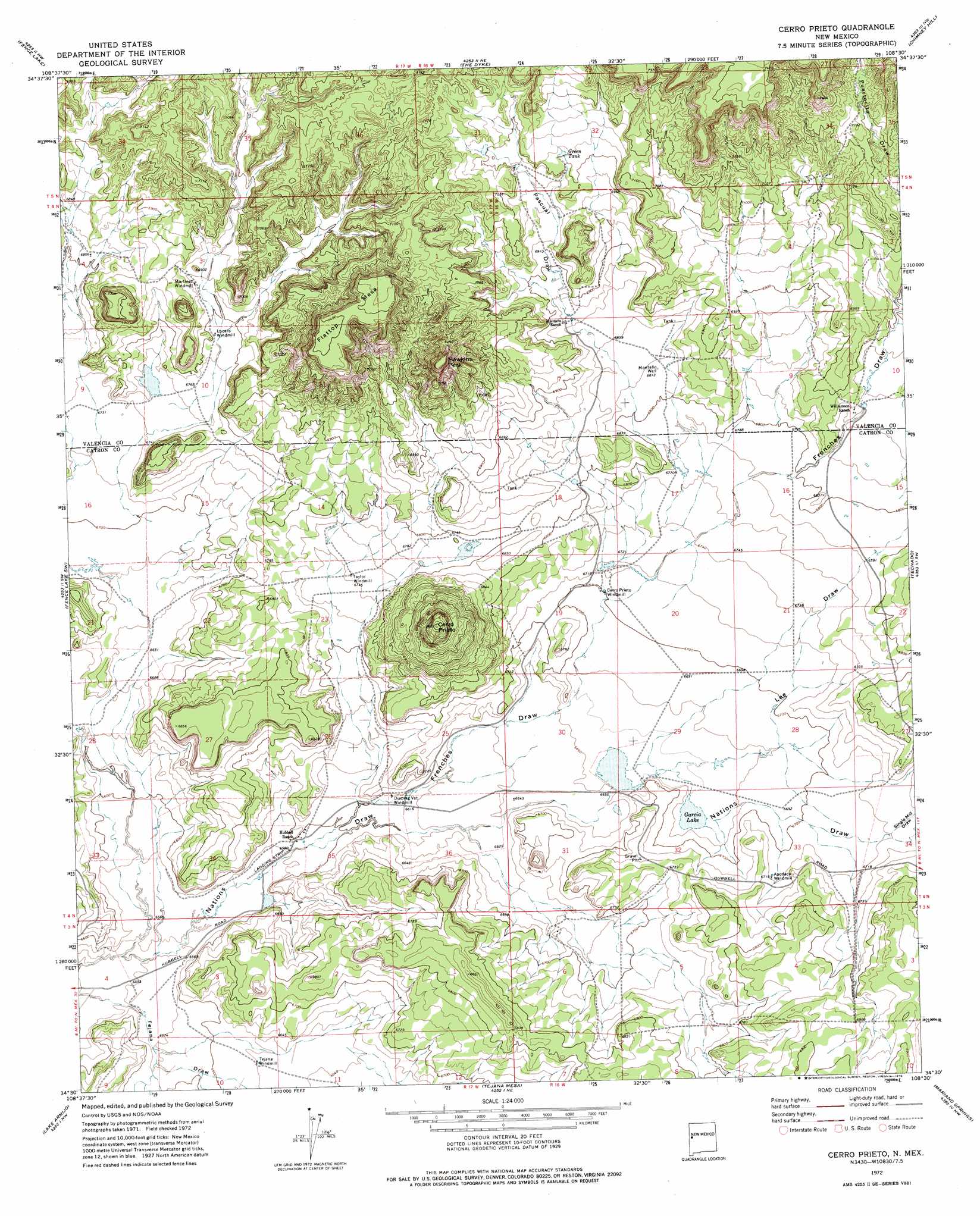
Cerro Prieto Topo Map New Mexico
To zoom in, hover over the map of Cerro Prieto
USGS Topo Quad 34108e5 - 1:24,000 scale
| Topo Map Name: | Cerro Prieto |
| USGS Topo Quad ID: | 34108e5 |
| Print Size: | ca. 21 1/4" wide x 27" high |
| Southeast Coordinates: | 34.5° N latitude / 108.5° W longitude |
| Map Center Coordinates: | 34.5625° N latitude / 108.5625° W longitude |
| U.S. State: | NM |
| Filename: | o34108e5.jpg |
| Download Map JPG Image: | Cerro Prieto topo map 1:24,000 scale |
| Map Type: | Topographic |
| Topo Series: | 7.5´ |
| Map Scale: | 1:24,000 |
| Source of Map Images: | United States Geological Survey (USGS) |
| Alternate Map Versions: |
Cerro Prieto NM 1972, updated 1976 Download PDF Buy paper map Cerro Prieto NM 2010 Download PDF Buy paper map Cerro Prieto NM 2013 Download PDF Buy paper map Cerro Prieto NM 2017 Download PDF Buy paper map |
1:24,000 Topo Quads surrounding Cerro Prieto
Atarque Lake |
Mesita De Yeso |
Shoemaker Canyon Se |
Red Lake Mission |
Cerro Alto |
Rincon Hondo |
Fence Lake |
The Dyke |
Chimney Hill |
Cerro Pomo |
Moreno Hill |
Fence Lake Sw |
Cerro Prieto |
Techado |
Veteado Mountain |
Zuni Salt Lake |
Lake Armijo |
Tejana Mesa |
Mariano Springs |
Adams Diggings |
Blaines Lake |
Tejana Mesa Sw |
Armstrong Canyon |
Quemado |
Omega |
> Back to 34108e1 at 1:100,000 scale
> Back to 34108a1 at 1:250,000 scale
> Back to U.S. Topo Maps home
Cerro Prieto topo map: Gazetteer
Cerro Prieto: Lakes
Garcia Lake elevation 2034m 6673′Cerro Prieto: Reservoirs
Green Tank elevation 2140m 7020′Cerro Prieto: Summits
Cerro Prieto elevation 2258m 7408′Flattop Mesa elevation 2259m 7411′
Hawkins Peak elevation 2219m 7280′
Cerro Prieto: Valleys
Frenches Draw elevation 2008m 6587′Hubbell Draw elevation 2086m 6843′
Lee Draw elevation 2019m 6624′
Pascual Draw elevation 2056m 6745′
Single Mill Draw elevation 2049m 6722′
Cerro Prieto: Wells
Lucero Water Well elevation 2070m 6791′Montaño Well elevation 2078m 6817′
Cerro Prieto digital topo map on disk
Buy this Cerro Prieto topo map showing relief, roads, GPS coordinates and other geographical features, as a high-resolution digital map file on DVD: