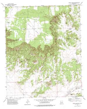
Fence Lake Sw Topo Map New Mexico
To zoom in, hover over the map of Fence Lake Sw
USGS Topo Quad 34108e6 - 1:24,000 scale
| Topo Map Name: | Fence Lake Sw |
| USGS Topo Quad ID: | 34108e6 |
| Print Size: | ca. 21 1/4" wide x 27" high |
| Southeast Coordinates: | 34.5° N latitude / 108.625° W longitude |
| Map Center Coordinates: | 34.5625° N latitude / 108.6875° W longitude |
| U.S. State: | NM |
| Filename: | o34108e6.jpg |
| Download Map JPG Image: | Fence Lake Sw topo map 1:24,000 scale |
| Map Type: | Topographic |
| Topo Series: | 7.5´ |
| Map Scale: | 1:24,000 |
| Source of Map Images: | United States Geological Survey (USGS) |
| Alternate Map Versions: |
Fence Lake SW NM 1972, updated 1976 Download PDF Buy paper map Fence Lake SW NM 2010 Download PDF Buy paper map Fence Lake SW NM 2013 Download PDF Buy paper map Fence Lake SW NM 2017 Download PDF Buy paper map |
1:24,000 Topo Quads surrounding Fence Lake Sw
> Back to 34108e1 at 1:100,000 scale
> Back to 34108a1 at 1:250,000 scale
> Back to U.S. Topo Maps home
Fence Lake Sw topo map: Gazetteer
Fence Lake Sw: Springs
Garcia Spring elevation 1995m 6545′Moreno Spring elevation 2203m 7227′
New Santa Rita Springs elevation 2029m 6656′
Nicolas Spring elevation 2025m 6643′
Old Santa Rita Springs elevation 2024m 6640′
Fence Lake Sw: Valleys
Tejana Draw elevation 1985m 6512′Fence Lake Sw: Wells
Escojeda Water Well elevation 2003m 6571′Medanoso Water Well elevation 2087m 6847′
New Santa Water Well elevation 2020m 6627′
Fence Lake Sw digital topo map on disk
Buy this Fence Lake Sw topo map showing relief, roads, GPS coordinates and other geographical features, as a high-resolution digital map file on DVD:


