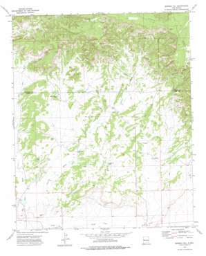
Moreno Hill Topo Map New Mexico
To zoom in, hover over the map of Moreno Hill
USGS Topo Quad 34108e7 - 1:24,000 scale
| Topo Map Name: | Moreno Hill |
| USGS Topo Quad ID: | 34108e7 |
| Print Size: | ca. 21 1/4" wide x 27" high |
| Southeast Coordinates: | 34.5° N latitude / 108.75° W longitude |
| Map Center Coordinates: | 34.5625° N latitude / 108.8125° W longitude |
| U.S. State: | NM |
| Filename: | o34108e7.jpg |
| Download Map JPG Image: | Moreno Hill topo map 1:24,000 scale |
| Map Type: | Topographic |
| Topo Series: | 7.5´ |
| Map Scale: | 1:24,000 |
| Source of Map Images: | United States Geological Survey (USGS) |
| Alternate Map Versions: |
Moreno Hill NM 1972, updated 1976 Download PDF Buy paper map Moreno Hill NM 2010 Download PDF Buy paper map Moreno Hill NM 2013 Download PDF Buy paper map Moreno Hill NM 2017 Download PDF Buy paper map |
1:24,000 Topo Quads surrounding Moreno Hill
> Back to 34108e1 at 1:100,000 scale
> Back to 34108a1 at 1:250,000 scale
> Back to U.S. Topo Maps home
Moreno Hill topo map: Gazetteer
Moreno Hill: Reservoirs
Hayhurst Tank elevation 1973m 6473′Heffner Tank elevation 2056m 6745′
Mueses Canyon Tank elevation 2020m 6627′
Pine Tank elevation 2181m 7155′
Ruvi Pit elevation 1952m 6404′
Moreno Hill: Streams
Largo Creek elevation 1904m 6246′Moreno Hill: Summits
Circle Butte elevation 2241m 7352′Moreno Hill elevation 2184m 7165′
Santa Rita Mesa elevation 2299m 7542′
Moreno Hill: Wells
Goesling Deep Well elevation 1975m 6479′Pueblo Water Well elevation 1971m 6466′
Moreno Hill digital topo map on disk
Buy this Moreno Hill topo map showing relief, roads, GPS coordinates and other geographical features, as a high-resolution digital map file on DVD:


