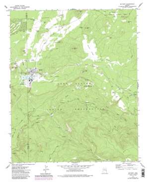
Mcnary Topo Map Arizona
To zoom in, hover over the map of Mcnary
USGS Topo Quad 34109a7 - 1:24,000 scale
| Topo Map Name: | Mcnary |
| USGS Topo Quad ID: | 34109a7 |
| Print Size: | ca. 21 1/4" wide x 27" high |
| Southeast Coordinates: | 34° N latitude / 109.75° W longitude |
| Map Center Coordinates: | 34.0625° N latitude / 109.8125° W longitude |
| U.S. State: | AZ |
| Filename: | o34109a7.jpg |
| Download Map JPG Image: | Mcnary topo map 1:24,000 scale |
| Map Type: | Topographic |
| Topo Series: | 7.5´ |
| Map Scale: | 1:24,000 |
| Source of Map Images: | United States Geological Survey (USGS) |
| Alternate Map Versions: |
McNary AZ 1976, updated 1977 Download PDF Buy paper map McNary AZ 1977, updated 1978 Download PDF Buy paper map McNary AZ 1977, updated 1985 Download PDF Buy paper map McNary AZ 1977, updated 1986 Download PDF Buy paper map McNary AZ 1996, updated 2003 Download PDF Buy paper map McNary AZ 1998, updated 2000 Download PDF Buy paper map McNary AZ 2011 Download PDF Buy paper map McNary AZ 2014 Download PDF Buy paper map |
| FStopo: | US Forest Service topo McNary is available: Download FStopo PDF Download FStopo TIF |
1:24,000 Topo Quads surrounding Mcnary
> Back to 34109a1 at 1:100,000 scale
> Back to 34108a1 at 1:250,000 scale
> Back to U.S. Topo Maps home
Mcnary topo map: Gazetteer
Mcnary: Crossings
Painted Desert Interchange elevation 2323m 7621′Mcnary: Dams
Cyclone Dam elevation 2505m 8218′Mcnary: Flats
Cluff Cienega elevation 2235m 7332′Haystack Cienega elevation 2307m 7568′
Reservation Flat elevation 2400m 7874′
Mcnary: Lakes
Blue Lake elevation 2202m 7224′Gooseberry Dam Lake elevation 2236m 7335′
Mcnary: Parks
Williams Creek National Fish Hatchery elevation 2136m 7007′Mcnary: Populated Places
McNary elevation 2228m 7309′Mcnary: Reservoirs
Boundary Tank elevation 2425m 7956′Buck Spring Tank elevation 2243m 7358′
Club Tank elevation 2229m 7312′
Haystack Tank elevation 2327m 7634′
McNary Tank elevation 2225m 7299′
Penrod Tank elevation 2367m 7765′
Twomile Spring Tank elevation 2254m 7395′
Mcnary: Springs
Boy Spring elevation 2327m 7634′Boyce Spring elevation 2332m 7650′
Gobbler Seep elevation 2262m 7421′
Twomile Spring elevation 2255m 7398′
Mcnary: Streams
Bog Creek elevation 2142m 7027′Gomez Creek elevation 1922m 6305′
Gooseberry Creek elevation 1957m 6420′
Lone Pine Creek elevation 1868m 6128′
No Name Creek elevation 2190m 7185′
Sand Creek elevation 2108m 6916′
Slide Creek elevation 2055m 6742′
Trout Creek elevation 1954m 6410′
Williams Creek elevation 1988m 6522′
Mcnary: Summits
Blue Mountain elevation 2370m 7775′Brushy Mountain elevation 2456m 8057′
Haystack Mountain elevation 2445m 8021′
Kinney Mountain elevation 2324m 7624′
Largo Mountain elevation 2309m 7575′
Little Haystack Mountain elevation 2357m 7732′
Logger Mountain elevation 2402m 7880′
Mcnary digital topo map on disk
Buy this Mcnary topo map showing relief, roads, GPS coordinates and other geographical features, as a high-resolution digital map file on DVD:


