Springerville Nw Topo Map Arizona
To zoom in, hover over the map of Springerville Nw
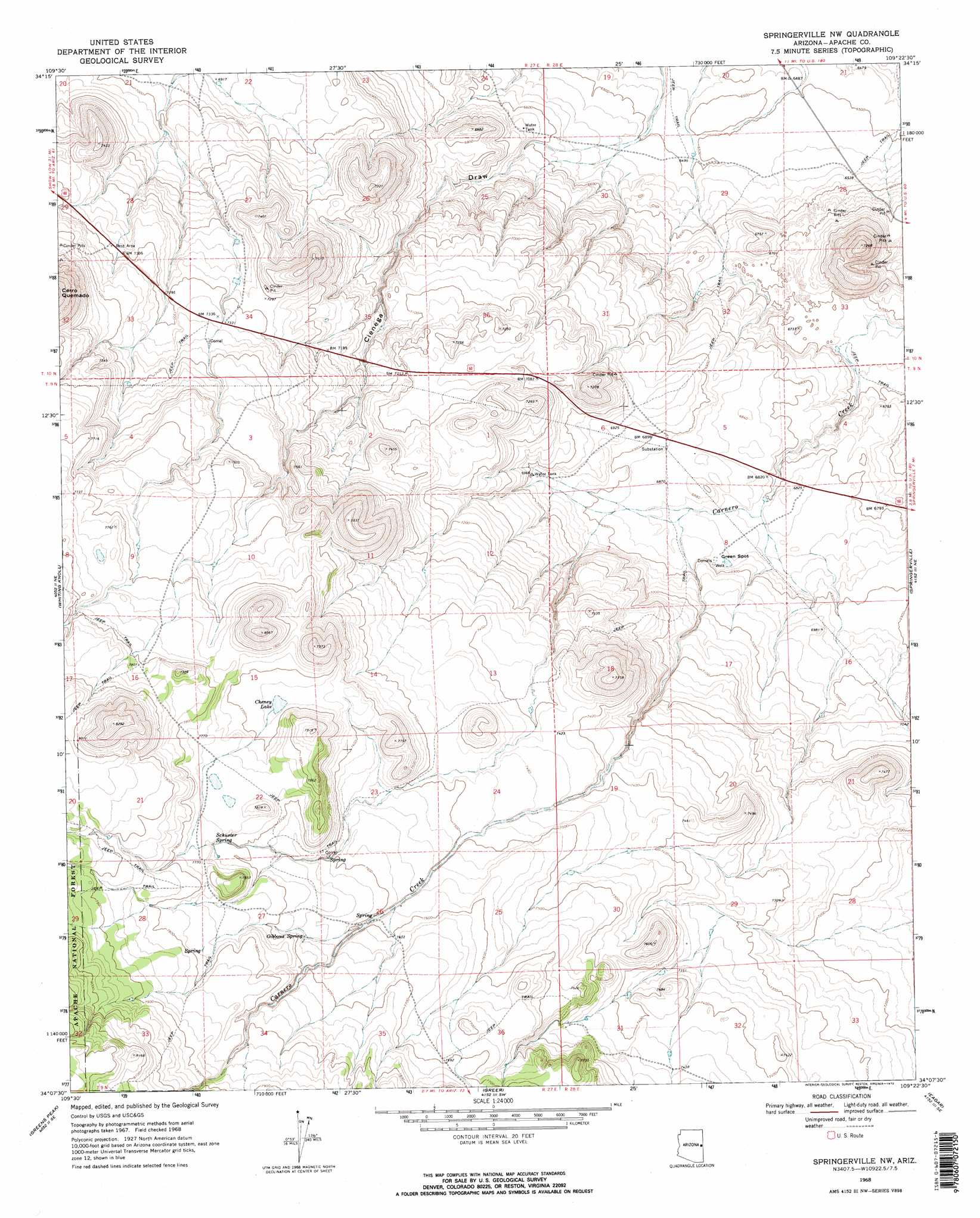
USGS Topo Quad 34109b4 - 1:24,000 scale
| Topo Map Name: | Springerville Nw |
| USGS Topo Quad ID: | 34109b4 |
| Print Size: | ca. 21 1/4" wide x 27" high |
| Southeast Coordinates: | 34.125° N latitude / 109.375° W longitude |
| Map Center Coordinates: | 34.1875° N latitude / 109.4375° W longitude |
| U.S. State: | AZ |
| Filename: | o34109b4.jpg |
| Download Map JPG Image: | Springerville Nw topo map 1:24,000 scale |
| Map Type: | Topographic |
| Topo Series: | 7.5´ |
| Map Scale: | 1:24,000 |
| Source of Map Images: | United States Geological Survey (USGS) |
| Alternate Map Versions: |
Springerville NW AZ 1968, updated 1972 Download PDF Buy paper map Springerville NW AZ 1968, updated 1972 Download PDF Buy paper map Springerville NW AZ 1997, updated 2000 Download PDF Buy paper map Springerville NW AZ 2011 Download PDF Buy paper map Springerville NW AZ 2014 Download PDF Buy paper map |
| FStopo: | US Forest Service topo Springerville NW is available: Download FStopo PDF Download FStopo TIF |
1:24,000 Topo Quads surrounding Springerville Nw
Concho Lake |
Concho |
Salado |
Saint Johns South |
Mesa Parada Nw |
Vernon |
Cerro Hueco |
Lyman Lake Sw |
Lyman Lake |
Voigt Ranch |
Boundary Butte |
Whiting Knoll |
Springerville Nw |
Springerville |
Coyote Hills |
Horseshoe Cienega |
Greens Peak |
Greer |
Eagar |
Nelson Reservoir |
Hawley Lake East |
Mount Baldy |
Big Lake North |
Rudd Knoll |
Nutrioso |
> Back to 34109a1 at 1:100,000 scale
> Back to 34108a1 at 1:250,000 scale
> Back to U.S. Topo Maps home
Springerville Nw topo map: Gazetteer
Springerville Nw: Lakes
Cheney Lake elevation 2339m 7673′Springerville Nw: Populated Places
Green Spot elevation 2089m 6853′Springerville Nw: Springs
Corral Spring elevation 2327m 7634′Gibbons Spring elevation 2335m 7660′
Schuster Spring elevation 2365m 7759′
Springerville Nw: Wells
Green Spot Well elevation 2090m 6856′Springerville Nw digital topo map on disk
Buy this Springerville Nw topo map showing relief, roads, GPS coordinates and other geographical features, as a high-resolution digital map file on DVD: