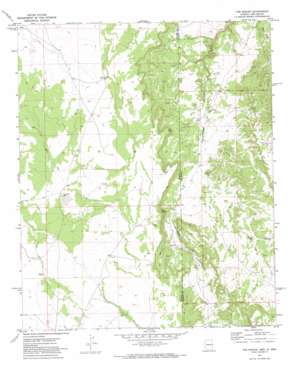
The Rincon Topo Map Arizona
To zoom in, hover over the map of The Rincon
USGS Topo Quad 34109c1 - 1:24,000 scale
| Topo Map Name: | The Rincon |
| USGS Topo Quad ID: | 34109c1 |
| Print Size: | ca. 21 1/4" wide x 27" high |
| Southeast Coordinates: | 34.25° N latitude / 109° W longitude |
| Map Center Coordinates: | 34.3125° N latitude / 109.0625° W longitude |
| U.S. States: | AZ, NM |
| Filename: | o34109c1.jpg |
| Download Map JPG Image: | The Rincon topo map 1:24,000 scale |
| Map Type: | Topographic |
| Topo Series: | 7.5´ |
| Map Scale: | 1:24,000 |
| Source of Map Images: | United States Geological Survey (USGS) |
| Alternate Map Versions: |
The Rincon AZ 1971, updated 1973 Download PDF Buy paper map The Rincon AZ 2011 Download PDF Buy paper map The Rincon AZ 2011 Download PDF Buy paper map The Rincon AZ 2014 Download PDF Buy paper map |
1:24,000 Topo Quads surrounding The Rincon
> Back to 34109a1 at 1:100,000 scale
> Back to 34108a1 at 1:250,000 scale
> Back to U.S. Topo Maps home
The Rincon topo map: Gazetteer
The Rincon: Capes
The Point elevation 2168m 7112′The Rincon: Cliffs
The Rincon elevation 2190m 7185′The Rincon: Reservoirs
Big Pit Tank elevation 2162m 7093′The Rincon: Wells
Callero Well elevation 2111m 6925′East Well elevation 2168m 7112′
Goldwater Well elevation 2150m 7053′
Middle Well elevation 2134m 7001′
Tom Phelps Well elevation 2068m 6784′
The Rincon digital topo map on disk
Buy this The Rincon topo map showing relief, roads, GPS coordinates and other geographical features, as a high-resolution digital map file on DVD:


