Concho Lake Topo Map Arizona
To zoom in, hover over the map of Concho Lake
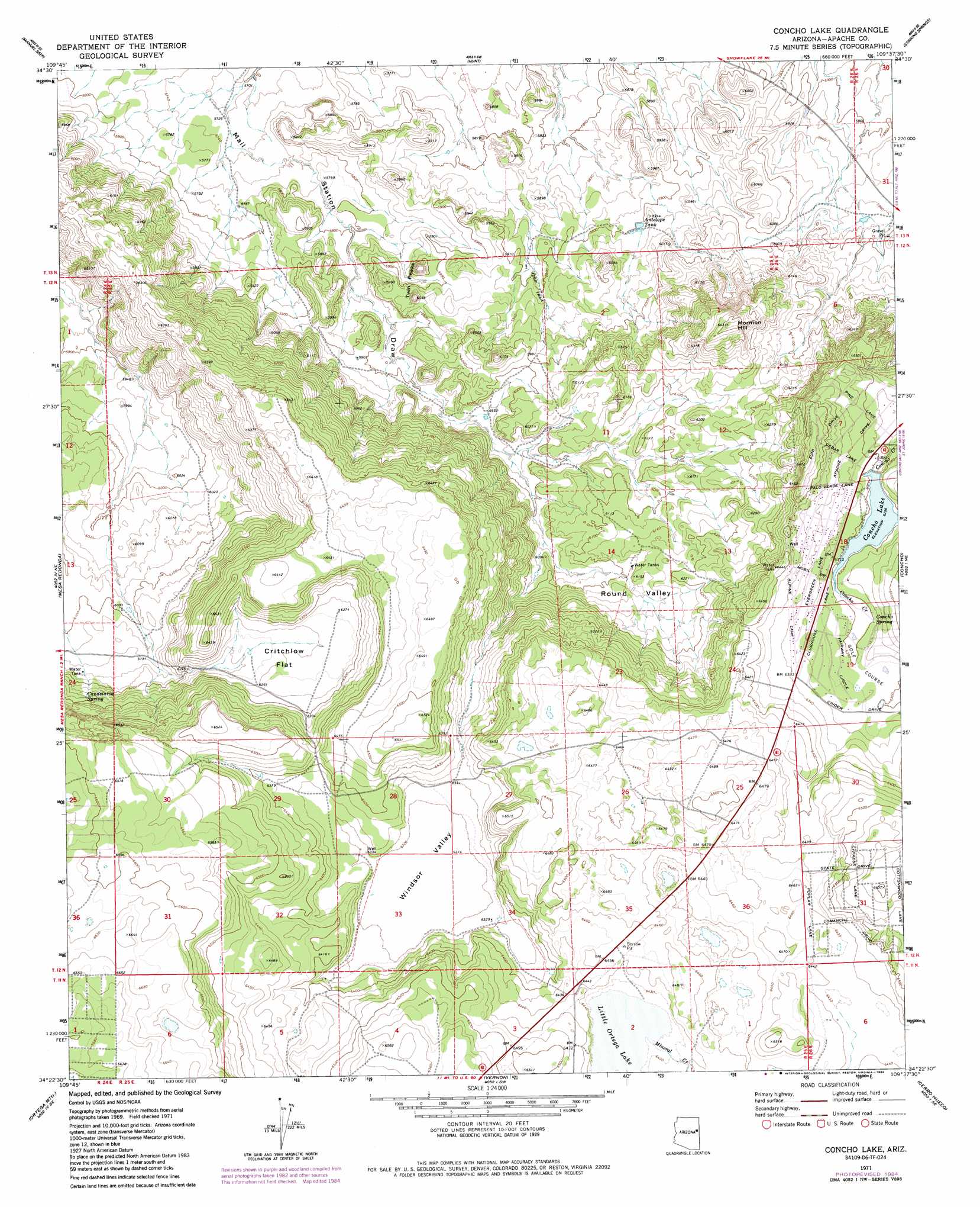
USGS Topo Quad 34109d6 - 1:24,000 scale
| Topo Map Name: | Concho Lake |
| USGS Topo Quad ID: | 34109d6 |
| Print Size: | ca. 21 1/4" wide x 27" high |
| Southeast Coordinates: | 34.375° N latitude / 109.625° W longitude |
| Map Center Coordinates: | 34.4375° N latitude / 109.6875° W longitude |
| U.S. State: | AZ |
| Filename: | o34109d6.jpg |
| Download Map JPG Image: | Concho Lake topo map 1:24,000 scale |
| Map Type: | Topographic |
| Topo Series: | 7.5´ |
| Map Scale: | 1:24,000 |
| Source of Map Images: | United States Geological Survey (USGS) |
| Alternate Map Versions: |
Concho Lake AZ 1971, updated 1973 Download PDF Buy paper map Concho Lake AZ 1971, updated 1984 Download PDF Buy paper map Concho Lake AZ 2011 Download PDF Buy paper map Concho Lake AZ 2014 Download PDF Buy paper map |
1:24,000 Topo Quads surrounding Concho Lake
Hay Hollow |
Little Milky Wash |
Potter Mesa Tank |
Stinking Springs Mountain |
Cedar Lake Wash |
Point Of The Mountain |
Manuel Seep |
Hunt |
Stinking Springs |
Zion Reservoir |
Mesa Redonda Nw |
Mesa Redonda |
Concho Lake |
Concho |
Salado |
Silver Springs |
Ortega Mountain |
Vernon |
Cerro Hueco |
Lyman Lake Sw |
Lakeside |
Sponseller Mountain |
Boundary Butte |
Whiting Knoll |
Springerville Nw |
> Back to 34109a1 at 1:100,000 scale
> Back to 34108a1 at 1:250,000 scale
> Back to U.S. Topo Maps home
Concho Lake topo map: Gazetteer
Concho Lake: Basins
Windsor Valley elevation 1923m 6309′Concho Lake: Flats
Critchlow Flat elevation 1908m 6259′Concho Lake: Lakes
Little Ortega Lake elevation 1959m 6427′Concho Lake: Reservoirs
Antelope Tank elevation 1799m 5902′Concho Lake elevation 1921m 6302′
Concho Lake: Springs
Candelaria Spring elevation 1908m 6259′Concho Spring elevation 1908m 6259′
Concho Lake: Streams
Mineral Creek elevation 1959m 6427′Concho Lake: Summits
Mormon Hill elevation 1959m 6427′Twin Peaks elevation 1842m 6043′
Concho Lake: Valleys
Round Valley elevation 0m 0′Concho Lake digital topo map on disk
Buy this Concho Lake topo map showing relief, roads, GPS coordinates and other geographical features, as a high-resolution digital map file on DVD: