Zion Reservoir Topo Map Arizona
To zoom in, hover over the map of Zion Reservoir
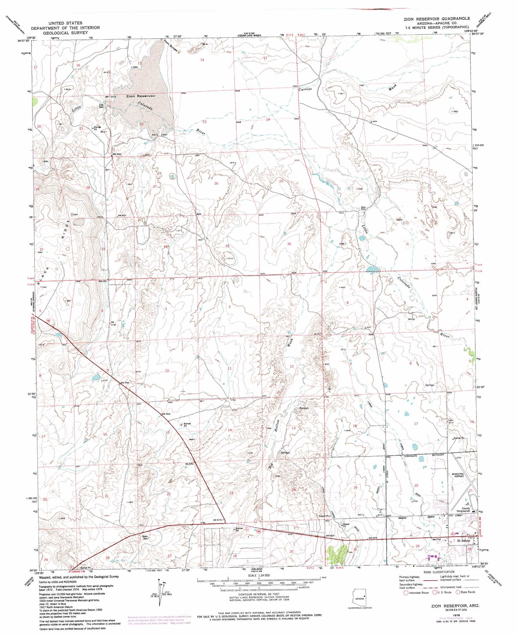
USGS Topo Quad 34109e4 - 1:24,000 scale
| Topo Map Name: | Zion Reservoir |
| USGS Topo Quad ID: | 34109e4 |
| Print Size: | ca. 21 1/4" wide x 27" high |
| Southeast Coordinates: | 34.5° N latitude / 109.375° W longitude |
| Map Center Coordinates: | 34.5625° N latitude / 109.4375° W longitude |
| U.S. State: | AZ |
| Filename: | o34109e4.jpg |
| Download Map JPG Image: | Zion Reservoir topo map 1:24,000 scale |
| Map Type: | Topographic |
| Topo Series: | 7.5´ |
| Map Scale: | 1:24,000 |
| Source of Map Images: | United States Geological Survey (USGS) |
| Alternate Map Versions: |
Wolford Springs 3 SW AZ 1955, updated 1957 Download PDF Buy paper map Zion Reservoir AZ 1978, updated 1978 Download PDF Buy paper map Zion Reservoir AZ 1978, updated 1984 Download PDF Buy paper map Zion Reservoir AZ 2011 Download PDF Buy paper map Zion Reservoir AZ 2014 Download PDF Buy paper map |
1:24,000 Topo Quads surrounding Zion Reservoir
Milky Ranch |
Seven Springs |
Long H Ranch |
Prospect Spring |
Ceadro Spring |
Potter Mesa Tank |
Stinking Springs Mountain |
Cedar Lake Wash |
Schnebly Well |
Valle Bonito |
Hunt |
Stinking Springs |
Zion Reservoir |
Saint Johns North |
Kearn Lake |
Concho Lake |
Concho |
Salado |
Saint Johns South |
Mesa Parada Nw |
Vernon |
Cerro Hueco |
Lyman Lake Sw |
Lyman Lake |
Voigt Ranch |
> Back to 34109e1 at 1:100,000 scale
> Back to 34108a1 at 1:250,000 scale
> Back to U.S. Topo Maps home
Zion Reservoir topo map: Gazetteer
Zion Reservoir: Airports
Saint Johns Industrial Air Park elevation 1746m 5728′Zion Reservoir: Canals
Lower Lyman Ditch elevation 1751m 5744′Zion Reservoir: Dams
Zion Dam elevation 1689m 5541′Zion Reservoir: Parks
Apache County Fairgrounds elevation 1747m 5731′Zion Reservoir: Populated Places
Heap Place elevation 1700m 5577′Zion Reservoir: Reservoirs
Zion Reservoir elevation 1689m 5541′Zion Reservoir: Streams
Big Hollow Wash elevation 1702m 5583′Zion Reservoir: Summits
Twin Buttes elevation 1695m 5561′Zion Reservoir: Valleys
Carrizo Wash elevation 1693m 5554′Zion Reservoir digital topo map on disk
Buy this Zion Reservoir topo map showing relief, roads, GPS coordinates and other geographical features, as a high-resolution digital map file on DVD: