Schnebly Well Topo Map Arizona
To zoom in, hover over the map of Schnebly Well
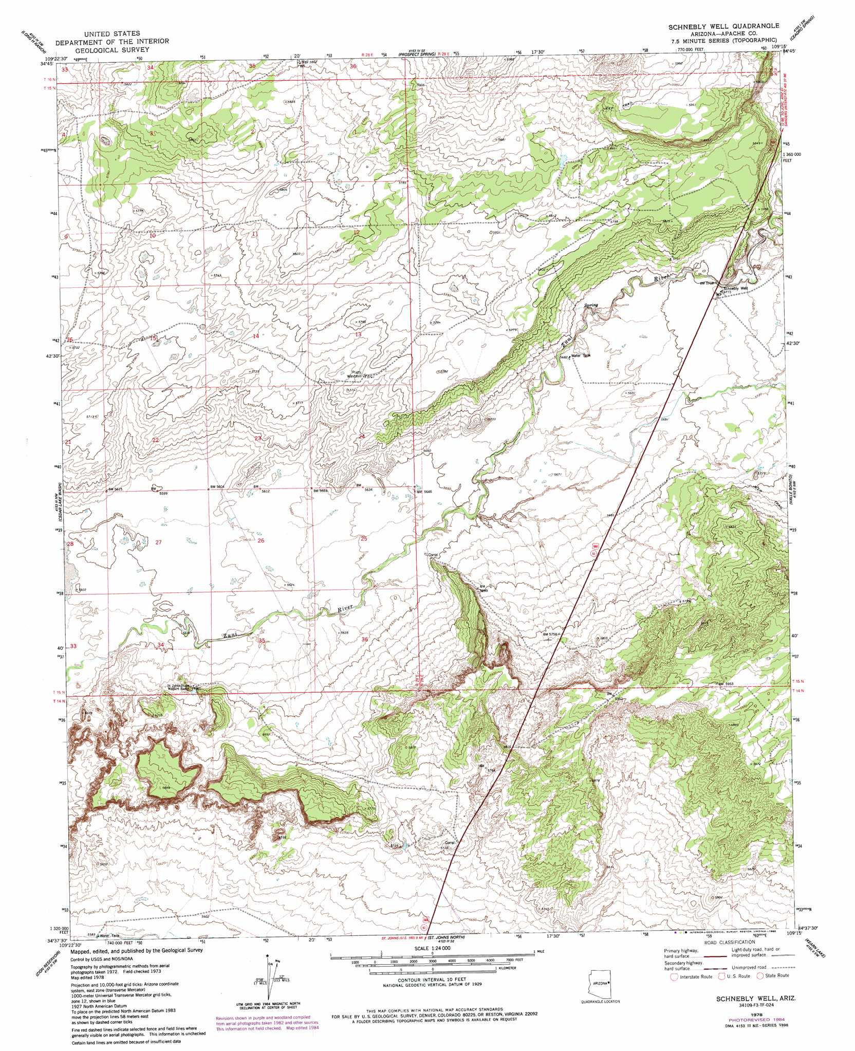
USGS Topo Quad 34109f3 - 1:24,000 scale
| Topo Map Name: | Schnebly Well |
| USGS Topo Quad ID: | 34109f3 |
| Print Size: | ca. 21 1/4" wide x 27" high |
| Southeast Coordinates: | 34.625° N latitude / 109.25° W longitude |
| Map Center Coordinates: | 34.6875° N latitude / 109.3125° W longitude |
| U.S. State: | AZ |
| Filename: | o34109f3.jpg |
| Download Map JPG Image: | Schnebly Well topo map 1:24,000 scale |
| Map Type: | Topographic |
| Topo Series: | 7.5´ |
| Map Scale: | 1:24,000 |
| Source of Map Images: | United States Geological Survey (USGS) |
| Alternate Map Versions: |
Schnebly Well AZ 1978, updated 1978 Download PDF Buy paper map Schnebly Well AZ 1978, updated 1985 Download PDF Buy paper map Schnebly Well AZ 2011 Download PDF Buy paper map Schnebly Well AZ 2014 Download PDF Buy paper map |
1:24,000 Topo Quads surrounding Schnebly Well
Ninemile Seep |
Hogan Well |
Fairchild Well |
Wild Cow Lake |
Barth Well |
Seven Springs |
Long H Ranch |
Prospect Spring |
Ceadro Spring |
Ceadro Spring Se |
Stinking Springs Mountain |
Cedar Lake Wash |
Schnebly Well |
Valle Bonito |
Valle Bonito Ne |
Stinking Springs |
Zion Reservoir |
Saint Johns North |
Kearn Lake |
Carrisito Spring |
Concho |
Salado |
Saint Johns South |
Mesa Parada Nw |
Mesa Parada |
> Back to 34109e1 at 1:100,000 scale
> Back to 34108a1 at 1:250,000 scale
> Back to U.S. Topo Maps home
Schnebly Well topo map: Gazetteer
Schnebly Well: Bridges
Zuni Wash Bridge elevation 1739m 5705′Schnebly Well: Streams
Pine Springs Wash elevation 1741m 5711′Schnebly Well: Valleys
Pine Spring Wash elevation 1745m 5725′Schnebly Well: Wells
Schnebly Well elevation 0m 0′Schnebly Well digital topo map on disk
Buy this Schnebly Well topo map showing relief, roads, GPS coordinates and other geographical features, as a high-resolution digital map file on DVD: