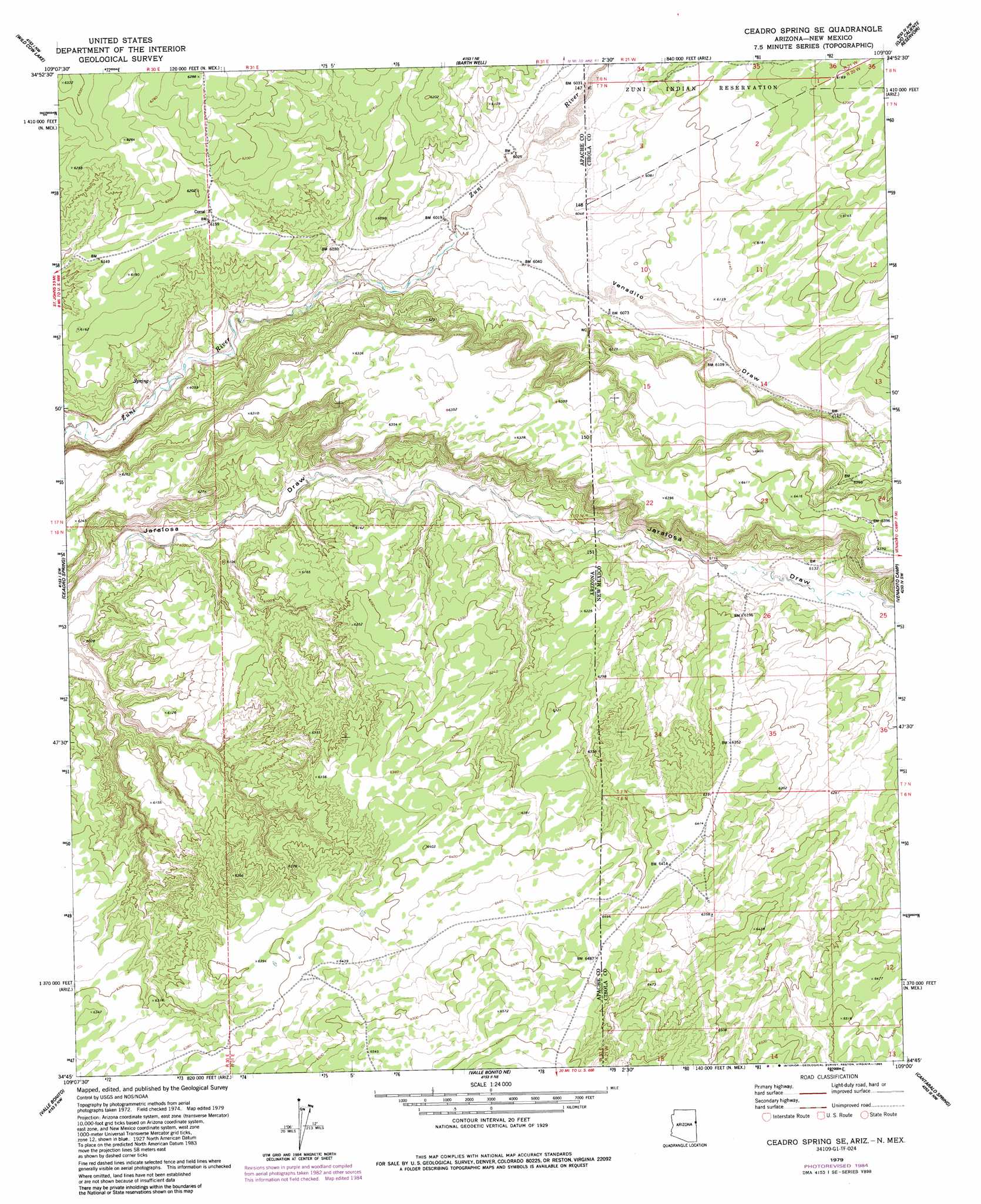
Ceadro Spring Se Topo Map Arizona
To zoom in, hover over the map of Ceadro Spring Se
USGS Topo Quad 34109g1 - 1:24,000 scale
| Topo Map Name: | Ceadro Spring Se |
| USGS Topo Quad ID: | 34109g1 |
| Print Size: | ca. 21 1/4" wide x 27" high |
| Southeast Coordinates: | 34.75° N latitude / 109° W longitude |
| Map Center Coordinates: | 34.8125° N latitude / 109.0625° W longitude |
| U.S. States: | AZ, NM |
| Filename: | o34109g1.jpg |
| Download Map JPG Image: | Ceadro Spring Se topo map 1:24,000 scale |
| Map Type: | Topographic |
| Topo Series: | 7.5´ |
| Map Scale: | 1:24,000 |
| Source of Map Images: | United States Geological Survey (USGS) |
| Alternate Map Versions: |
Ceadro Spring SE AZ 1979, updated 1985 Download PDF Buy paper map Ceadro Spring SE AZ 2011 Download PDF Buy paper map Ceadro Spring SE AZ 2011 Download PDF Buy paper map Ceadro Spring SE AZ 2014 Download PDF Buy paper map |
1:24,000 Topo Quads surrounding Ceadro Spring Se
Beacon Well |
Deep Lake |
High Lonesome Well |
Tekapo |
Zuni |
Fairchild Well |
Wild Cow Lake |
Barth Well |
Ojo Caliente Reservoir |
Plumasano Basin |
Prospect Spring |
Ceadro Spring |
Ceadro Spring Se |
Venadito Camp |
Atarque Lake |
Schnebly Well |
Valle Bonito |
Valle Bonito Ne |
Cantaralo Spring |
Rincon Hondo |
Saint Johns North |
Kearn Lake |
Carrisito Spring |
Twentytwo Spring |
Moreno Hill |
> Back to 34109e1 at 1:100,000 scale
> Back to 34108a1 at 1:250,000 scale
> Back to U.S. Topo Maps home
Ceadro Spring Se topo map: Gazetteer
Ceadro Spring Se: Streams
Meadow Wash elevation 1867m 6125′Ceadro Spring Se: Valleys
Venadito Draw elevation 1835m 6020′Venadito Draw elevation 1835m 6020′
Ceadro Spring Se: Wells
Bob Water Well elevation 1848m 6062′Jaralosa Water Well elevation 1865m 6118′
Ojo Bonito Water Well elevation 1880m 6167′
Ruth Water Well elevation 1948m 6391′
Ceadro Spring Se digital topo map on disk
Buy this Ceadro Spring Se topo map showing relief, roads, GPS coordinates and other geographical features, as a high-resolution digital map file on DVD: