Wild Cow Lake Topo Map Arizona
To zoom in, hover over the map of Wild Cow Lake
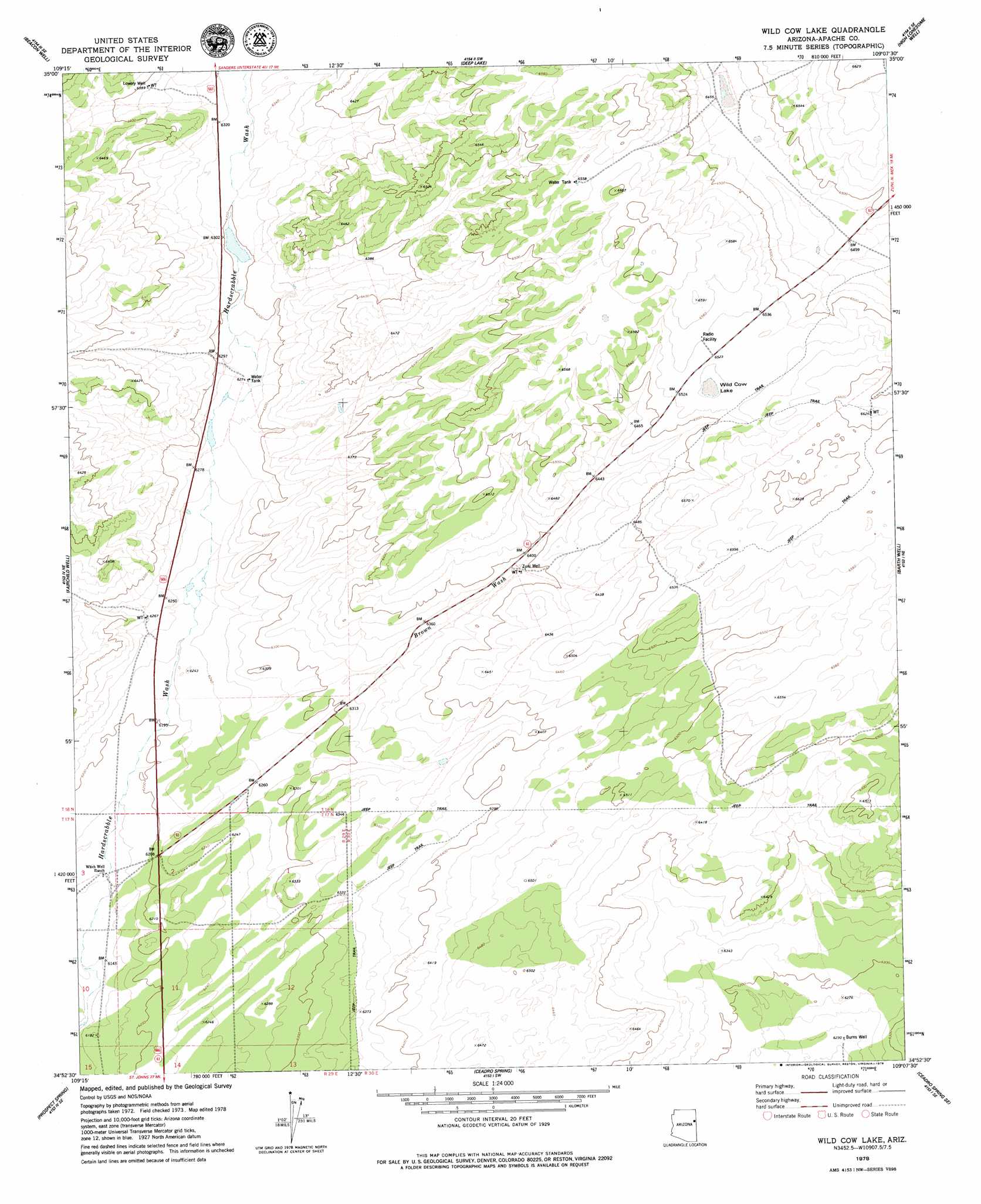
USGS Topo Quad 34109h2 - 1:24,000 scale
| Topo Map Name: | Wild Cow Lake |
| USGS Topo Quad ID: | 34109h2 |
| Print Size: | ca. 21 1/4" wide x 27" high |
| Southeast Coordinates: | 34.875° N latitude / 109.125° W longitude |
| Map Center Coordinates: | 34.9375° N latitude / 109.1875° W longitude |
| U.S. State: | AZ |
| Filename: | o34109h2.jpg |
| Download Map JPG Image: | Wild Cow Lake topo map 1:24,000 scale |
| Map Type: | Topographic |
| Topo Series: | 7.5´ |
| Map Scale: | 1:24,000 |
| Source of Map Images: | United States Geological Survey (USGS) |
| Alternate Map Versions: |
Wild Cow Lake AZ 1978, updated 1979 Download PDF Buy paper map Wild Cow Lake AZ 2011 Download PDF Buy paper map Wild Cow Lake AZ 2014 Download PDF Buy paper map |
1:24,000 Topo Quads surrounding Wild Cow Lake
Chambers |
Sanders |
Tolapai Spring |
Chafin Well |
Chi Chil Tah |
Navajo Springs |
Beacon Well |
Deep Lake |
High Lonesome Well |
Tekapo |
Hogan Well |
Fairchild Well |
Wild Cow Lake |
Barth Well |
Ojo Caliente Reservoir |
Long H Ranch |
Prospect Spring |
Ceadro Spring |
Ceadro Spring Se |
Venadito Camp |
Cedar Lake Wash |
Schnebly Well |
Valle Bonito |
Valle Bonito Ne |
Cantaralo Spring |
> Back to 34109e1 at 1:100,000 scale
> Back to 34108a1 at 1:250,000 scale
> Back to U.S. Topo Maps home
Wild Cow Lake topo map: Gazetteer
Wild Cow Lake: Lakes
Wild Cow Lake elevation 1988m 6522′Wild Cow Lake: Streams
Brown Wash elevation 1892m 6207′Wild Cow Lake: Wells
Burns Well elevation 1900m 6233′Lowery Well elevation 1949m 6394′
Zuni Well elevation 1946m 6384′
Wild Cow Lake digital topo map on disk
Buy this Wild Cow Lake topo map showing relief, roads, GPS coordinates and other geographical features, as a high-resolution digital map file on DVD: