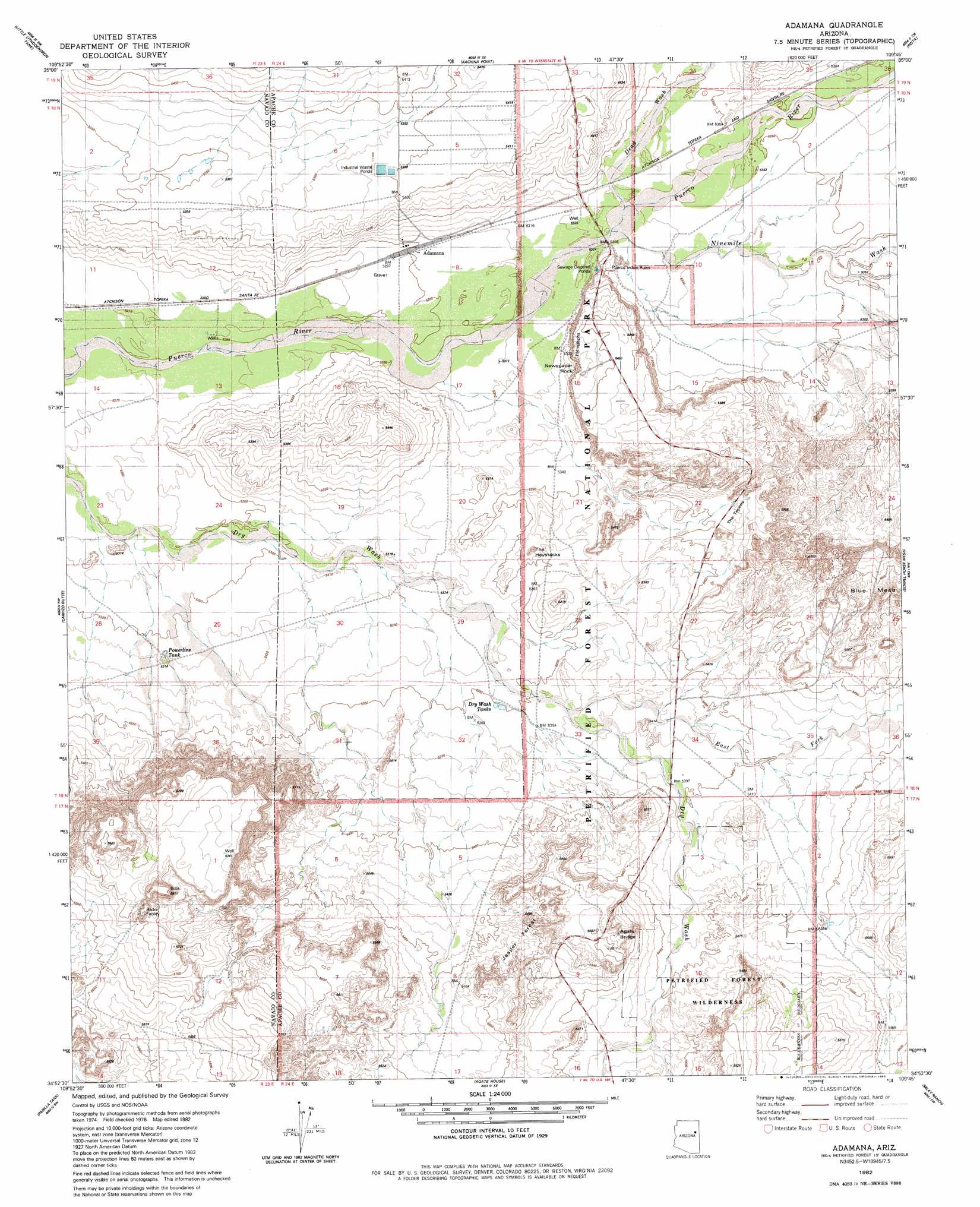
Adamana Topo Map Arizona
To zoom in, hover over the map of Adamana
USGS Topo Quad 34109h7 - 1:24,000 scale
| Topo Map Name: | Adamana |
| USGS Topo Quad ID: | 34109h7 |
| Print Size: | ca. 21 1/4" wide x 27" high |
| Southeast Coordinates: | 34.875° N latitude / 109.75° W longitude |
| Map Center Coordinates: | 34.9375° N latitude / 109.8125° W longitude |
| U.S. State: | AZ |
| Filename: | o34109h7.jpg |
| Download Map JPG Image: | Adamana topo map 1:24,000 scale |
| Map Type: | Topographic |
| Topo Series: | 7.5´ |
| Map Scale: | 1:24,000 |
| Source of Map Images: | United States Geological Survey (USGS) |
| Alternate Map Versions: |
Adamana AZ 1982, updated 1983 Download PDF Buy paper map Adamana AZ 2011 Download PDF Buy paper map Adamana AZ 2014 Download PDF Buy paper map |
1:24,000 Topo Quads surrounding Adamana
Mitten Peak |
Pilot Rock |
Chinde Mesa |
North Mill Well |
Navajo North |
Hennessy Buttes |
Little Lithodendron Tank |
Kachina Point |
Pinta |
Navajo South |
Sun Valley |
Carrizo Butte |
Adamana |
Sorrel Horse Mesa |
Ninemile Seep |
Woodruff |
Padilla Tank |
Agate House |
Milky Ranch |
Seven Springs |
Tenmile Cedars |
Hay Hollow |
Little Milky Wash |
Potter Mesa Tank |
Stinking Springs Mountain |
> Back to 34109e1 at 1:100,000 scale
> Back to 34108a1 at 1:250,000 scale
> Back to U.S. Topo Maps home
Adamana topo map: Gazetteer
Adamana: Arches
Agate Bridge elevation 1702m 5583′Keystone Bridge elevation 1697m 5567′
Adamana: Areas
Blue Mesa elevation 1677m 5501′First Forest elevation 1659m 5442′
Adamana: Forests
Jasper Forest elevation 1670m 5479′Adamana: Pillars
Newspaper Rock elevation 1663m 5456′The Haystacks elevation 1643m 5390′
The Tepees elevation 1655m 5429′
Adamana: Populated Places
Adamana elevation 1617m 5305′Paulcell Place elevation 1619m 5311′
Adamana: Reservoirs
Dry Creek Tanks elevation 1631m 5351′Adamana: Streams
Dead Wash elevation 1623m 5324′East Fork Dry Creek elevation 1635m 5364′
Ninemile Wash elevation 1622m 5321′
Adamana: Wells
Jensen Well elevation 1608m 5275′Adamana digital topo map on disk
Buy this Adamana topo map showing relief, roads, GPS coordinates and other geographical features, as a high-resolution digital map file on DVD: