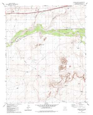
Carrizo Butte Topo Map Arizona
To zoom in, hover over the map of Carrizo Butte
USGS Topo Quad 34109h8 - 1:24,000 scale
| Topo Map Name: | Carrizo Butte |
| USGS Topo Quad ID: | 34109h8 |
| Print Size: | ca. 21 1/4" wide x 27" high |
| Southeast Coordinates: | 34.875° N latitude / 109.875° W longitude |
| Map Center Coordinates: | 34.9375° N latitude / 109.9375° W longitude |
| U.S. State: | AZ |
| Filename: | o34109h8.jpg |
| Download Map JPG Image: | Carrizo Butte topo map 1:24,000 scale |
| Map Type: | Topographic |
| Topo Series: | 7.5´ |
| Map Scale: | 1:24,000 |
| Source of Map Images: | United States Geological Survey (USGS) |
| Alternate Map Versions: |
Carrizo Butte AZ 1982, updated 1983 Download PDF Buy paper map Carrizo Butte AZ 2011 Download PDF Buy paper map Carrizo Butte AZ 2014 Download PDF Buy paper map |
1:24,000 Topo Quads surrounding Carrizo Butte
> Back to 34109e1 at 1:100,000 scale
> Back to 34108a1 at 1:250,000 scale
> Back to U.S. Topo Maps home
Carrizo Butte topo map: Gazetteer
Carrizo Butte: Crossings
Adamana Interchange elevation 1610m 5282′Carrizo Butte: Populated Places
Goodwater elevation 1604m 5262′Ubank Place elevation 1613m 5291′
Carrizo Butte: Reservoirs
Delaney Tank elevation 1711m 5613′Gray Tank elevation 1600m 5249′
Lower Delaney Tank elevation 1669m 5475′
Middle Tank elevation 1608m 5275′
Puerco Tank elevation 1587m 5206′
Ramsey Slide Tank elevation 1693m 5554′
Rock Tank elevation 1605m 5265′
Wooden Tank elevation 1616m 5301′
Carrizo Butte: Ridges
Ramsey Slide elevation 1659m 5442′Carrizo Butte: Streams
Dry Creek elevation 1599m 5246′East Twin Wash elevation 1606m 5269′
Lithodendron Wash elevation 1591m 5219′
Little Lithodendron Wash elevation 1588m 5209′
Twin Wash elevation 1584m 5196′
West Twin Wash elevation 1606m 5269′
Winsor Wash elevation 1584m 5196′
Carrizo Butte: Summits
Carrizo Butte elevation 1637m 5370′Twin Buttes elevation 1736m 5695′
Carrizo Butte: Wells
Partnership Well elevation 1595m 5232′Carrizo Butte digital topo map on disk
Buy this Carrizo Butte topo map showing relief, roads, GPS coordinates and other geographical features, as a high-resolution digital map file on DVD:


