Long Tom Canyon Topo Map Arizona
To zoom in, hover over the map of Long Tom Canyon
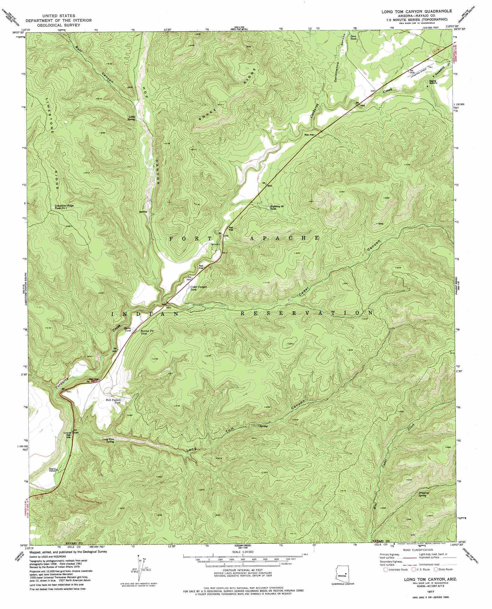
USGS Topo Quad 34110a2 - 1:24,000 scale
| Topo Map Name: | Long Tom Canyon |
| USGS Topo Quad ID: | 34110a2 |
| Print Size: | ca. 21 1/4" wide x 27" high |
| Southeast Coordinates: | 34° N latitude / 110.125° W longitude |
| Map Center Coordinates: | 34.0625° N latitude / 110.1875° W longitude |
| U.S. State: | AZ |
| Filename: | o34110a2.jpg |
| Download Map JPG Image: | Long Tom Canyon topo map 1:24,000 scale |
| Map Type: | Topographic |
| Topo Series: | 7.5´ |
| Map Scale: | 1:24,000 |
| Source of Map Images: | United States Geological Survey (USGS) |
| Alternate Map Versions: |
Long Tom Canyon AZ 1977, updated 1978 Download PDF Buy paper map Long Tom Canyon AZ 2011 Download PDF Buy paper map Long Tom Canyon AZ 2014 Download PDF Buy paper map |
1:24,000 Topo Quads surrounding Long Tom Canyon
Day Spring |
Clay Springs |
Pinedale |
Show Low North |
Silver Springs |
Bear Ridge |
Limestone Canyon North |
Red Top Mountain |
Show Low South |
Lakeside |
Cibecue |
Limestone Canyon South |
Long Tom Canyon |
Faught Ridge |
Indian Pine |
Cibecue Peak |
Carrizo |
Cedar Creek |
Round Top Mountain |
Alchesay Flat |
Beckers Butte |
Carrizo Se |
Cone Butte |
Canyon Day |
Whiteriver |
> Back to 34110a1 at 1:100,000 scale
> Back to 34110a1 at 1:250,000 scale
> Back to U.S. Topo Maps home
Long Tom Canyon topo map: Gazetteer
Long Tom Canyon: Reservoirs
Borrow Pit Tank elevation 1714m 5623′Bull Pasture Tank elevation 1683m 5521′
Cedar Canyon Tank elevation 1732m 5682′
Dove Tank elevation 1801m 5908′
Highway Sixty Tank elevation 1780m 5839′
Horse Tank elevation 1720m 5643′
Limestone Ridge Tank Number One elevation 1896m 6220′
Long Tom Canyon: Ridges
Limestone Ridge elevation 1993m 6538′Snake Ridge elevation 2025m 6643′
Long Tom Canyon: Springs
Bear Playground Spring elevation 1875m 6151′Dripping Spring elevation 1822m 5977′
Little Spring elevation 1750m 5741′
Long Tom Spring elevation 1563m 5127′
Long Tom Canyon: Streams
Forestdale Creek elevation 1792m 5879′Long Tom Canyon: Valleys
Bull Canyon elevation 1743m 5718′Cedar Canyon elevation 1756m 5761′
Cottonwood Canyon elevation 1767m 5797′
Hop Canyon elevation 1675m 5495′
Long Tom Canyon elevation 1549m 5082′
Long Tom Canyon digital topo map on disk
Buy this Long Tom Canyon topo map showing relief, roads, GPS coordinates and other geographical features, as a high-resolution digital map file on DVD: