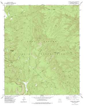
Chediski Peak Topo Map Arizona
To zoom in, hover over the map of Chediski Peak
USGS Topo Quad 34110b6 - 1:24,000 scale
| Topo Map Name: | Chediski Peak |
| USGS Topo Quad ID: | 34110b6 |
| Print Size: | ca. 21 1/4" wide x 27" high |
| Southeast Coordinates: | 34.125° N latitude / 110.625° W longitude |
| Map Center Coordinates: | 34.1875° N latitude / 110.6875° W longitude |
| U.S. State: | AZ |
| Filename: | o34110b6.jpg |
| Download Map JPG Image: | Chediski Peak topo map 1:24,000 scale |
| Map Type: | Topographic |
| Topo Series: | 7.5´ |
| Map Scale: | 1:24,000 |
| Source of Map Images: | United States Geological Survey (USGS) |
| Alternate Map Versions: |
Chediski Peak AZ 1977, updated 1977 Download PDF Buy paper map Chediski Peak AZ 2011 Download PDF Buy paper map Chediski Peak AZ 2014 Download PDF Buy paper map |
1:24,000 Topo Quads surrounding Chediski Peak
> Back to 34110a1 at 1:100,000 scale
> Back to 34110a1 at 1:250,000 scale
> Back to U.S. Topo Maps home
Chediski Peak topo map: Gazetteer
Chediski Peak: Flats
Cow Flat elevation 1994m 6541′Chediski Peak: Lakes
Chuck Box Lake elevation 2219m 7280′Nyce Lake elevation 2238m 7342′
Chediski Peak: Mines
Iron Mine elevation 1814m 5951′Chediski Peak: Ridges
Chediski Ridge elevation 2197m 7208′Steer Ridge elevation 2100m 6889′
Telephone Ridge elevation 2265m 7431′
Chediski Peak: Springs
Rotten Spring elevation 1733m 5685′Chediski Peak: Streams
West Fork Bull Flat Canyon elevation 1958m 6423′Willow Creek elevation 1658m 5439′
Chediski Peak: Summits
Chediski Mountain elevation 2016m 6614′Chediski Peak elevation 2272m 7454′
Swamp Creek Mountain elevation 2083m 6833′
The Pyramids elevation 1792m 5879′
Chediski Peak: Valleys
Bear Spring Canyon elevation 1755m 5757′Big Spring Canyon elevation 1631m 5351′
Cave Canyon elevation 1741m 5711′
Dazen Canyon elevation 1682m 5518′
Gatewood Canyon elevation 1644m 5393′
Lost Tank Canyon elevation 1668m 5472′
Miners Gulch elevation 1755m 5757′
Wagon Wheel Canyon elevation 1915m 6282′
Chediski Peak digital topo map on disk
Buy this Chediski Peak topo map showing relief, roads, GPS coordinates and other geographical features, as a high-resolution digital map file on DVD:


