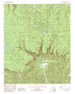
O W Point Topo Map Arizona
To zoom in, hover over the map of O W Point
USGS Topo Quad 34110c7 - 1:24,000 scale
| Topo Map Name: | O W Point |
| USGS Topo Quad ID: | 34110c7 |
| Print Size: | ca. 21 1/4" wide x 27" high |
| Southeast Coordinates: | 34.25° N latitude / 110.75° W longitude |
| Map Center Coordinates: | 34.3125° N latitude / 110.8125° W longitude |
| U.S. State: | AZ |
| Filename: | o34110c7.jpg |
| Download Map JPG Image: | O W Point topo map 1:24,000 scale |
| Map Type: | Topographic |
| Topo Series: | 7.5´ |
| Map Scale: | 1:24,000 |
| Source of Map Images: | United States Geological Survey (USGS) |
| Alternate Map Versions: |
O W Point AZ 1990, updated 1991 Download PDF Buy paper map O W Point AZ 1990, updated 1991 Download PDF Buy paper map O W Point AZ 1990, updated 2000 Download PDF Buy paper map O W Point AZ 2011 Download PDF Buy paper map O W Point AZ 2014 Download PDF Buy paper map |
| FStopo: | US Forest Service topo O W Point is available: Download FStopo PDF Download FStopo TIF |
1:24,000 Topo Quads surrounding O W Point
> Back to 34110a1 at 1:100,000 scale
> Back to 34110a1 at 1:250,000 scale
> Back to U.S. Topo Maps home
O W Point topo map: Gazetteer
O W Point: Capes
Sheep Creek Point elevation 2257m 7404′O W Point: Cliffs
Canyon Creek Point elevation 2266m 7434′Mule Creek Point elevation 2242m 7355′
Nelson Lake Point elevation 2232m 7322′
North OW Point elevation 2280m 7480′
O W Point: Lakes
Aspen Lake elevation 2311m 7582′Aspen Lake elevation 2281m 7483′
Hidden Lake elevation 2328m 7637′
Horse Trap Lake elevation 2317m 7601′
Jacob Lake elevation 2311m 7582′
Lake Two elevation 2311m 7582′
Lonesome Lake elevation 2325m 7627′
Mosquito Lake elevation 2315m 7595′
Moss Lake elevation 2322m 7618′
Nelson Lake elevation 2335m 7660′
Patrick Pond elevation 2297m 7536′
Pinto Lake elevation 2310m 7578′
O W Point: Mines
Rainbow Mines elevation 2297m 7536′O W Point: Parks
Canyon Point Recreation Area elevation 2328m 7637′O W Point: Populated Places
Forest Lakes Estates elevation 2305m 7562′O W Point: Reservoirs
Brad Tank elevation 2335m 7660′Bruno Tank elevation 2268m 7440′
Clay Tank elevation 2317m 7601′
Double A Tank elevation 2333m 7654′
Eubank Tank elevation 2327m 7634′
Hidden Tank elevation 2322m 7618′
Home Tank elevation 2314m 7591′
Lonesome Tank elevation 2330m 7644′
Mule Tank elevation 2271m 7450′
P51 Tank elevation 2324m 7624′
Poon Tank elevation 2334m 7657′
Red Tank elevation 2324m 7624′
Saint Joe Tank elevation 2269m 7444′
Sandstone Tank elevation 2311m 7582′
Scott Tank elevation 2330m 7644′
Sink Tank elevation 2292m 7519′
Smith Tank elevation 2263m 7424′
Willow Tank elevation 2311m 7582′
O W Point: Ridges
Valentine Ridge elevation 2199m 7214′O W Point: Springs
Mule Spring elevation 2286m 7500′Saint Joe Spring elevation 2257m 7404′
Sheep Spring elevation 2287m 7503′
O W Point: Streams
Mule Creek elevation 1951m 6400′Sheep Creek elevation 1979m 6492′
O W Point: Summits
OW Point elevation 2303m 7555′O W Point: Wells
Jacob Well elevation 2320m 7611′O W Point digital topo map on disk
Buy this O W Point topo map showing relief, roads, GPS coordinates and other geographical features, as a high-resolution digital map file on DVD:


