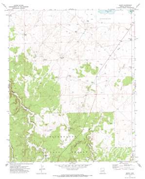
Zeniff Topo Map Arizona
To zoom in, hover over the map of Zeniff
USGS Topo Quad 34110e4 - 1:24,000 scale
| Topo Map Name: | Zeniff |
| USGS Topo Quad ID: | 34110e4 |
| Print Size: | ca. 21 1/4" wide x 27" high |
| Southeast Coordinates: | 34.5° N latitude / 110.375° W longitude |
| Map Center Coordinates: | 34.5625° N latitude / 110.4375° W longitude |
| U.S. State: | AZ |
| Filename: | o34110e4.jpg |
| Download Map JPG Image: | Zeniff topo map 1:24,000 scale |
| Map Type: | Topographic |
| Topo Series: | 7.5´ |
| Map Scale: | 1:24,000 |
| Source of Map Images: | United States Geological Survey (USGS) |
| Alternate Map Versions: |
Zeniff AZ 1971, updated 1973 Download PDF Buy paper map Zeniff AZ 1998, updated 2000 Download PDF Buy paper map Zeniff AZ 2011 Download PDF Buy paper map Zeniff AZ 2014 Download PDF Buy paper map |
| FStopo: | US Forest Service topo Zeniff is available: Download FStopo PDF Download FStopo TIF |
1:24,000 Topo Quads surrounding Zeniff
> Back to 34110e1 at 1:100,000 scale
> Back to 34110a1 at 1:250,000 scale
> Back to U.S. Topo Maps home
Zeniff topo map: Gazetteer
Zeniff: Populated Places
Zeniff elevation 1795m 5889′Zeniff: Reservoirs
Big Tank elevation 1781m 5843′Bigler Tank elevation 1792m 5879′
Charlie Ross Tank elevation 1854m 6082′
Corner Number Two Tank elevation 1851m 6072′
Corner Tank elevation 1833m 6013′
DeSpain Tank elevation 1891m 6204′
Homestead Tank elevation 1814m 5951′
Little Scott Tank elevation 1860m 6102′
Lower Pierce Tank elevation 1863m 6112′
Lower Tank elevation 1854m 6082′
Morris Tank elevation 1814m 5951′
New Tank elevation 1827m 5994′
Purcell Tank elevation 1830m 6003′
Scott Number Two Tank elevation 1846m 6056′
Scott Tank elevation 1848m 6062′
Section Eighteen Tank elevation 1785m 5856′
Sinkhole Tank elevation 1869m 6131′
Smith Tank elevation 1862m 6108′
Zeniff: Streams
Decker Wash elevation 1842m 6043′Scott Wash elevation 1785m 5856′
Zeniff: Wells
Scott Well elevation 1884m 6181′Zeniff digital topo map on disk
Buy this Zeniff topo map showing relief, roads, GPS coordinates and other geographical features, as a high-resolution digital map file on DVD:


