Woodruff Topo Map Arizona
To zoom in, hover over the map of Woodruff
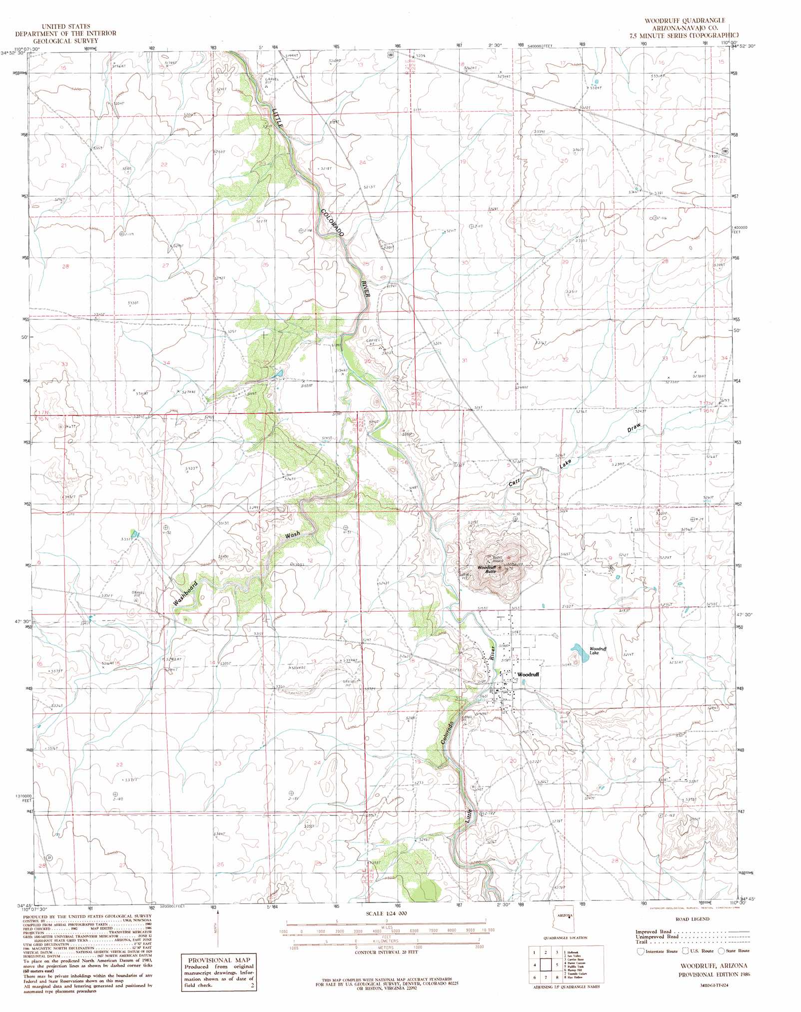
USGS Topo Quad 34110g1 - 1:24,000 scale
| Topo Map Name: | Woodruff |
| USGS Topo Quad ID: | 34110g1 |
| Print Size: | ca. 21 1/4" wide x 27" high |
| Southeast Coordinates: | 34.75° N latitude / 110° W longitude |
| Map Center Coordinates: | 34.8125° N latitude / 110.0625° W longitude |
| U.S. State: | AZ |
| Filename: | o34110g1.jpg |
| Download Map JPG Image: | Woodruff topo map 1:24,000 scale |
| Map Type: | Topographic |
| Topo Series: | 7.5´ |
| Map Scale: | 1:24,000 |
| Source of Map Images: | United States Geological Survey (USGS) |
| Alternate Map Versions: |
St. Joseph 1 SE AZ 1955, updated 1957 Download PDF Buy paper map Woodruff AZ 1986, updated 1986 Download PDF Buy paper map Woodruff AZ 2011 Download PDF Buy paper map Woodruff AZ 2014 Download PDF Buy paper map |
1:24,000 Topo Quads surrounding Woodruff
Blairs Spring |
Lee Mountain |
Hennessy Buttes |
Little Lithodendron Tank |
Kachina Point |
Joseph City |
Holbrook |
Sun Valley |
Carrizo Butte |
Adamana |
Saunders Draw |
Porter Canyon |
Woodruff |
Padilla Tank |
Agate House |
Dry Lake Ne |
Flattop Hill |
Tenmile Cedars |
Hay Hollow |
Little Milky Wash |
Sheepskin Wash |
Second Knolls |
Snowflake |
Point Of The Mountain |
Manuel Seep |
> Back to 34110e1 at 1:100,000 scale
> Back to 34110a1 at 1:250,000 scale
> Back to U.S. Topo Maps home
Woodruff topo map: Gazetteer
Woodruff: Lakes
Woodruff Lake elevation 1569m 5147′Woodruff: Populated Places
Woodruff elevation 1568m 5144′Woodruff: Streams
Washboard Wash elevation 1566m 5137′Woodruff: Summits
Woodruff Butte elevation 1717m 5633′Woodruff: Valleys
Carr Lake Draw elevation 1568m 5144′Woodruff digital topo map on disk
Buy this Woodruff topo map showing relief, roads, GPS coordinates and other geographical features, as a high-resolution digital map file on DVD: