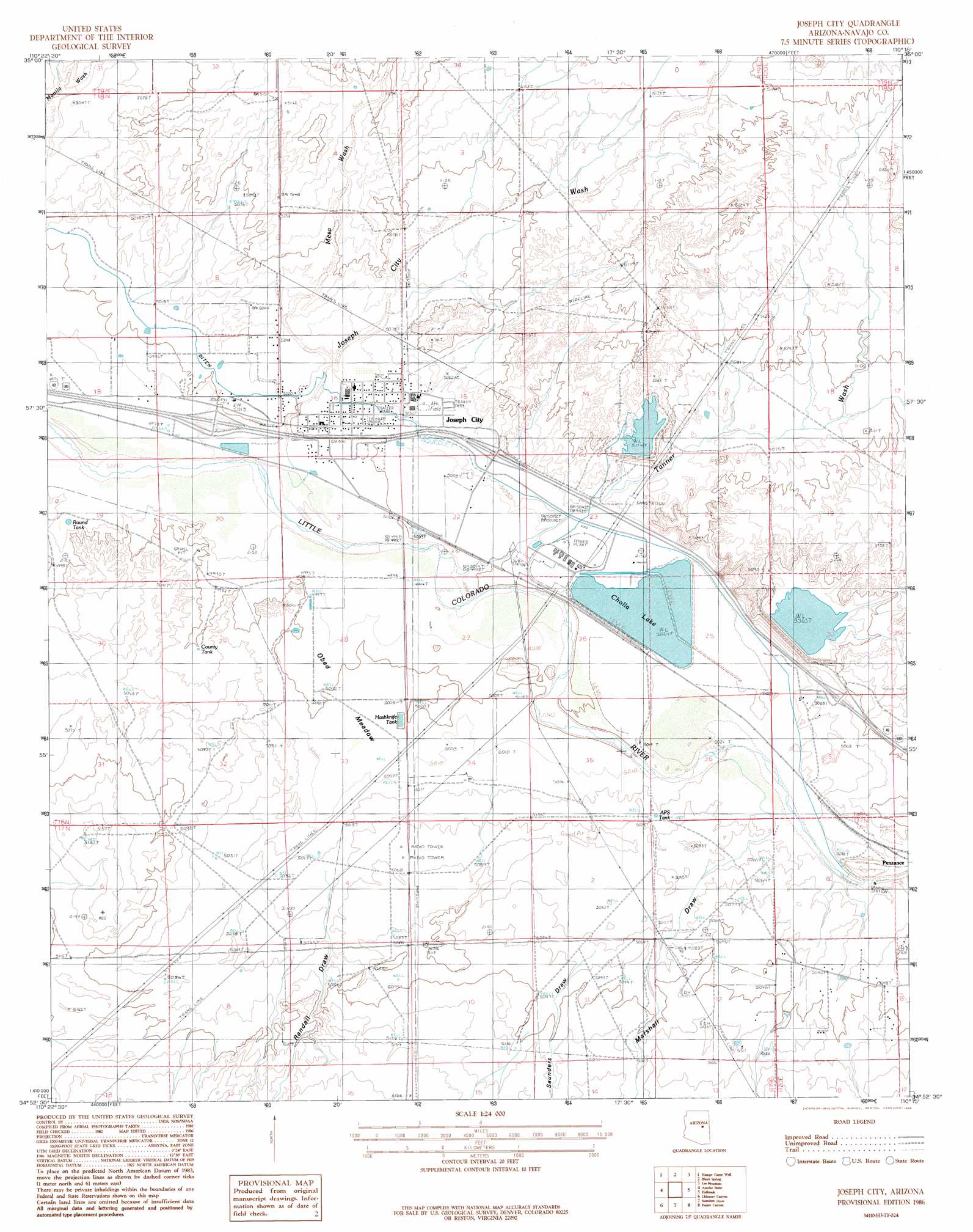
Joseph City Topo Map Arizona
To zoom in, hover over the map of Joseph City
USGS Topo Quad 34110h3 - 1:24,000 scale
| Topo Map Name: | Joseph City |
| USGS Topo Quad ID: | 34110h3 |
| Print Size: | ca. 21 1/4" wide x 27" high |
| Southeast Coordinates: | 34.875° N latitude / 110.25° W longitude |
| Map Center Coordinates: | 34.9375° N latitude / 110.3125° W longitude |
| U.S. State: | AZ |
| Filename: | o34110h3.jpg |
| Download Map JPG Image: | Joseph City topo map 1:24,000 scale |
| Map Type: | Topographic |
| Topo Series: | 7.5´ |
| Map Scale: | 1:24,000 |
| Source of Map Images: | United States Geological Survey (USGS) |
| Alternate Map Versions: |
St. Joseph 2 NE AZ 1955, updated 1957 Download PDF Buy paper map Joseph City AZ 1986, updated 1986 Download PDF Buy paper map Joseph City AZ 2011 Download PDF Buy paper map Joseph City AZ 2014 Download PDF Buy paper map |
1:24,000 Topo Quads surrounding Joseph City
Winslow Ne |
Standing Horse Mesa |
Rotten Bananas Butte |
Turkey Track Butte |
Mitten Peak |
Rincon Ranch |
Humpy Camp Well |
Blairs Spring |
Lee Mountain |
Hennessy Buttes |
Hibbard |
Apache Butte |
Joseph City |
Holbrook |
Sun Valley |
Mccauley Sinks |
Chimney Canyon |
Saunders Draw |
Porter Canyon |
Woodruff |
Potato Wash Ne |
Dry Lake Nw |
Dry Lake Ne |
Flattop Hill |
Tenmile Cedars |
> Back to 34110e1 at 1:100,000 scale
> Back to 34110a1 at 1:250,000 scale
> Back to U.S. Topo Maps home
Joseph City topo map: Gazetteer
Joseph City: Arroyos
Tanner Wash elevation 1523m 4996′Joseph City: Dams
Cholla Bottom Ash Pond Dam elevation 1589m 5213′Cholla Cooling Pond Dam elevation 1542m 5059′
Cholla Fly Ash Pond Dam elevation 1548m 5078′
Joseph City: Parks
The Old Fort Historical Monument elevation 1531m 5022′Joseph City: Populated Places
Joseph City elevation 1526m 5006′Penzance elevation 1543m 5062′
Joseph City: Post Offices
Joseph City Post Office elevation 1526m 5006′Joseph City: Reservoirs
Cholla Bottom Ash Pond elevation 1589m 5213′Cholla Fly Ash Pond elevation 1548m 5078′
Cholla Lake elevation 1531m 5022′
Joseph City: Streams
Joseph City Wash elevation 1518m 4980′Mesa Wash elevation 1531m 5022′
Tanner Wash elevation 1523m 4996′
Joseph City: Swamps
Obed Meadow elevation 1525m 5003′Joseph City digital topo map on disk
Buy this Joseph City topo map showing relief, roads, GPS coordinates and other geographical features, as a high-resolution digital map file on DVD: