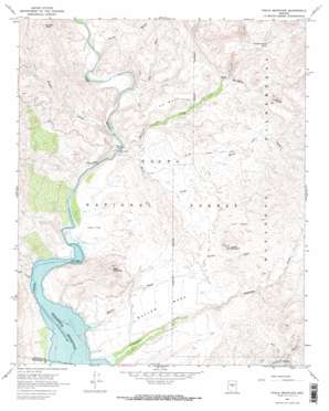
Chalk Mountain Topo Map Arizona
To zoom in, hover over the map of Chalk Mountain
USGS Topo Quad 34111a6 - 1:24,000 scale
| Topo Map Name: | Chalk Mountain |
| USGS Topo Quad ID: | 34111a6 |
| Print Size: | ca. 21 1/4" wide x 27" high |
| Southeast Coordinates: | 34° N latitude / 111.625° W longitude |
| Map Center Coordinates: | 34.0625° N latitude / 111.6875° W longitude |
| U.S. State: | AZ |
| Filename: | o34111a6.jpg |
| Download Map JPG Image: | Chalk Mountain topo map 1:24,000 scale |
| Map Type: | Topographic |
| Topo Series: | 7.5´ |
| Map Scale: | 1:24,000 |
| Source of Map Images: | United States Geological Survey (USGS) |
| Alternate Map Versions: |
Chalk Mountain AZ 1967, updated 1968 Download PDF Buy paper map Chalk Mountain AZ 1967, updated 1973 Download PDF Buy paper map Chalk Mountain AZ 1967, updated 1973 Download PDF Buy paper map Chalk Mountain AZ 2004, updated 2006 Download PDF Buy paper map Chalk Mountain AZ 2011 Download PDF Buy paper map Chalk Mountain AZ 2014 Download PDF Buy paper map |
| FStopo: | US Forest Service topo Chalk Mountain is available: Download FStopo PDF Download FStopo TIF |
1:24,000 Topo Quads surrounding Chalk Mountain
> Back to 34111a1 at 1:100,000 scale
> Back to 34110a1 at 1:250,000 scale
> Back to U.S. Topo Maps home
Chalk Mountain topo map: Gazetteer
Chalk Mountain: Bridges
Sheep Bridge elevation 634m 2080′Chalk Mountain: Cliffs
The White Bluffs elevation 633m 2076′Chalk Mountain: Flats
Ister Flat elevation 635m 2083′Chalk Mountain: Springs
Andrea Spring elevation 719m 2358′Dutchman Grave Spring elevation 888m 2913′
Lower Dutchman Grave Spring elevation 859m 2818′
Manterola Spring elevation 771m 2529′
Chalk Mountain: Streams
Deadman Creek elevation 611m 2004′Dry Wash elevation 658m 2158′
Horse Creek elevation 625m 2050′
Mullen Wash elevation 610m 2001′
Spring Wash elevation 658m 2158′
Sycamore Creek elevation 624m 2047′
Tangle Creek elevation 630m 2066′
Chalk Mountain: Summits
Chalk Mountain elevation 838m 2749′H K Mesa elevation 782m 2565′
Horse Mountain elevation 888m 2913′
Mullen Mesa elevation 700m 2296′
Tangle Peak elevation 1070m 3510′
Chalk Mountain: Trails
Verde River Trail Number Eleven elevation 701m 2299′Chalk Mountain: Valleys
Hell Canyon elevation 620m 2034′Chalk Mountain digital topo map on disk
Buy this Chalk Mountain topo map showing relief, roads, GPS coordinates and other geographical features, as a high-resolution digital map file on DVD:


