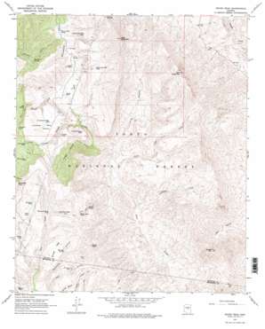
Rover Peak Topo Map Arizona
To zoom in, hover over the map of Rover Peak
USGS Topo Quad 34111a7 - 1:24,000 scale
| Topo Map Name: | Rover Peak |
| USGS Topo Quad ID: | 34111a7 |
| Print Size: | ca. 21 1/4" wide x 27" high |
| Southeast Coordinates: | 34° N latitude / 111.75° W longitude |
| Map Center Coordinates: | 34.0625° N latitude / 111.8125° W longitude |
| U.S. State: | AZ |
| Filename: | o34111a7.jpg |
| Download Map JPG Image: | Rover Peak topo map 1:24,000 scale |
| Map Type: | Topographic |
| Topo Series: | 7.5´ |
| Map Scale: | 1:24,000 |
| Source of Map Images: | United States Geological Survey (USGS) |
| Alternate Map Versions: |
Rover Peak AZ 1967, updated 1968 Download PDF Buy paper map Rover Peak AZ 1967, updated 1975 Download PDF Buy paper map Rover Peak AZ 1967, updated 1975 Download PDF Buy paper map Rover Peak AZ 2004, updated 2006 Download PDF Buy paper map Rover Peak AZ 2011 Download PDF Buy paper map Rover Peak AZ 2014 Download PDF Buy paper map |
| FStopo: | US Forest Service topo Rover Peak is available: Download FStopo PDF Download FStopo TIF |
1:24,000 Topo Quads surrounding Rover Peak
> Back to 34111a1 at 1:100,000 scale
> Back to 34110a1 at 1:250,000 scale
> Back to U.S. Topo Maps home
Rover Peak topo map: Gazetteer
Rover Peak: Forests
Cave Creek Ranger District elevation 1122m 3681′Rover Peak: Mines
Red Rover Mine elevation 1283m 4209′Rover Peak: Reservoirs
Blackjack Tank elevation 1318m 4324′Brush Basin Tank elevation 1289m 4229′
Cedar Mountain Trick Tank elevation 1464m 4803′
Cottonwood Tank elevation 1236m 4055′
Cougar Canyon Tank elevation 1104m 3622′
Cougar Tank elevation 1221m 4005′
CP Tank elevation 1127m 3697′
Grapevine Tank elevation 1275m 4183′
High Mesa Tank elevation 1379m 4524′
Indian Ruin Tank elevation 1286m 4219′
Latimore Tank elevation 1243m 4078′
Lockwood Mesa Tank elevation 1195m 3920′
Lower CP Tank elevation 1085m 3559′
Monument Mesa Tank elevation 1244m 4081′
North Cedar Mountain Tank elevation 1255m 4117′
Rincon Tank elevation 1232m 4041′
Seldom Trick Tank elevation 1277m 4189′
Tank Number Five elevation 1203m 3946′
Trail Tank elevation 1291m 4235′
West Cedar Mountain Tank elevation 1255m 4117′
Rover Peak: Springs
Ash Spring elevation 1175m 3854′Barbara Spring elevation 1170m 3838′
Indian Spring elevation 1200m 3937′
Jack Brooks Spring elevation 1121m 3677′
Lime Spring elevation 819m 2687′
Marcelle Spring elevation 1269m 4163′
Professor Spring elevation 999m 3277′
Renner Spring elevation 1186m 3891′
Roundtree Spring elevation 1124m 3687′
Stone Camp Spring elevation 1073m 3520′
Rover Peak: Streams
Ash Spring Creek elevation 1036m 3398′Holmes Creek elevation 1085m 3559′
Little Lime Creek elevation 876m 2874′
Professor Creek elevation 827m 2713′
Rover Peak: Summits
Bulldog Mesa elevation 1342m 4402′CP Butte elevation 1122m 3681′
East Cedar Mountain elevation 1661m 5449′
Lockwood Mesa elevation 1277m 4189′
Rover Peak elevation 1590m 5216′
Sunset Mountain elevation 1395m 4576′
West Cedar Mountain elevation 1672m 5485′
Rover Peak: Valleys
Cougar Canyon elevation 940m 3083′Holmes Canyon elevation 1085m 3559′
Little Cougar Canyon elevation 1006m 3300′
Long Canyon elevation 895m 2936′
Marcelle Canyon elevation 1110m 3641′
Rover Peak digital topo map on disk
Buy this Rover Peak topo map showing relief, roads, GPS coordinates and other geographical features, as a high-resolution digital map file on DVD:


